 placenames
Roodstown
Baile an Rútaigh
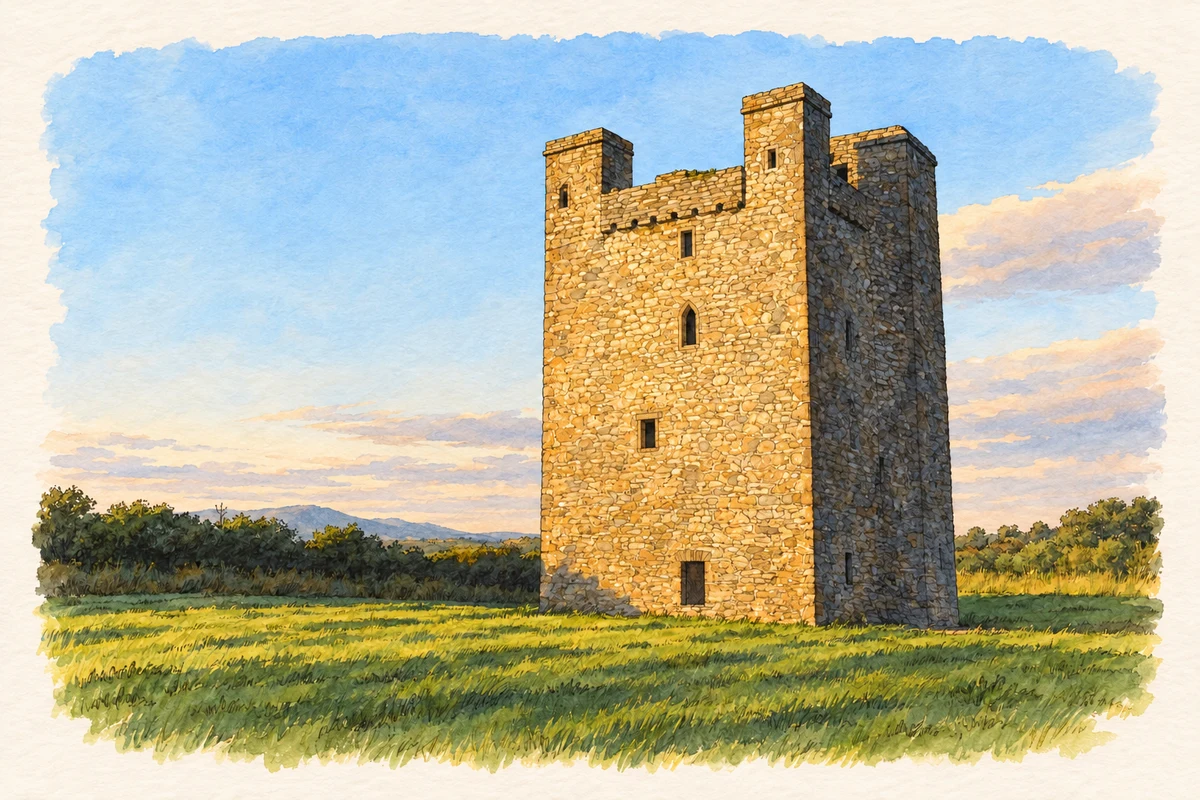
A surviving tower house marks Roodstown’s place on the old road between Ardee and Castlebellingham.
The name
These Irish name elements are associated with this record in the Logainm glossary.
An element’s translation is a clue, rather than a complete explanation of the name. Its form and meaning depend on local history and the full Irish name.
Recorded forms
- Baile an Rútaigh · Irish · main form
- Roodstown · English · main form
Place & story
The nineteenth-century village
Samuel Lewis described the settlement as Rootstown or Ruthstown in 1837. It then contained twenty-five houses and 148 inhabitants, and lay in Stabannon parish on the road from Ardee to Castlebellingham. His short entry already referred to the neighbouring castle as a ruin. It records a small roadside village alongside the older fortified building, rather than an inhabited castle estate. [2]
A fortified residence
Roodstown Castle rises through four storeys, approximately fifteen metres high. Its rubble-built walls have limestone dressings and two square turrets placed at opposite corners. One held a staircase and the other a garderobe. Adèle Commins and Daithí Kearney’s local architectural account records the surviving vault above the entrance level, while the timber floors that once divided the upper rooms have disappeared. [3]
Domestic rooms and defences
The windows help explain the tower’s combination of residence and stronghold. Upper rooms have curved, ogee-headed openings, including paired windows that admitted more light to principal chambers. Inside the ground-level entrance, a murder hole provided a defensive opening over the doorway. The surviving stair connected the living accommodation with the battlements. These details preserve evidence of circulation, comfort and protection within a compact building. [3]
Geographic information
Sources & further reading
- Logainm.ie — Roodstown. Place names and geographic record, licensed under CC BY 4.0.
- Rootstown, A Topographical Dictionary of Ireland (1837) · Samuel Lewis
- Roodstown Castle, Co. Louth, 27 July 2020 · Adèle Commins and Daithí Kearney
- Roodstown Castle, County Louth, as photographed in July 2008 illustration: based on a Roodstown Castle, Co. Louth by Kieran Campbell. AI-assisted watercolour and ink adaptation; cream paper margins added, incidental clutter omitted and fine details simplified. Licence: CC BY-SA 2.0.
Name record retrieved 2026-10-25 · Source record modified 2009-07-15. How this page was prepared.