These Irish name elements are associated with this record in the Logainm glossary.
An element’s translation is a clue, rather than a complete explanation of the name. Its form and meaning depend on local history and the full Irish name.
Recorded forms
Baile an Tallúnaigh· Irish · main form · validated name
Tallonstown· English · main form · local name
Tallanstown· English · main form
Place & story
Saint Peter and Saint Paul
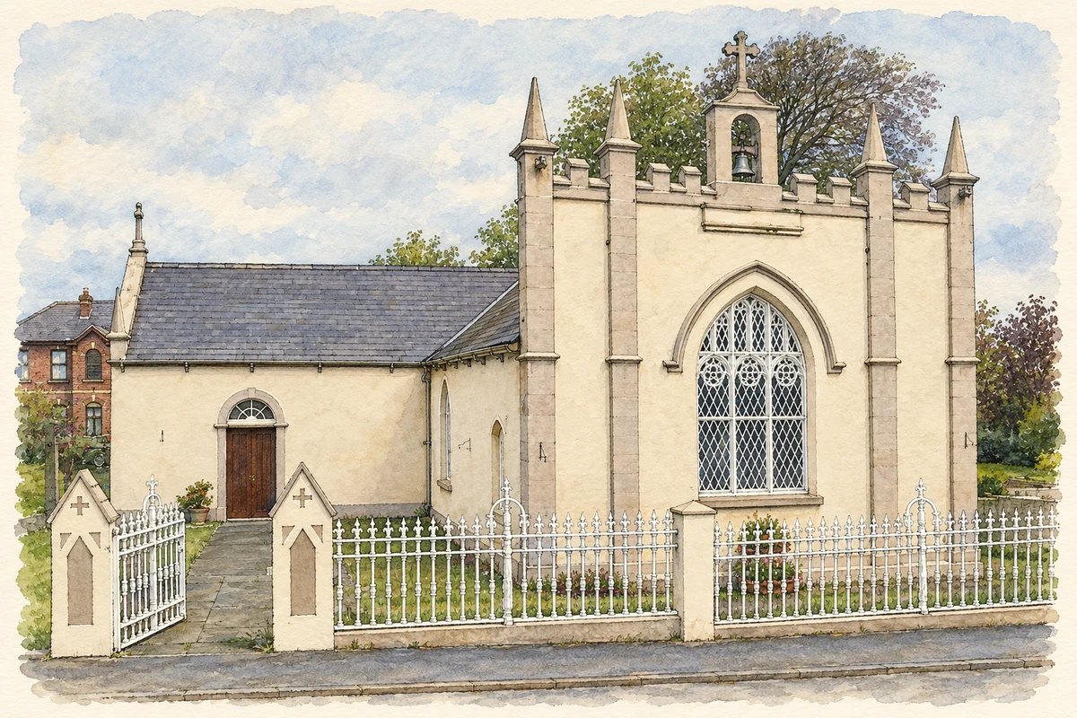
The Catholic church of Saint Peter and Saint Paul began around 1780 as a simple single-cell building. About 1830 it was enlarged to a T-shaped plan and given a Gothic front. Its battlemented parapet, pinnacles and bellcote are prominent features of the village centre. Inside, timber galleries occupy the transepts and a carved wooden reredos stands behind the altar. The National Inventory of Architectural Heritage places it within the estate village associated with Lord Louth.[2]
From school to community centre
Tallanstown’s original school opened in 1840 and closed in 1966, when a new building took its place. The older school became a community centre, continuing its public role in another form. In 1969 the outlying schools at Aclint and Stormanstown amalgamated with Tallanstown. The present school, subsequently extended, bears the name Vere Foster Memorial School, connecting local education with a figure whose family home was at nearby Glyde Court.[3]
People & connections
Vere Foster’s educational legacy
Vere Foster left diplomatic work to help people suffering during the Great Famine on his brother’s estate near Ardee. He later supported emigrants and campaigned to improve conditions aboard passenger ships. Education became another major concern: he helped establish the Irish National Teachers’ Organisation and became its first president, supported school buildings and produced inexpensive schoolbooks. The village school’s name commemorates this practical philanthropy, rooted locally at Glyde Court but extending far beyond the district.[3]
Both counts use the 2016 settlement boundary, allowing like-for-like comparison. CSO supplies the 2022 count on this older boundary for comparison only. The official 2022 Built Up Area has different boundaries.
View population figures
Tallanstown — Census 2016 settlement footprint — census population
These are the historical areas published in the 2006 census report. Boundaries may differ between censuses and from modern settlements. Legal towns, environs and suburbs are shown separately; none has been combined into a modern settlement total.
View population figures
Tallanstown, Louth — Census town, CSO 2006 report — census population
These are the historical areas published in the 1996 census report. Boundaries may differ between censuses and from modern settlements. Legal towns, environs and suburbs are shown separately; none has been combined into a modern settlement total.
View population figures
Tallanstown, Louth — Census town, CSO 1996 report — census population
Figures cover the historical town area printed in the 1986 report. Boundaries may have changed between censuses. Legal town, environs and suburb totals remain separate and differ from modern settlement boundaries.
View population figures
Tallanstown, Louth — Census town, CSO 1986 report — census population
These figures use different area definitions. Read the boundary note before comparing them.
Tallanstown, Louth
Published census settlement populations
674people · 2016
Settlement boundaries changed during this period. Differences may reflect boundary changes as well as population change. Where a 2011 legal-town-and-environs count is shown, it has not been recalculated onto the 2016 settlement boundary.
Saints Peter and Paul Church, Tallonstown, County Louth illustration: based on a Church at Tallanstown, Co. Louth by Kieran Campbell. AI-assisted watercolour and ink adaptation; cream paper margins added, incidental clutter omitted and fine details simplified. Licence: CC BY-SA 2.0.
 placenames