 placenames
Street
An tSráid
Street, also written Streete, combines a small educational hall with the scientific legacy of nearby Daramona.
The name
These Irish name elements are associated with this record in the Logainm glossary.
An element’s translation is a clue, rather than a complete explanation of the name. Its form and meaning depend on local history and the full Irish name.
Recorded forms
- An tSráid · Irish · main form · validated name
- Street · English · main form
Place & story
The Institute
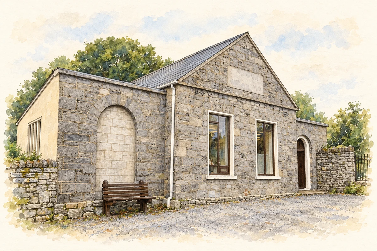
The Wilson family of Daramona built Street’s Institute around 1856 as an educational and community centre. Its facilities included a library, and the National Inventory of Architectural Heritage records classes in farming and engineering, with a harmonium for concerts. The small limestone building has a gabled central block flanked by lower wings. Its combination of instruction, reading and performance gave the village an unusually varied community facility for its rural setting. [2]
Science at Daramona
William E. Wilson established an observatory at Daramona, just north of Street. The surviving observatory building dates from around 1892 and replaced an earlier installation. Wilson’s work here included measuring the Sun’s temperature with P. L. Gray, photographing astronomical objects and investigating the detection of starlight by electrical means. A laboratory, darkroom and machine shop accompanied the telescope. The estate’s scientific work gave this small village a connection with international astronomical research. [3]
Saint James’s church
Saint James’s stands at the southern end of Street within an enclosed graveyard. Rebuilt in 1810 and altered around 1880, it has a square battlemented tower and round-headed windows. Their uneven spacing suggests that parts of an earlier building may survive within the present walls. A memorial dated 1767 also predates the recorded rebuilding, although such monuments could be transferred between churches. The site therefore preserves evidence of several phases rather than a single, wholly new nineteenth-century structure. [4]
Geographic information
Sources & further reading
- Logainm.ie — Street. Place names and geographic record, licensed under CC BY 4.0.
- Street Institute, Cornacausk, 15400207 · National Inventory of Architectural Heritage
- Daramona observatory, Cornacausk, 15400223 · National Inventory of Architectural Heritage
- Saint James’s Church, Barradrum, Street, 15400201 · National Inventory of Architectural Heritage
- Street Institute, Street, County Westmeath illustration: based on a Village shop, Street (24July2012) by Richard Webb. AI-assisted watercolour and ink adaptation; cream paper margins added, incidental clutter omitted and fine details simplified. Licence: CC BY-SA 2.0.
Name record retrieved 2026-10-25 · Source record modified 2025-01-10. How this page was prepared.