These Irish name elements are associated with this record in the Logainm glossary.
An element’s translation is a clue, rather than a complete explanation of the name. Its form and meaning depend on local history and the full Irish name.
Recorded forms
Ard na Croise· Irish · main form · validated name
Ardnacrusha· English · main form
Place & story
Harnessing the Shannon’s fall
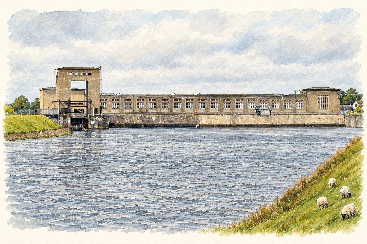
The Shannon Scheme diverted water from the river near Parteen into a purpose-built headrace leading to Ardnacrusha. The arrangement concentrated the available fall at one generating station, with a tailrace returning the water downstream. Clare Libraries' account describes the enormous supporting construction effort: machinery arrived through Limerick docks, and a railway link from Longpavement carried equipment to the works. The power station was therefore only one part of a much larger landscape of canals, bridges, transport routes and excavation. Building that system required coordination between the river works and the national electricity network.[2]
People & connections
Thomas McLaughlin’s proposal
Engineer Thomas McLaughlin developed the proposal while working with Siemens Schuckert in Germany. He argued that the Shannon could supply an electricity system extending beyond the principal cities. With minister Patrick McGilligan's support, the scheme received parliamentary approval in 1925. McLaughlin became managing director when the Electricity Supply Board was established in 1927. His role joined technical planning with the creation of a new public institution. The project required political agreement and organisational change as well as engineering, at a time when the state was still establishing its economic priorities.[3]
Turbines, penstocks and the national grid
Ardnacrusha's first three generating units were commissioned in 1929; a fourth followed in 1934. ESB identifies the earlier machines as vertical-shaft Francis generators and the later unit as a Kaplan turbine generator. Four large steel penstocks carry water down to the turbines. Each is about forty-one metres long and six metres in diameter, making these pipes a defining feature of the station's architecture. The national high-voltage grid was constructed alongside the original scheme, allowing power generated here to serve a much wider territory than the surrounding Clare and Limerick communities.[4]
Ardnacrusha or Castlebank — Census 2016 settlement footprint
Population within 2016 settlement boundaries
1,332people · 2022
Both counts use the 2016 settlement boundary, allowing like-for-like comparison. CSO supplies the 2022 count on this older boundary for comparison only. The official 2022 Built Up Area has different boundaries.
View population figures
Ardnacrusha or Castlebank — Census 2016 settlement footprint — census population
Ardnacrusha (Castlebank), Clare — Census town, CSO 2006 report
2002–2006: census town
1,169people · 2006
These are the historical areas published in the 2006 census report. Boundaries may differ between censuses and from modern settlements. Legal towns, environs and suburbs are shown separately; none has been combined into a modern settlement total.
View population figures
Ardnacrusha (Castlebank), Clare — Census town, CSO 2006 report — census population
Ardnacrusha (Castlebank), Clare — Census town, CSO 1996 report
1991–1996: census town
655people · 1996
These are the historical areas published in the 1996 census report. Boundaries may differ between censuses and from modern settlements. Legal towns, environs and suburbs are shown separately; none has been combined into a modern settlement total.
View population figures
Ardnacrusha (Castlebank), Clare — Census town, CSO 1996 report — census population
Ardnacrusha (Castlebank), Clare — Census town, CSO 1986 report
1981–1986: census town
481people · 1986
Figures cover the historical town area printed in the 1986 report. Boundaries may have changed between censuses. Legal town, environs and suburb totals remain separate and differ from modern settlement boundaries.
View population figures
Ardnacrusha (Castlebank), Clare — Census town, CSO 1986 report — census population
These figures use different area definitions. Read the boundary note before comparing them.
Ardnacrusha (Castlebank), Clare
Published census settlement populations
1,383people · 2016
Settlement boundaries changed during this period. Differences may reflect boundary changes as well as population change. Where a 2011 legal-town-and-environs count is shown, it has not been recalculated onto the 2016 settlement boundary.
View population figures
Ardnacrusha (Castlebank), Clare — census population
Ardnacrusha hydroelectric power station illustration: based on a Ard na Croise.jpg by Sean an Scuab. AI-assisted watercolour and ink adaptation; cream paper margins added, incidental clutter omitted and fine details simplified. Licence: CC BY-SA 3.0.
 placenames