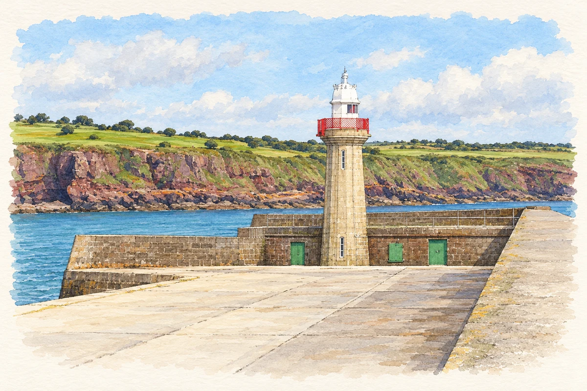
A granite lighthouse and stone pier recall an ambitious packet-port project, while lifeboat records preserve the names behind dangerous coastal rescues.
Illustration, Dunmore East Lighthouse
⊕Recorded locationDunmore East52.15567° N · 6.99872° WInteractive map supplied by OpenStreetMap.
These Irish name elements are associated with this record in the Logainm glossary.
An element’s translation is a clue, rather than a complete explanation of the name. Its form and meaning depend on local history and the full Irish name.
Recorded forms
Dún Mór· Irish · main form · validated name
Dunmore East· English · main form
Place & story
A harbour facing Milford Haven
The harbour pier was designed by Alexander Nimmo for a packet port linked with Milford Haven. The National Inventory of Architectural Heritage dates the pier to 1814 and records its later renovation in 1969. Cut-stone walls, steps down to the water and iron mooring posts preserve the working character of the structure. Its roughly L-shaped plan shelters the harbour rather than simply extending a promenade. The pier and lighthouse together express the engineering investment behind Dunmore East's maritime economy.[2]
The lighthouse shaped like a classical column
Nimmo also designed the lighthouse at the pier's end, built in 1824. Its granite shaft is fluted like a Doric column, with a cornice supporting the lantern above. A curved metal dome caps the lantern, and iron railings encircle the upper stage. The architectural inventory notes both the quality of the stonework and surviving mechanisms inside. The familiar silhouette is therefore more than a coastal ornament: the carefully worked classical form encloses the equipment of a navigational structure.[3]
People & connections
Stephen Whittle and the Glenmalure rescue
Dunmore East's lifeboat house and slipway were built in 1884. The RNLI's station history records a later rescue on 25 November 1970, when Coxswain Stephen Whittle and his crew saved three men from the waterlogged fishing boat Glenmalure near Hook Point. The rescue took place during a south-easterly gale, rough seas and a flooding tide. Among those saved was James Bates, himself coxswain of the Kilmore Quay lifeboat. Whittle received a silver medal the following year. The episode shows neighbouring fishing and lifeboat communities meeting in an emergency.[4]
Both counts use the 2016 settlement boundary, allowing like-for-like comparison. CSO supplies the 2022 count on this older boundary for comparison only. The official 2022 Built Up Area has different boundaries.
View population figures
Dunmore East — Census 2016 settlement footprint — census population
Dunmore East, Waterford — Census town, CSO 2006 report
2002–2006: census town
1,547people · 2006
These are the historical areas published in the 2006 census report. Boundaries may differ between censuses and from modern settlements. Legal towns, environs and suburbs are shown separately; none has been combined into a modern settlement total.
View population figures
Dunmore East, Waterford — Census town, CSO 2006 report — census population
Dunmore East, Waterford — Census town, CSO 1996 report
1991–1996: census town
1,430people · 1996
These are the historical areas published in the 1996 census report. Boundaries may differ between censuses and from modern settlements. Legal towns, environs and suburbs are shown separately; none has been combined into a modern settlement total.
View population figures
Dunmore East, Waterford — Census town, CSO 1996 report — census population
Dunmore East, Waterford — Census town, CSO 1986 report
1981–1986: census town
1,041people · 1986
Figures cover the historical town area printed in the 1986 report. Boundaries may have changed between censuses. Legal town, environs and suburb totals remain separate and differ from modern settlement boundaries.
View population figures
Dunmore East, Waterford — Census town, CSO 1986 report — census population
These figures use different area definitions. Read the boundary note before comparing them.
Dunmore East, Waterford
Published census settlement populations
1,808people · 2016
Settlement boundaries changed during this period. Differences may reflect boundary changes as well as population change. Where a 2011 legal-town-and-environs count is shown, it has not been recalculated onto the 2016 settlement boundary.
 placenames