 placenames
Ballyboylands
Baile Uí Bhaolláin
A railway quarry, a vanished signal cabin and changing level-crossing equipment connect Ballyboylands with the working history of the Northern Counties line.
The name
These Irish name elements are associated with this record in the Logainm glossary.
An element’s translation is a clue, rather than a complete explanation of the name. Its form and meaning depend on local history and the full Irish name.
Recorded forms
- Baile Uí Bhaolláin · Irish · main form · validated name
- Ballyboylands · English · main form
- Ballyboyland · English · main form · local name
Place & story
Stone for the permanent way
Ballyboyland quarry supplied stone for railway track under Berkeley Deane Wise, chief engineer of the Belfast and Northern Counties Railway from 1888. Wise introduced crushing machinery there to produce suitable material for the line. The quarry belongs to the less conspicuous side of his work: alongside stations and seaside attractions, the railway needed a dependable supply of stone to maintain its tracks. [2]
The passing loop
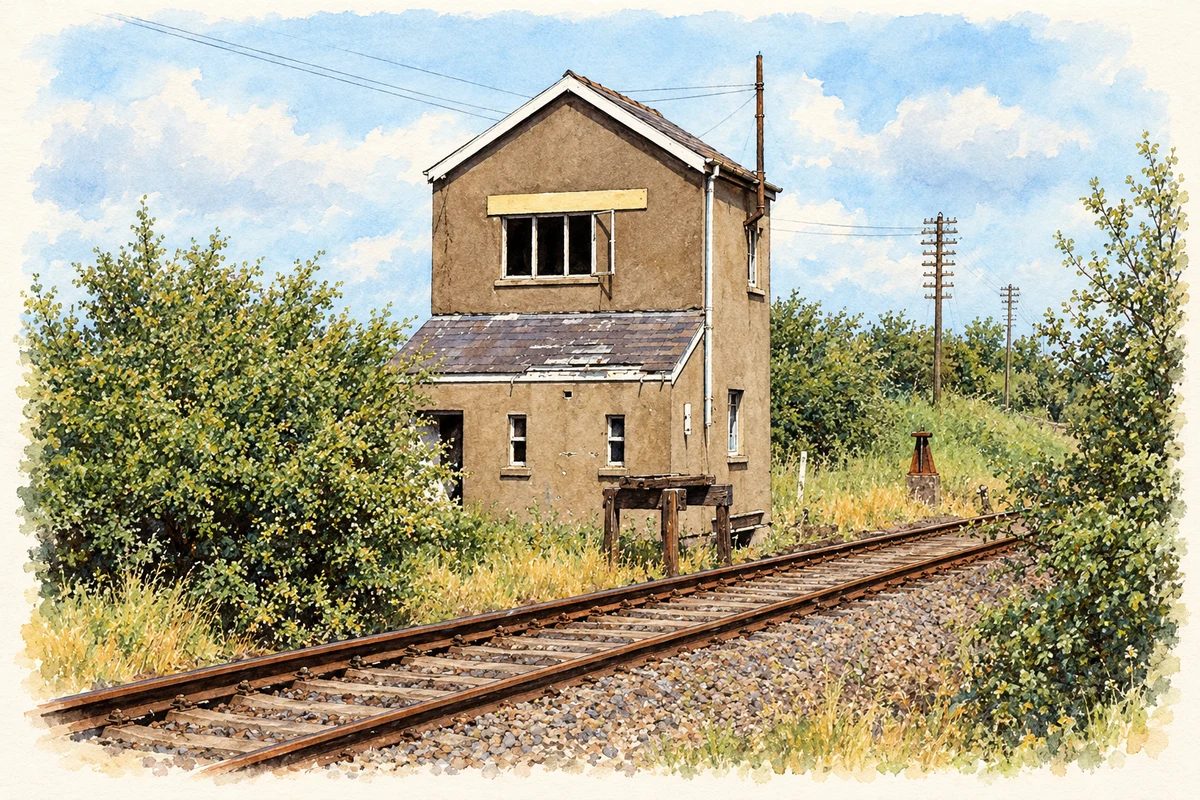
The Ulster Transport Authority built a signal cabin and passing loop at Ballyboyland in 1958. These divided the steep railway section between Killagan and Ballymoney. The cabin closed in 1969, although photographs record it still standing during the 1970s and in 1983; it was subsequently demolished. Albert Bridge’s photograph also identifies the remains of a tablet catcher beside the building, a reminder of the equipment used in railway signalling. [3]
A changing crossing
The Kilraughts Road crossing lies in Ballyboylands Upper, where the railway runs between Ballymoney and Ballymena. An order effective in November 1985 required an automatic open crossing to replace the existing half barriers. This arrangement was itself due for replacement: in March 1991 a parliamentary answer listed Ballyboyland among thirteen crossings scheduled for conversion to automatic half barriers, with its order planned to take effect on 9 December. [4] [5]
Geographic information
- Place type
- Population centre
- County
- Antrim
- Barony
- Dunluce Upper
- Coordinates
- 55.07144, -6.45001 (approximate)
- Logainm ID
- 1167046 ↗
Sources & further reading
- Logainm.ie — Ballyboylands. Place names and geographic record, licensed under CC BY 4.0.
- Berkeley Deane Wise · Art Ward, Causeway Coastal Route
- Historic photographs in grid square C9826 · Albert Bridge and The Carlisle Kid, Geograph
- Level Crossing (Ballyboyland) Order (Northern Ireland) 1985 · Department of the Environment, Northern Ireland
- Railway Crossings, 4 March 1991 · UK Parliament, Hansard
- Ballyboyland signal cabin, Ballyboylands, County Antrim, in 1983 illustration: based on a Ballyboyland signal cabin near Ballymoney (2 July 1983) by Albert Bridge. AI-assisted watercolour and ink adaptation; cream paper margins added, incidental clutter omitted and fine details simplified. Licence: CC BY-SA 2.0.
Name record retrieved 2026-10-25 · Source record modified 2021-05-26. How this page was prepared.