These Irish name elements are associated with this record in the Logainm glossary.
An element’s translation is a clue, rather than a complete explanation of the name. Its form and meaning depend on local history and the full Irish name.
Recorded forms
An Droichead Nua· Irish · main form · validated name
Goresbridge· English · main form
Place & story
Nine arches over the Barrow
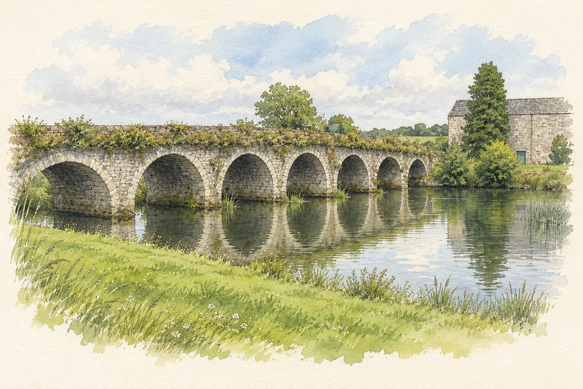
Gore’s Bridge joins the Kilkenny and Carlow banks of the River Barrow. The architectural inventory dates it to 1760 and names its builders as Samuel Biass and Thomas Dunn. Nine round arches carry the roadway, with granite arch stones and triangular cutwaters facing upstream. The village took its name from the crossing and the Gore family of Barrowmount.[2][3]
The fighting in June 1798
On 23 June 1798 Wexford insurgents reached Goresbridge during the rebellion. Dragoon Guards and Wexford militia attempted to hold the crossing. The account quoted by the architectural inventory describes rebel cannon being brought up while insurgents forded the Barrow, prompting the defenders to retreat. Some militia were captured. A granite memorial beside the bridge commemorates the engagement.[2][3]
Mills, navigation and cattle fairs
The Barrow Navigation's incorporation into the Grand Canal system in 1794 improved Goresbridge's trading connections. Corn mills used the river's power; Ballyellen Mill, erected in 1789, had an attached malt house supplying breweries in larger towns. Samuel Lewis counted 634 inhabitants in 1837. He recorded a fortnightly petty sessions court, police stations and several annual fairs, including the Barrowmount cattle fairs. Although a market patent existed, he reported that no market was being held.[3][4]
People & connections
Kitty Donohoe and the sales ring
Ned Donohoe started the Goresbridge horse sales in 1968. In a later interview, his wife Kitty recalled the first sale taking place from a trailer in the yard. After Ned's sudden death in 1978 she continued the business while raising their family, with her eldest son Martin joining her. She also served on the Irish Horse Board, then Bord na gCapall. Kilkenny Chamber recognised her business career with its Lifetime Achievement Award in 2020.[5]
Both counts use the 2016 settlement boundary, allowing like-for-like comparison. CSO supplies the 2022 count on this older boundary for comparison only. The official 2022 Built Up Area has different boundaries.
View population figures
Goresbridge — Census 2016 settlement footprint — census population
Goresbridge, Kilkenny — Census town, CSO 2006 report
2002–2006: census town
376people · 2006
These are the historical areas published in the 2006 census report. Boundaries may differ between censuses and from modern settlements. Legal towns, environs and suburbs are shown separately; none has been combined into a modern settlement total.
View population figures
Goresbridge, Kilkenny — Census town, CSO 2006 report — census population
Goresbridge, Kilkenny — Census town, CSO 1996 report
1991–1996: census town
407people · 1996
These are the historical areas published in the 1996 census report. Boundaries may differ between censuses and from modern settlements. Legal towns, environs and suburbs are shown separately; none has been combined into a modern settlement total.
View population figures
Goresbridge, Kilkenny — Census town, CSO 1996 report — census population
Goresbridge, Kilkenny — Census town, CSO 1986 report
1981–1986: census town
415people · 1986
Figures cover the historical town area printed in the 1986 report. Boundaries may have changed between censuses. Legal town, environs and suburb totals remain separate and differ from modern settlement boundaries.
View population figures
Goresbridge, Kilkenny — Census town, CSO 1986 report — census population
These figures use different area definitions. Read the boundary note before comparing them.
Goresbridge, Kilkenny
Published census settlement populations
347people · 2016
Settlement boundaries changed during this period. Differences may reflect boundary changes as well as population change. Where a 2011 legal-town-and-environs count is shown, it has not been recalculated onto the 2016 settlement boundary.
 placenames