These Irish name elements are associated with this record in the Logainm glossary.
An element’s translation is a clue, rather than a complete explanation of the name. Its form and meaning depend on local history and the full Irish name.
Recorded forms
An Ráth· Irish · main form · validated name
Charleville· English · main form
Ráth Luirc· English · main form · local name
Place & story
People & connections
Roger Boyle’s foundation
Roger Boyle, Earl of Orrery, founded Charleville in 1661 and named it for Charles II. Two broad parallel streets formed the core of the planned estate town. Boyle’s residence and deer park lay to the north; the house was burned in 1690 and later demolished. Surviving walls, earthworks and fishponds retain traces of the demesne beyond the town’s street frontages.[2]
Trading below, justice above
The market house, built in 1769, accommodated the buying and selling of local produce. Its originally open ground-floor arcade served trade associated with the neighbouring shambles. The upper floor became a courthouse and continued in judicial use into the 1980s. The building brought the regulated market and the exercise of local justice under one roof.[2]
A church becomes a library
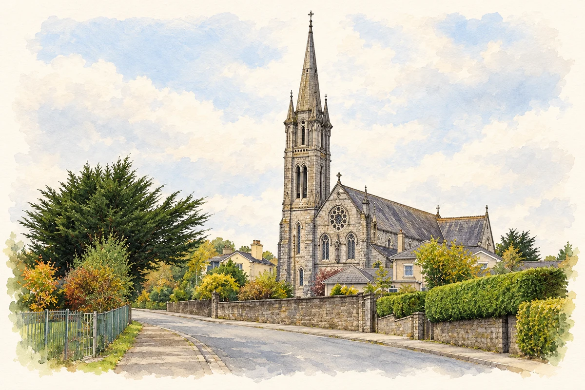
St James’s Church of Ireland was built in 1846 on the site of the earlier church established by Boyle. Limestone ashlar and Gothic details shaped its nineteenth-century appearance. Cork County Council converted it into a library during the 1990s. It preserves another civic use for a building whose first purpose had been worship.[2]
People & connections
Eliza Lynch’s early connection
Eliza Alicia Lynch’s family belonged to Charleville, and she was baptised in its Catholic church in May 1834. Her later life took her to France and Paraguay, where she became the partner of Francisco Solano López. The connection brought a woman with an exceptionally international and contested later career out of a small north Cork town. Her early family circumstances and subsequent travels form distinct stages of that biography.[3]
Rathluirc (Charleville) — Census 2016 settlement footprint
Population within 2016 settlement boundaries
4,091people · 2022
Both counts use the 2016 settlement boundary, allowing like-for-like comparison. CSO supplies the 2022 count on this older boundary for comparison only. The official 2022 Built Up Area has different boundaries.
View population figures
Rathluirc (Charleville) — Census 2016 settlement footprint — census population
Rathluirc (Charleville), Cork and Limerick — Census town, CSO 2006 report
2002–2006: census town
2,984people · 2006
These are the historical areas published in the 2006 census report. Boundaries may differ between censuses and from modern settlements. Legal towns, environs and suburbs are shown separately; none has been combined into a modern settlement total.
View population figures
Rathluirc (Charleville), Cork and Limerick — Census town, CSO 2006 report — census population
Rathluirc (Charleville), Cork and Limerick — Census town, CSO 1996 report
1991–1996: census town
2,667people · 1996
These are the historical areas published in the 1996 census report. Boundaries may differ between censuses and from modern settlements. Legal towns, environs and suburbs are shown separately; none has been combined into a modern settlement total.
View population figures
Rathluirc (Charleville), Cork and Limerick — Census town, CSO 1996 report — census population
Rathluirc (or Charleville), Cork — Census town, CSO 1986 report
1981–1986: census town
2,814people · 1986
Figures cover the historical town area printed in the 1986 report. Boundaries may have changed between censuses. Legal town, environs and suburb totals remain separate and differ from modern settlement boundaries.
View population figures
Rathluirc (or Charleville), Cork — Census town, CSO 1986 report — census population
These figures use different area definitions. Read the boundary note before comparing them.
Rathluirc (Charleville), Cork and Limerick
Published census settlement populations
3,919people · 2016
Settlement boundaries changed during this period. Differences may reflect boundary changes as well as population change. Where a 2011 legal-town-and-environs count is shown, it has not been recalculated onto the 2016 settlement boundary.
View population figures
Rathluirc (Charleville), Cork and Limerick — census population
Holy Cross Church, Charleville, County Cork illustration: based on a Charleville church by john salter. AI-assisted watercolour and ink adaptation; cream paper margins added, incidental clutter omitted and fine details simplified. Licence: CC BY-SA 2.0.
 placenames