These Irish name elements are associated with this record in the Logainm glossary.
An element’s translation is a clue, rather than a complete explanation of the name. Its form and meaning depend on local history and the full Irish name.
Recorded forms
An Gleann· Irish · main form · validated name
Glin· English · main form
Place & story
The old castle and the siege
The old castle at Glin was besieged by Sir George Carew's forces in July 1600 during the Nine Years War. Limerick's heritage plan identifies it separately from the later house now generally called Glin Castle. Its surviving ruins belong to the earlier fortified residence of the Knights of Glin. The distinction matters because accounts of the siege concern this medieval building, not the Georgian country house. The family's title and local influence continued across changes in residence, political allegiance and the appearance of the estate.[2]
A country house with an earlier wing
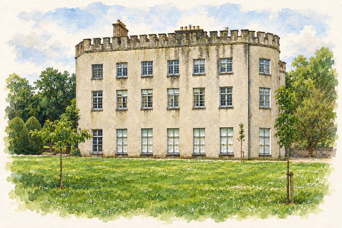
The architectural inventory dates the main body of the present Glin Castle approximately to 1790, while identifying an older western wing from the late seventeenth or early eighteenth century. Curved bays, battlements and an elaborate interior give the house a character assembled across several building phases. Its hall contains decorative plasterwork with military trophies and Irish harps. A timber staircase rises from two lower flights into a single suspended flight. The inventory treats the identities of some designers and craftsmen as uncertain, rather than assigning every feature to a named architect.[3]
Folklore & tradition
The horse on the staircase
The castle's own family-history account preserves a story about the twenty-sixth Knight, remembered by the nickname 'Crack'd Jack'. He was said to have ridden a horse up the flying staircase to bed. The account presents this as something told about him, not as an independently documented event. It attaches a memorable piece of family lore to a real and unusual architectural feature. Such stories form part of how the household has remembered its predecessors, alongside the more securely dated evidence of buildings, documents and ownership.[4]
Both counts use the 2016 settlement boundary, allowing like-for-like comparison. CSO supplies the 2022 count on this older boundary for comparison only. The official 2022 Built Up Area has different boundaries.
View population figures
Glin — Census 2016 settlement footprint — census population
These are the historical areas published in the 2006 census report. Boundaries may differ between censuses and from modern settlements. Legal towns, environs and suburbs are shown separately; none has been combined into a modern settlement total.
View population figures
Glin, Limerick — Census town, CSO 2006 report — census population
These are the historical areas published in the 1996 census report. Boundaries may differ between censuses and from modern settlements. Legal towns, environs and suburbs are shown separately; none has been combined into a modern settlement total.
View population figures
Glin, Limerick — Census town, CSO 1996 report — census population
Figures cover the historical town area printed in the 1986 report. Boundaries may have changed between censuses. Legal town, environs and suburb totals remain separate and differ from modern settlement boundaries.
View population figures
Glin, Limerick — Census town, CSO 1986 report — census population
These figures use different area definitions. Read the boundary note before comparing them.
Glin, Limerick
Published census settlement populations
576people · 2016
Settlement boundaries changed during this period. Differences may reflect boundary changes as well as population change. Where a 2011 legal-town-and-environs count is shown, it has not been recalculated onto the 2016 settlement boundary.
Glin Castle illustration: based on a Glin Castle, Limerick by Garry Dickinson. AI-assisted watercolour and ink adaptation; cream paper margins added, incidental clutter omitted and fine details simplified. Licence: CC BY-SA 2.0.
 placenames