Patrickswell’s central well preserves a story about Saint Patrick, while its railway buildings and an RTÉ film record other chapters in the village’s life.
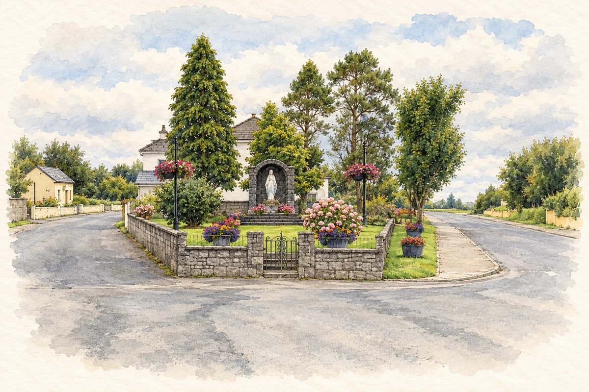
Illustration, roadside Marian shrine, Patrickswell, in 2010
⊕Recorded locationPatrickswell52.59982° N · 8.70720° WInteractive map supplied by OpenStreetMap.
A reliable full-name meaning has not been established here. The recorded Irish and English forms are given without an unsupported translation.
Recorded forms
Tobar Phádraig· Irish · main form · validated name
Patrickswell· English · main form
Place & story
Folklore & tradition
Patrick and the light on the rock
The Limerick Diocesan Heritage Project records a local story in which a witch at Carrigogunnell lit a deadly candle each evening. Saint Patrick, standing near the well, read from his book while looking towards the castle. When he closed the book, the light went out for good. The project presents this as a story explaining the village's association with Patrick, rather than a documented event. The tale gives a familiar local landmark a role in a wider landscape of saints, dangerous lights and supernatural protection.[2]
A well adapted for everyday use
Limerick's protected-structure record describes Saint Patrick's Well as originally open, with a carved plaque added in the early nineteenth century. A pump was installed over it around 1890. Traditions connected its water with relief from toothache and other ailments; these are historical beliefs, not medical evidence. A different piece of infrastructure survives at the railway station, built in 1856. The stationmaster's house, station wings and associated signal box formed part of the Limerick-to-Kerry railway network, joining domestic accommodation to the practical work of running trains.[3][4]
The village greets a television crew
RTÉ's archive preserves an opening sequence for Hall's Pictorial Weekly broadcast on 14 November 1979. It shows people around Patrickswell's food shop, post office, garage and pub acknowledging the visiting camera. Such short location films were a recurring feature of the programme, with the chosen place kept out of advance listings. For Patrickswell, the sequence is a compact record of ordinary village life and familiar businesses at a particular moment. It complements the surviving buildings with movement, faces and the everyday activity of the street.[5]
Both counts use the 2016 settlement boundary, allowing like-for-like comparison. CSO supplies the 2022 count on this older boundary for comparison only. The official 2022 Built Up Area has different boundaries.
View population figures
Patrickswell — Census 2016 settlement footprint — census population
Patrickswell, Limerick — Census town, CSO 2006 report
2002–2006: census town
924people · 2006
These are the historical areas published in the 2006 census report. Boundaries may differ between censuses and from modern settlements. Legal towns, environs and suburbs are shown separately; none has been combined into a modern settlement total.
View population figures
Patrickswell, Limerick — Census town, CSO 2006 report — census population
Patrickswell, Limerick — Census town, CSO 1996 report
1991–1996: census town
1,022people · 1996
These are the historical areas published in the 1996 census report. Boundaries may differ between censuses and from modern settlements. Legal towns, environs and suburbs are shown separately; none has been combined into a modern settlement total.
View population figures
Patrickswell, Limerick — Census town, CSO 1996 report — census population
Patrickswell, Limerick — Census town, CSO 1986 report
1981–1986: census town
905people · 1986
Figures cover the historical town area printed in the 1986 report. Boundaries may have changed between censuses. Legal town, environs and suburb totals remain separate and differ from modern settlement boundaries.
View population figures
Patrickswell, Limerick — Census town, CSO 1986 report — census population
These figures use different area definitions. Read the boundary note before comparing them.
Patrickswell, Limerick
Published census settlement populations
847people · 2016
Settlement boundaries changed during this period. Differences may reflect boundary changes as well as population change. Where a 2011 legal-town-and-environs count is shown, it has not been recalculated onto the 2016 settlement boundary.
Roadside Marian shrine, Patrickswell illustration: based on a Shrine in Patrickswell by David Hawgood. AI-assisted watercolour and ink adaptation; cream paper margins added, incidental clutter omitted and fine details simplified. Licence: CC BY-SA 2.0.
 placenames