These Irish name elements are associated with this record in the Logainm glossary.
An element’s translation is a clue, rather than a complete explanation of the name. Its form and meaning depend on local history and the full Irish name.
Recorded forms
Áth na gCasán· Irish · main form · validated name
Annagassan· English · main form
Place & story
Finding Linn Duachaill
The search for the Viking longphort of Linn Duachaill led archaeologists to ground beside the Glyde about a kilometre north of Annagassan. A 2007 geophysical survey preceded trial excavations in September 2010. Mark Clinton's report records a substantial defensive ditch, approximately five metres wide and three metres deep, with traces of an internal bank. Other trenches uncovered cobbled surfaces, drains and pits, giving physical evidence for the fortified riverside site.[2]
Evidence of ships and exchange
The 2010 excavations also recovered clinker nails and roves, fittings associated with the construction of overlapping-plank ships. Metalworking debris connected the enclosure with practical craft activity. Two pieces of cut silver, a lead weight and a possible fragment of scales suggested exchange and the handling of valuable materials. A loom weight and copper-alloy objects added evidence of activities beyond fortification. These were excavated finds, distinct from later stories about the Vikings.[2]
The five-arched bridge
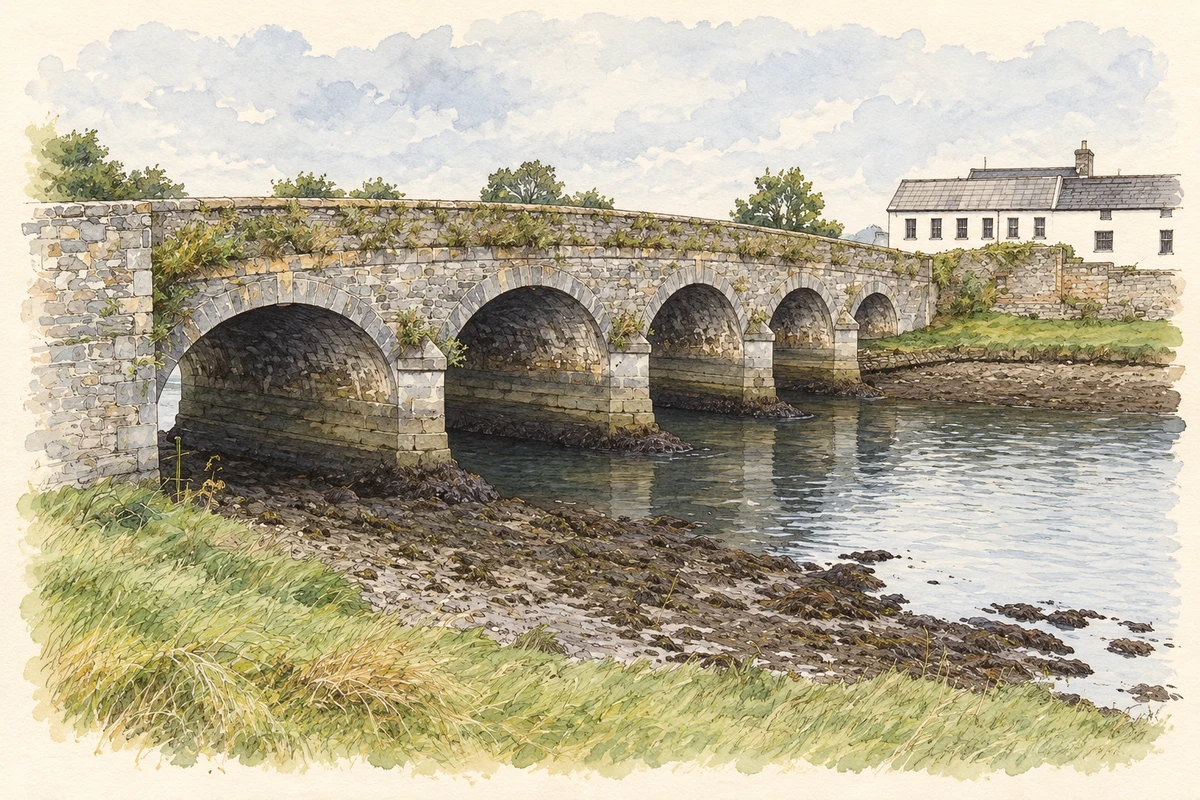
At the village's southern approach, Annagassan Bridge carries the road over the Glyde. The architectural inventory dates the limestone crossing to around 1800. Its five rounded arches have dressed stone surrounds, and pointed cutwaters on both sides of the piers carry conical caps. Rubble parapets contrast with the more carefully finished stonework. The bridge preserves a later phase in the locality's long dependence on river crossings and coastal routes.[3]
Both counts use the 2016 settlement boundary, allowing like-for-like comparison. CSO supplies the 2022 count on this older boundary for comparison only. The official 2022 Built Up Area has different boundaries.
View population figures
Annagassan — Census 2016 settlement footprint — census population
These figures use different area definitions. Read the boundary note before comparing them.
Annagassan, Louth
Published census settlement populations
201people · 2016
Settlement boundaries changed during this period. Differences may reflect boundary changes as well as population change. Where a 2011 legal-town-and-environs count is shown, it has not been recalculated onto the 2016 settlement boundary.
Annagassan Bridge, County Louth illustration: based on a Annagassan Bridge by Jonathan Billinger. AI-assisted watercolour and ink adaptation; cream paper margins added, incidental clutter omitted and fine details simplified. Licence: CC BY-SA 2.0.
 placenames