These Irish name elements are associated with this record in the Logainm glossary.
An element’s translation is a clue, rather than a complete explanation of the name. Its form and meaning depend on local history and the full Irish name.
Recorded forms
Baile Trá· Irish · main form · validated name
Baltray· English · main form
Place & story
A surviving thatched village house
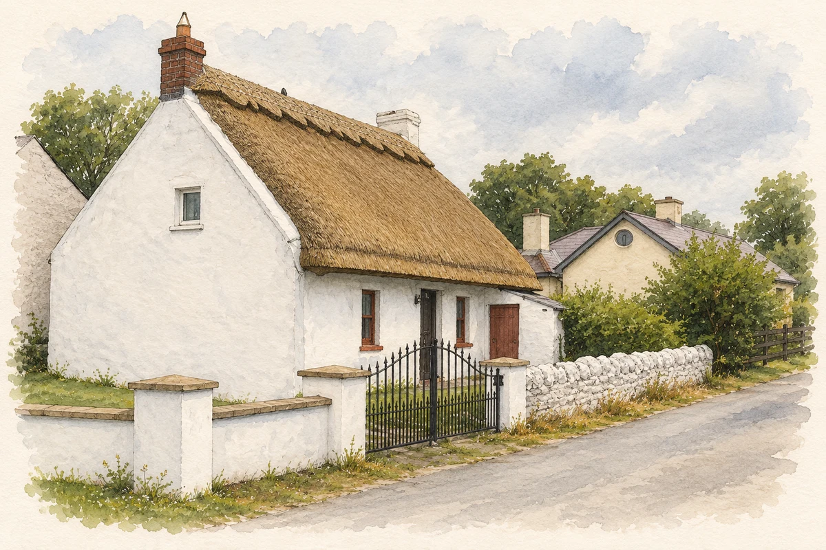
A thatched house at the centre of Baltray is dated to about 1780 by the National Inventory of Architectural Heritage. It has a rectangular plan, direct entry from outside and an attic beneath the thatch. Brick and rendered chimneystacks rise from opposite ends. The inventory identifies it as one of several surviving thatched houses in the village, preserving building methods and a domestic scale once more widespread there.[2]
The links and their designers
County Louth Golf Club began at Baltray in 1892 with a nine-hole course on the seashore. Its own history identifies Thomas Gilroy, George Henry Pentland and greenkeeper Tom Smith among the early figures. Tom Simpson, assisted by Molly Gourlay, redesigned the course in 1938. Baltray later hosted the Irish Open in 2004 and 2009, the latter won by Shane Lowry while still an amateur. These events connect the small coastal village with national sporting history.[3]
The little tern colony
Baltray’s little tern conservation project began in 2007 with volunteers whose work helped establish Louth Nature Trust. BirdWatch Ireland records the Trust’s subsequent management of the colony. Little terns nest on shingle, leaving eggs and chicks vulnerable to weather and predators. Protecting the nesting area is therefore central to the beach’s role as breeding habitat, rather than simply a matter of recording birds passing along the coast.[4]
The Irish Trader on the beach
The remains of the Irish Trader lie on the beach at Baltray, where the vessel ran aground in 1974. Visit Louth identifies the wreck as a feature of the sand-and-shingle shore extending towards Termonfeckin, overlooked by the County Louth and Seapoint golf links. The exposed remains add a twentieth-century maritime episode to a coast otherwise often discussed through its wildlife and recreational landscape.[5]
Both counts use the 2016 settlement boundary, allowing like-for-like comparison. CSO supplies the 2022 count on this older boundary for comparison only. The official 2022 Built Up Area has different boundaries.
View population figures
Baltray — Census 2016 settlement footprint — census population
These are the historical areas published in the 2006 census report. Boundaries may differ between censuses and from modern settlements. Legal towns, environs and suburbs are shown separately; none has been combined into a modern settlement total.
View population figures
Baltray, Louth — Census town, CSO 2006 report — census population
These are the historical areas published in the 1996 census report. Boundaries may differ between censuses and from modern settlements. Legal towns, environs and suburbs are shown separately; none has been combined into a modern settlement total.
View population figures
Baltray, Louth — Census town, CSO 1996 report — census population
Figures cover the historical town area printed in the 1986 report. Boundaries may have changed between censuses. Legal town, environs and suburb totals remain separate and differ from modern settlement boundaries.
View population figures
Baltray, Louth — Census town, CSO 1986 report — census population
These figures use different area definitions. Read the boundary note before comparing them.
Baltray, Louth
Published census settlement populations
132people · 2016
Settlement boundaries changed during this period. Differences may reflect boundary changes as well as population change. Where a 2011 legal-town-and-environs count is shown, it has not been recalculated onto the 2016 settlement boundary.
Thatched cottage at Baltray illustration: based on a Thatched cottage at Baltray, Co. Louth by Kieran Campbell. AI-assisted watercolour and ink adaptation; cream paper margins added, incidental clutter omitted and fine details simplified. Licence: CC BY-SA 2.0.
 placenames