These Irish name elements are associated with this record in the Logainm glossary.
An element’s translation is a clue, rather than a complete explanation of the name. Its form and meaning depend on local history and the full Irish name.
Recorded forms
Béal Linne· Irish · main form · validated name
Bealin· English · main form
Baylin· English · main form · local name
Place & story
A cross moved from its earlier setting
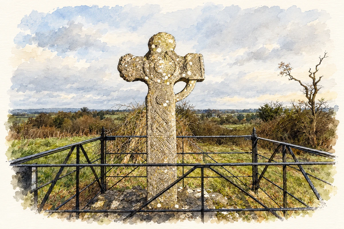
Bealin High Cross, also called the Twyford Cross, stands on a small hill within the Twyford demesne. The Office of Public Works records its removal by the Reverend Richard Handcock from an old graveyard during the eighteenth century. It associates that earlier location with the ecclesiastical site of Íseal Chiaráin, of which no surface remains are visible. The cross survives as an isolated monument after changes to the landscape around its former setting.[2]
Animals, interlace and an inscription
The monument’s decoration includes birds, intertwined animals and a hunting scene with a horseman, dog and stag. Different faces combine this imagery with spirals and knotwork. Its western inscription asks for a prayer for Tuathgail, who had the cross made. The damaged northern arm and incomplete ring show that the sculpture has suffered losses, but substantial carving remains. Its imagery and lettering preserve evidence beyond the cross’s familiar outline.[2]
From Lower Warren to Bealin
Saint Ciaran’s National School was formerly located in Lower Warren, nearer Athlone. Its building in Bealin opened in 1949, and extensions followed in 1994, 2013 and 2021. The school’s own account describes children attending from Twyford and the village, as well as surrounding districts including Moydrum and Walderstown. These successive additions record the growth of a village institution whose history began at another site.[3]
Both counts use the 2016 settlement boundary, allowing like-for-like comparison. CSO supplies the 2022 count on this older boundary for comparison only. The official 2022 Built Up Area has different boundaries.
View population figures
Baylin — Census 2016 settlement footprint — census population
These figures use different area definitions. Read the boundary note before comparing them.
Baylin, Westmeath
Published census settlement populations
240people · 2016
Settlement boundaries changed during this period. Differences may reflect boundary changes as well as population change. Where a 2011 legal-town-and-environs count is shown, it has not been recalculated onto the 2016 settlement boundary.
Bealin High Cross, Twyford, near Bealin, County Westmeath illustration: based on a Bealin High Cross, West Side (16 January 2015) by Bradley Davis (backpackphotography). AI-assisted watercolour and ink adaptation; cream paper margins added, incidental clutter omitted and fine details simplified. Licence: CC BY 2.0.
 placenames