 placenames
Castlebaldwin
Béal Átha na gCarraigíní
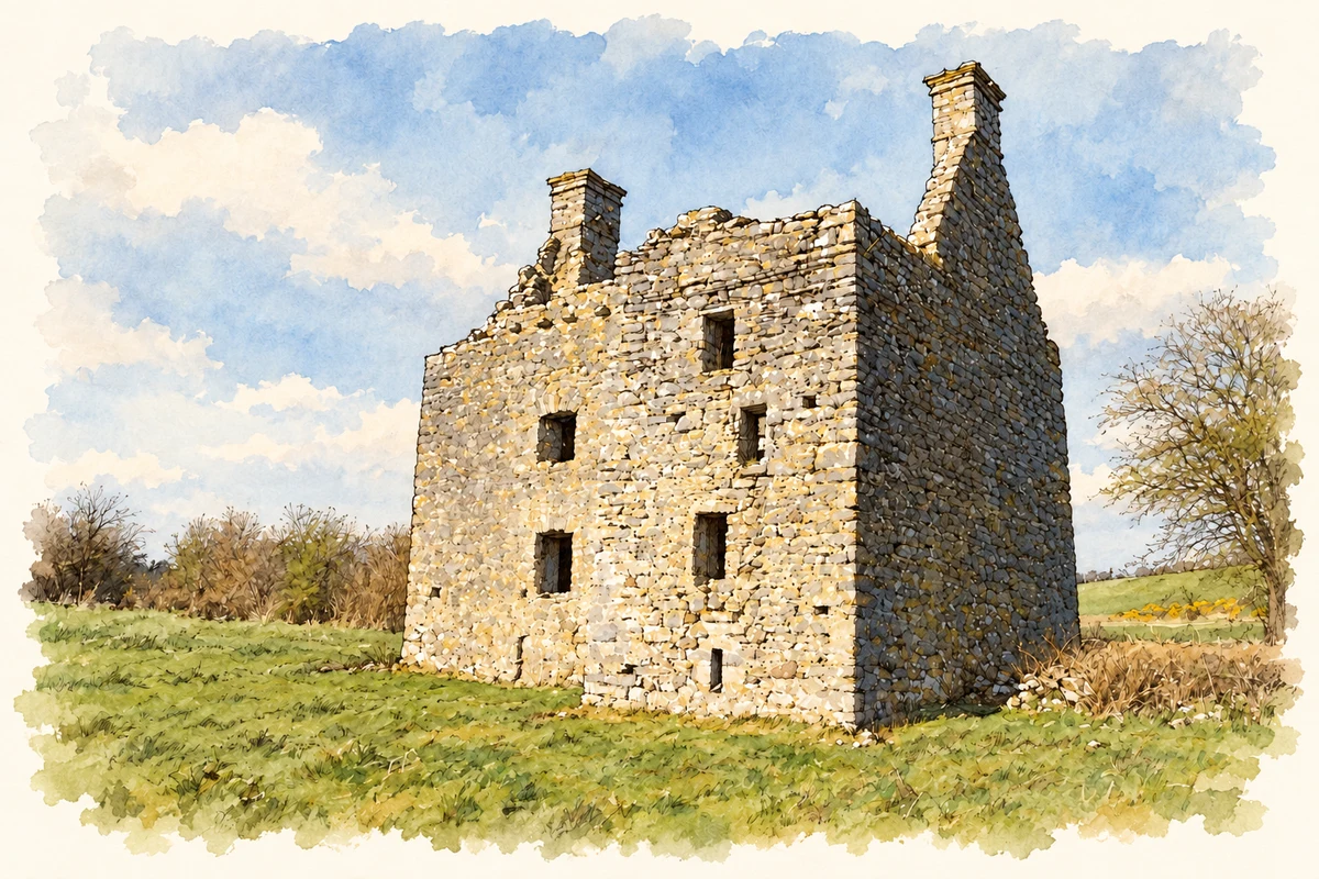
A seventeenth-century fortified residence stands behind the story of a village shaped by coaching traffic and livestock trading.
The name
These Irish name elements are associated with this record in the Logainm glossary.
An element’s translation is a clue, rather than a complete explanation of the name. Its form and meaning depend on local history and the full Irish name.
Recorded forms
- Béal Átha na gCarraigíní · Irish · main form · validated name
- Castlebaldwin · English · main form
Place & story
A house built for security
The roofless fortified house at Castlebaldwin belongs to the seventeenth century. The National Inventory of Architectural Heritage dates it to about 1625. Its two-storey main block has a projecting tower and a defensive opening above the doorway. Fireplaces and chimney stacks survive, showing how domestic comfort and protection were combined as fortified houses succeeded medieval tower houses. [2]
The coach road village
Clare Walsh's local history links the village's development to the Dublin–Sligo mail coach road, whose service through Boyle and Longford began in 1808. At Cloghogue, a staging house owned by Michael Walsh provided accommodation. A road to Annaghcurra was added in the 1880s, helping form the later crossroads settlement. [3]
Trading at Baldwin
Walsh records that Sir Henry Nicholson established Baldwin's fair in 1712, alongside a Wednesday market. Livestock dealing occupied the first day of each fair, followed by stalls and social gatherings. The market had ended by 1850, and a local attempt to revive the fair during the Second World War proved unsuccessful. [3]
Geographic information
- Place type
- Population centre
- County
- Sligo
- Barony
- Tirerrill
- Civil parish
- Kilmacallan
- Coordinates
- 54.07446, -8.38196 (approximate)
- Logainm ID
- 1375249 ↗
Sources & further reading
- Logainm.ie — Castlebaldwin. Place names and geographic record, licensed under CC BY 4.0.
- Castlebaldwin fortified house — NIAH 32403404 · National Inventory of Architectural Heritage
- Castlebaldwin Village and The Fair of Baldwin, The Corran Herald 44 (2011/2012), pp. 46, 67 · Clare Walsh; Ballymote Heritage Group
- Castlebaldwin fortified house ruin, County Sligo illustration: based on a Castlebaldwin (or Baldwin Castle) by dougf. AI-assisted watercolour and ink adaptation; cream paper margins added, incidental clutter omitted and fine details simplified. Licence: CC BY-SA 2.0.
Name record retrieved 2026-10-25 · Source record modified 2025-01-10. How this page was prepared.