Kildrum lies beside Killea in east Donegal. Its district history includes nineteenth-century lime burning and the formation of a football club whose early matches were played locally.
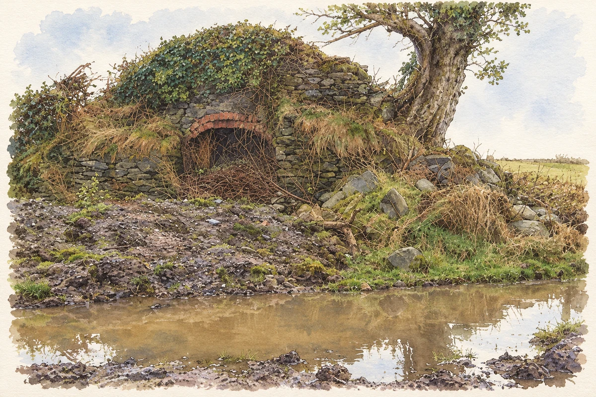
Illustration, lime kiln, Kildrum Lower, near Kildrum
⊕Recorded locationKildrum54.97980° N · 7.41413° WInteractive map supplied by OpenStreetMap.
These Irish name elements are associated with this record in the Logainm glossary.
An element’s translation is a clue, rather than a complete explanation of the name. Its form and meaning depend on local history and the full Irish name.
Recorded forms
Cúl Droma· Irish · main form
Kildrum· English · main form
Place & story
Lime burning in Kildrum Lower
A surviving lime kiln in Kildrum Lower dates from about 1870. Its square structure uses uncoursed limestone, with a red-brick arch over the opening where the fire was tended. The burning chamber has become filled with rubble and vegetation. Lime burning supplied material for mortar and other building work and for improving agricultural soils. The kiln records a small rural industry closely connected with the needs of surrounding farms and houses, even though the structure itself has long been disused.[2]
People & connections
The men who founded Kildrum Tigers
The football club's own history credits Bobby Toland, Paddy McFadden and Paddy McDaid with founding Kildrum Tigers in 1948. Early football took place before the establishment of the organised Donegal leagues, and a surviving team photograph records an FAI Junior Cup match against Sligo Bohemians played at Killea during the 1950s. The Tigers joined the Derry and District League in 1952 and later became founder members of the Inishowen and Donegal leagues. Their origins connect the Kildrum–Killea district with the development of organised football across the county.[3]
The neighbouring parish church
The Church of the Immaculate Conception at neighbouring Killea was built in 1954. It serves the parish shared with Newtowncunningham, whose present Church of All Saints opened in 1999. These two buildings belong to different phases of twentieth-century parish development. Killea's church provides a nearby public landmark for the communities around Kildrum.[4]
Both counts use the 2016 settlement boundary, allowing like-for-like comparison. CSO supplies the 2022 count on this older boundary for comparison only. The official 2022 Built Up Area has different boundaries.
View population figures
Kildrum — Census 2016 settlement footprint — census population
These are the historical areas published in the 2006 census report. Boundaries may differ between censuses and from modern settlements. Legal towns, environs and suburbs are shown separately; none has been combined into a modern settlement total.
View population figures
Kildrum, Donegal — Census town, CSO 2006 report — census population
These figures use different area definitions. Read the boundary note before comparing them.
Kildrum, Donegal
Published census settlement populations
534people · 2016
Settlement boundaries changed during this period. Differences may reflect boundary changes as well as population change. Where a 2011 legal-town-and-environs count is shown, it has not been recalculated onto the 2016 settlement boundary.
 placenames