Ballyhooly's river setting brings together a medieval tower house, a twentieth-century fishing lodge and a bridge that combines masonry piers with a later concrete deck.
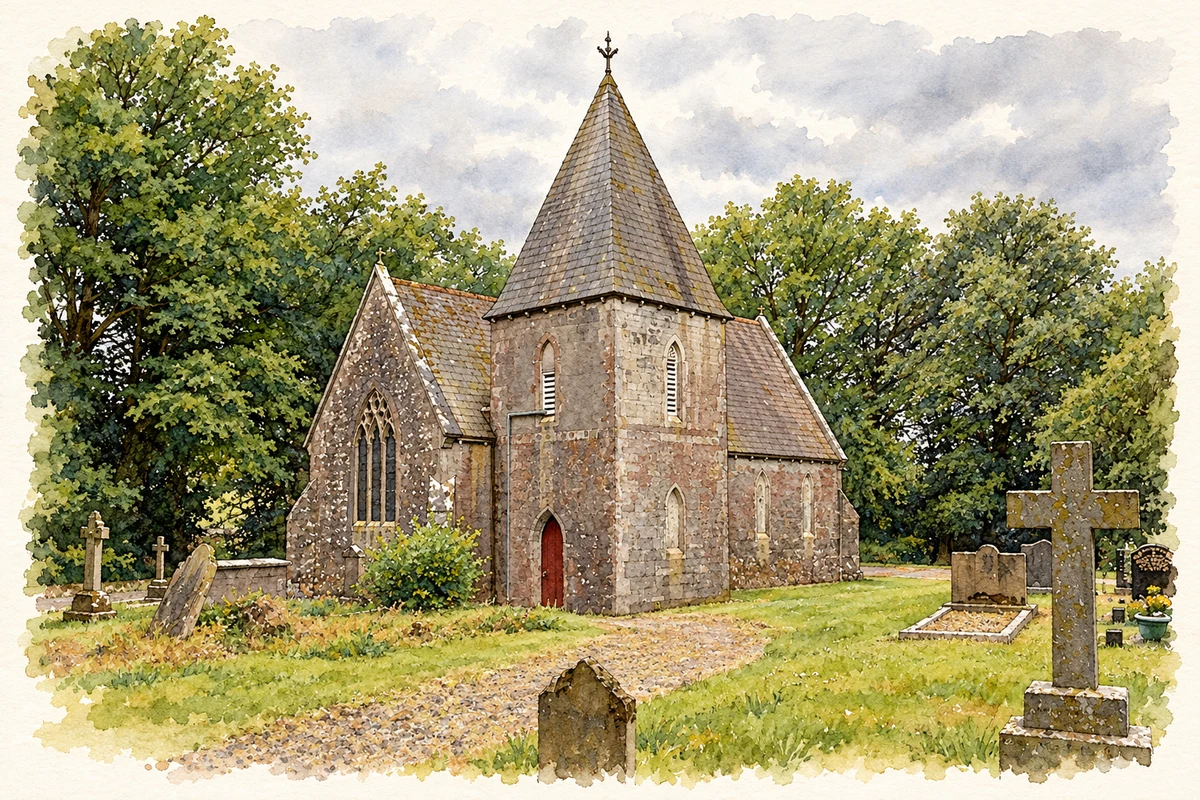
Illustration, Christ Church, Ballyhooly, County Cork
⊕Recorded locationBallyhooly52.14545° N · 8.39774° WInteractive map supplied by OpenStreetMap.
These Irish name elements are associated with this record in the Logainm glossary.
An element’s translation is a clue, rather than a complete explanation of the name. Its form and meaning depend on local history and the full Irish name.
Recorded forms
Baile Átha hÚlla· Irish · main form · validated name
Ballyhooly· English · main form
Place & story
A village beside an unnavigable reach
Ballyhooly lay on the Fermoy–Mallow road beside the Blackwater. In 1837 Samuel Lewis counted 85 houses, most of them thatched, and 533 inhabitants in the village. A bridge crossed the river, but shoals and rapids prevented navigation along this stretch. The surrounding parish supplied turf and limestone, with an extensive corn mill at Millvale. The river landscape therefore supported agriculture, milling and road transport while limiting the passage of boats.[2]
A fishing lodge beside the tower house
The house beside Ballyhooly's medieval tower house was built as a fishing lodge in 1922. Its river-facing elevation alternates projecting gables with bowed upper-floor windows. Carved timber bargeboards decorate the gables, giving the building an elaborate domestic appearance against the older defensive structure. Stone-faced terraces were added to the steep slope towards the Blackwater in 1949–50. The arrangement places twentieth-century leisure architecture beside a much earlier riverside stronghold.[3]
Two generations of bridge engineering
Ballyhooly Bridge combines stonework from about 1820 with a reinforced-concrete superstructure added around 1970. Its five spans rest on limestone piers, which have rounded cutwaters and carefully finished caps. The later flat-beam deck replaced an earlier structure while retaining the older supports. This reuse gives the crossing a visible engineering history: the river piers belong to one period of road building, while the surface carrying traffic belongs to another.[4]
Christ Church and reused medieval stone
Christ Church was built in 1881 to a design by William Henry Hill, replacing an earlier church of 1774. Its construction reused cut stone from Bridgetown Abbey. The design combined a nave and chancel with a bell tower and side chapel, using patterned slate, limestone dressings and decorative timber work. The reuse of abbey masonry connected this nineteenth-century church with the older religious buildings of the Blackwater valley.[5]
Both counts use the 2016 settlement boundary, allowing like-for-like comparison. CSO supplies the 2022 count on this older boundary for comparison only. The official 2022 Built Up Area has different boundaries.
View population figures
Ballyhooly — Census 2016 settlement footprint — census population
These are the historical areas published in the 2006 census report. Boundaries may differ between censuses and from modern settlements. Legal towns, environs and suburbs are shown separately; none has been combined into a modern settlement total.
View population figures
Ballyhooly, Cork — Census town, CSO 2006 report — census population
These are the historical areas published in the 1996 census report. Boundaries may differ between censuses and from modern settlements. Legal towns, environs and suburbs are shown separately; none has been combined into a modern settlement total.
View population figures
Ballyhooly, Cork — Census town, CSO 1996 report — census population
Figures cover the historical town area printed in the 1986 report. Boundaries may have changed between censuses. Legal town, environs and suburb totals remain separate and differ from modern settlement boundaries.
View population figures
Ballyhooly, Cork — Census town, CSO 1986 report — census population
These figures use different area definitions. Read the boundary note before comparing them.
Ballyhooly, Cork
Published census settlement populations
475people · 2016
Settlement boundaries changed during this period. Differences may reflect boundary changes as well as population change. Where a 2011 legal-town-and-environs count is shown, it has not been recalculated onto the 2016 settlement boundary.
Christ Church, Ballyhooly, County Cork illustration: based on a Ballyhooly (Church of Ireland) Church by Mike Searle. AI-assisted watercolour and ink adaptation; cream paper margins added, incidental clutter omitted and fine details simplified. Licence: CC BY-SA 2.0.
 placenames