 placenames
Clongriffin
Cluain Ghrífín
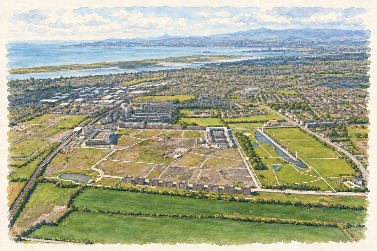
Clongriffin’s modern history is closely tied to its phased construction, railway station and neighbouring Father Collins Park.
The name
These Irish name elements are associated with this record in the Logainm glossary.
An element’s translation is a clue, rather than a complete explanation of the name. Its form and meaning depend on local history and the full Irish name.
Recorded forms
- Cluain Ghrífín · Irish · main form
- Clongriffin · English · main form
Place & story
Building a new neighbourhood
Waterman Moylan, the project’s engineering consultant, records the first planning permission for Clongriffin in 2003. The initial construction phase was completed in 2006 and the town centre followed in 2008. Development then slowed during the international financial crisis before work resumed in 2014. This interrupted sequence explains why the neighbourhood developed in distinct phases rather than as a single completed scheme. [2]
Father Collins Park
Neighbouring Father Collins Park opened in 2009 and commemorates Joe Collins, a local Donaghmede parish priest. The council’s local area plan records construction beginning in 2007, funded through development levies. Its design came from an international competition won by an Argentinian architectural practice. Five wind turbines were incorporated to supply electricity for water features and lighting, alongside sports grounds, play areas and an amphitheatre. [3]
The station opens
Clongriffin’s railway station opened for passengers on 19 April 2010, between Howth Junction and Portmarnock. The Railway Safety Commission recorded the opening in its annual report. The new stop connected the developing neighbourhood to the suburban rail network, making rail transport an established part of Clongriffin’s early infrastructure. [4]
Geographic information
Sources & further reading
- Logainm.ie — Clongriffin. Place names and geographic record, licensed under CC BY 4.0.
- Clongriffin Town Centre,30 August2022 · Waterman Moylan
- Clongriffin–Belmayne Local Area Plan2012: public open space · Dublin City Council
- Railway Safety Commission Annual Report2010, section2.1.2 · Railway Safety Commission
- Clongriffin and Father Collins Park from the air illustration: based on a Clongriffin from the air by Thomas Nugent. AI-assisted watercolour and ink adaptation; cream paper margins added, incidental clutter omitted and fine details simplified. Licence: CC BY-SA 2.0.
Name record retrieved 2026-10-25 · Source record modified 2009-10-23. How this page was prepared.