 placenames
Ballyhillin
Baile Choillín
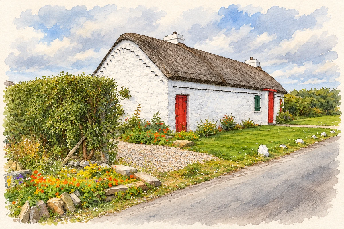
At Ballyhillin, surviving thatched homes stand close to the headland where visual shipping signals gave way to wireless communications.
The name
These Irish name elements are associated with this record in the Logainm glossary.
An element’s translation is a clue, rather than a complete explanation of the name. Its form and meaning depend on local history and the full Irish name.
Recorded forms
- Baile Choillín · Irish · main form
- Ballyhillin · English · main form
Place & story
A surviving clachan
Ballyhillin preserves part of a clachan, a cluster of homes shown on the first Ordnance Survey map around 1837. One surviving house, dated to about 1820, combines living accommodation with a byre at its south gable. Its flax-thatch roof, limewashed stone walls, half-doors and windbreak porch record the practical arrangements of a small coastal farming household. The building makes the older settlement pattern legible at close quarters. [2]
Watching for invasion
On the headland northwest of Ballyhillin, Malin’s square signal tower belongs to the coastal warning system built during the Napoleonic wars. Largely completed by 1804, it received a signal lieutenant in February 1806. Flags and balls raised on a mast passed messages between stations. The tower’s elevated position served the practical need to see neighbouring signals and watch approaching ships. [3]
From visual signals to wireless
The headland’s communications role outlasted the invasion alarm. In the late nineteenth century Lloyd’s used the site to relay shipping information, with a semaphore connection involving Inishtrahull. A Marconi wireless station was established beside the tower in 1901; the architectural inventory records a commercial message to the SS Lake Ontario in 1902. Separate buildings around the tower reflect these successive changes in technology. [3]
Geographic information
Sources & further reading
- Logainm.ie — Ballyhillin. Place names and geographic record, licensed under CC BY 4.0.
- Ardmalin, Ballyhillin: vernacular house, register 40900107 · National Inventory of Architectural Heritage
- Malin Signal Tower, register 40900101 · National Inventory of Architectural Heritage
- Traditional cottage, Ballyhillin illustration: based on a Cottage at Ballyhillin by David Dixon. AI-assisted watercolour and ink adaptation; cream paper margins added, incidental clutter omitted and fine details simplified. Licence: CC BY-SA 2.0.
Name record retrieved 2026-10-25 · Source record modified 2026-05-20. How this page was prepared.