A reliable full-name meaning has not been established here. The recorded Irish and English forms are given without an unsupported translation.
Recorded forms
Cairlinn· Irish · main form · validated name
Carlingford· English · main form
Place & story
The castle overlooking the lough
Carlingford Castle was built around the end of the twelfth century above the harbour. Its association with King John follows his seizure of the de Lacy possessions in 1210, and the traditional name King John's Castle survives. The Office of Public Works describes it as a defensive centre for the surrounding area. Accounts differ over the precise identity of its original builder, so the late-twelfth-century foundation is more secure than a single unqualified attribution. The castle's prominent position still explains its relationship with the water and town below.[2][4]
A gate and a merchant’s decorated windows
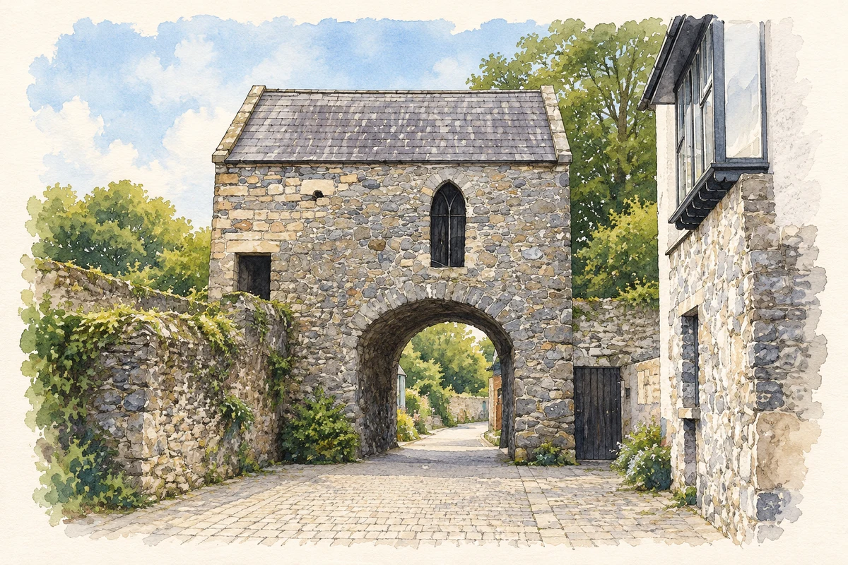
The Tholsel is Carlingford's surviving town gate, once a point for collecting tolls and later used for detention. Nearby, the building called the Mint has elaborate limestone window decoration dating from the sixteenth century. Although Carlingford received permission to mint coins in 1467, the Office of Public Works considers it unlikely that this house actually served that purpose; a wealthy merchant's residence is the more likely explanation. These buildings show how a historic name can preserve an association without proving the original use of the structure.[3]
Folklore & tradition
Finn’s outline in Slieve Foy
The mountain above Carlingford is associated with the sleeping giant Finn Mac Cumhaill. The Office of Public Works records the legend in its introduction to the castle, placing the medieval monument beneath a landscape already carrying an imaginative story. This is folklore attached to the mountain's form, not a geological account or a proven derivation of its name. It belongs alongside the town's documented buildings as a different way people have understood the same setting: stone walls beside the lough, and a giant remembered in the ridge above.[2]
Both counts use the 2016 settlement boundary, allowing like-for-like comparison. CSO supplies the 2022 count on this older boundary for comparison only. The official 2022 Built Up Area has different boundaries.
View population figures
Carlingford — Census 2016 settlement footprint — census population
These are the historical areas published in the 2006 census report. Boundaries may differ between censuses and from modern settlements. Legal towns, environs and suburbs are shown separately; none has been combined into a modern settlement total.
View population figures
Carlingford, Louth — Census town, CSO 2006 report — census population
These are the historical areas published in the 1996 census report. Boundaries may differ between censuses and from modern settlements. Legal towns, environs and suburbs are shown separately; none has been combined into a modern settlement total.
View population figures
Carlingford, Louth — Census town, CSO 1996 report — census population
Figures cover the historical town area printed in the 1986 report. Boundaries may have changed between censuses. Legal town, environs and suburb totals remain separate and differ from modern settlement boundaries.
View population figures
Carlingford, Louth — Census town, CSO 1986 report — census population
These figures use different area definitions. Read the boundary note before comparing them.
Carlingford, Louth
Published census settlement populations
1,445people · 2016
Settlement boundaries changed during this period. Differences may reflect boundary changes as well as population change. Where a 2011 legal-town-and-environs count is shown, it has not been recalculated onto the 2016 settlement boundary.
 placenames