These Irish name elements are associated with this record in the Logainm glossary.
An element’s translation is a clue, rather than a complete explanation of the name. Its form and meaning depend on local history and the full Irish name.
Recorded forms
Béal Átha Beithe· Irish · main form · validated name
Ballybay· English · main form
Place & story
People & connections
Hugh Jackson's linen town
Linen merchant Hugh Jackson helped establish eighteenth-century Ballybay as an industrial and trading centre. The surrounding Creeve district offered suitable conditions for flax processing and water-powered manufacture. The Jackson family controlled fourteen mills along a small river, while Jackson's town improvements included a first market house, stores and substantial houses. A square with streets radiating from it gave the settlement a planned focus. Roads linking several neighbouring towns supplied passing trade as well as a market for the local industry.[2]
A mill vat put to another purpose
During the Great Famine, Ballybay's relief committee concentrated on providing food for people in need. One soup kitchen stood at Annanesse, at the junction of the Cootehill and Shercock roads. A surviving soup pot had previously served as a steeping vat in the Creeve bleach mills. Its change of use links two crucial episodes in local life: linen production and emergency food relief. The Leslie family also supported relief through work on roads, drainage and a new market house.[2]
William Walker's market house
Ballybay's present market house dates from 1848 and replaced an eighteenth-century predecessor. Architect William Walker gave it the classical vocabulary associated with many Irish market buildings: an arcaded ground floor beneath a pedimented frontage. The stonework gives this modest public building a dignified presence on Lower Main Street. Its construction belonged to a difficult moment for both the town and the linen economy, leaving a particularly clear architectural record of efforts to sustain Ballybay's role as a place of trade.[3]
Both counts use the 2016 settlement boundary, allowing like-for-like comparison. CSO supplies the 2022 count on this older boundary for comparison only. The official 2022 Built Up Area has different boundaries.
View population figures
Ballybay — Census 2016 settlement footprint — census population
These are the historical areas published in the 2006 census report. Boundaries may differ between censuses and from modern settlements. Legal towns, environs and suburbs are shown separately; none has been combined into a modern settlement total.
View population figures
Ballybay Legal Town, Monaghan — Legal town, CSO 2006 report — census population
Ballybay Environs, Monaghan — Town environs only, CSO 2006 report
2002–2006: town environs only
816people · 2006
These are the historical areas published in the 2006 census report. Boundaries may differ between censuses and from modern settlements. Legal towns, environs and suburbs are shown separately; none has been combined into a modern settlement total.
View population figures
Ballybay Environs, Monaghan — Town environs only, CSO 2006 report — census population
These are the historical areas published in the 1996 census report. Boundaries may differ between censuses and from modern settlements. Legal towns, environs and suburbs are shown separately; none has been combined into a modern settlement total.
View population figures
Ballybay Legal Town, Monaghan — Legal town, CSO 1996 report — census population
Ballybay Environs, Monaghan — Town environs only, CSO 1996 report
1991–1996: town environs only
678people · 1996
These are the historical areas published in the 1996 census report. Boundaries may differ between censuses and from modern settlements. Legal towns, environs and suburbs are shown separately; none has been combined into a modern settlement total.
View population figures
Ballybay Environs, Monaghan — Town environs only, CSO 1996 report — census population
Ballybay, Monaghan — Town environs only, CSO 1986 report
1981–1986: town environs only
727people · 1986
Figures cover the historical town area printed in the 1986 report. Boundaries may have changed between censuses. Legal town, environs and suburb totals remain separate and differ from modern settlement boundaries.
View population figures
Ballybay, Monaghan — Town environs only, CSO 1986 report — census population
Figures cover the historical town area printed in the 1986 report. Boundaries may have changed between censuses. Legal town, environs and suburb totals remain separate and differ from modern settlement boundaries.
View population figures
Ballybay, Monaghan — Legal town, CSO 1986 report — census population
These figures use different area definitions. Read the boundary note before comparing them.
Ballybay, Monaghan — 2011 legal town and environs; 2016 census settlement
Published census settlement populations
1,241people · 2016
Settlement boundaries changed during this period. Differences may reflect boundary changes as well as population change. Where a 2011 legal-town-and-environs count is shown, it has not been recalculated onto the 2016 settlement boundary.
View population figures
Ballybay, Monaghan — 2011 legal town and environs; 2016 census settlement — census population
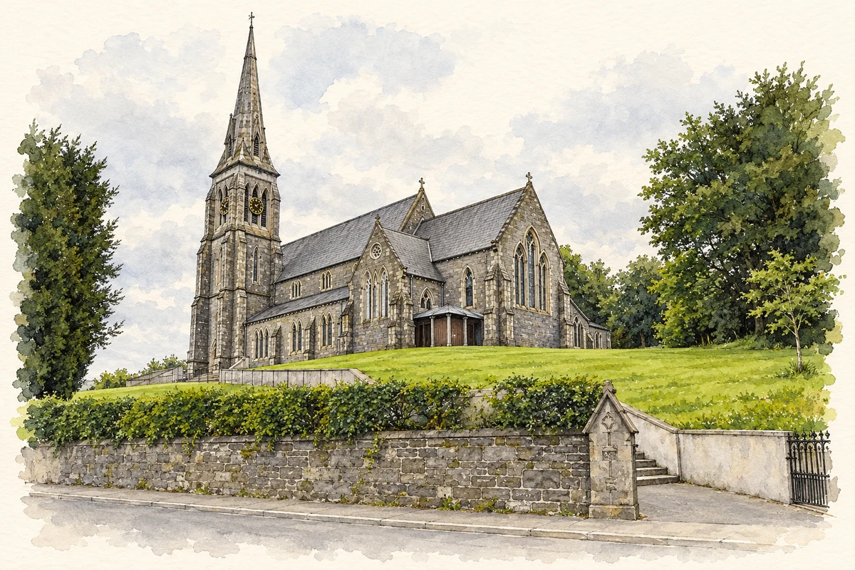
St Patrick's Catholic Church, Ballybay, County Monaghan illustration: based on a St Patrick's RC Church, Ballybay by Kenneth Allen. AI-assisted watercolour and ink adaptation; cream paper margins added, incidental clutter omitted and fine details simplified. Licence: CC BY-SA 2.0.
 placenames