A reliable full-name meaning has not been established here. The recorded Irish and English forms are given without an unsupported translation.
Recorded forms
Greanach· Irish · main form · validated name
Grenagh· English · main form
Place & story
Farming and a water-powered factory
Samuel Lewis’s 1837 account of Grenagh describes an uneven, slate-based landscape where farming methods were changing slowly. Older heavy wooden ploughs remained in use in parts of the parish, particularly towards the hills. He also recorded a woollen factory, built in 1806 and powered by a mountain stream. This small industrial presence belonged to a much wider farming parish, rather than implying that the village itself was a large manufacturing centre.[2]
Saint Lachteen’s Church
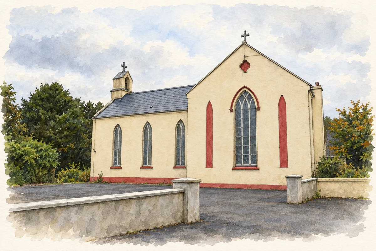
Saint Lachteen’s Church dates from about 1820. Its T-shaped plan has a nave and two short transepts, with a bellcote above the central entrance. Pointed windows contain timber tracery and stained glass. Inside, the carved neoclassical reredos is particularly elaborate: Corinthian columns and pilasters support an open, curved pediment. The National Inventory of Architectural Heritage also records the timber ceiling and a pair of carved wooden confessionals beside the main entrance.[3]
The double championship year
Grenagh’s hurlers and footballers won county championships in the same season in 2013. The football victory completed the double after a long run of matches across the two codes. Interviewed immediately after the final against Aghabullogue, coach Donie Dorgan credited the players’ sustained effort through fourteen championship outings, including a Munster match. His account captures the demands of a dual club’s exceptional season and recalls an earlier football championship success in 2007.[4]
Both counts use the 2016 settlement boundary, allowing like-for-like comparison. CSO supplies the 2022 count on this older boundary for comparison only. The official 2022 Built Up Area has different boundaries.
View population figures
Grenagh — Census 2016 settlement footprint — census population
These figures use different area definitions. Read the boundary note before comparing them.
Grenagh, Cork
Published census settlement populations
579people · 2016
Settlement boundaries changed during this period. Differences may reflect boundary changes as well as population change. Where a 2011 legal-town-and-environs count is shown, it has not been recalculated onto the 2016 settlement boundary.
St Lacteen Catholic Church, Grenagh, County Cork illustration: based on a St. Lacteen Catholic Church, Grenagh by Jonathan Thacker. AI-assisted watercolour and ink adaptation; cream paper margins added, incidental clutter omitted and fine details simplified. Licence: CC BY-SA 2.0.
 placenames