Population centre

Killashee

Cill na Sí

Killashee’s canal harbour and nineteenth-century churches preserve links between navigation, local patronage and village life.

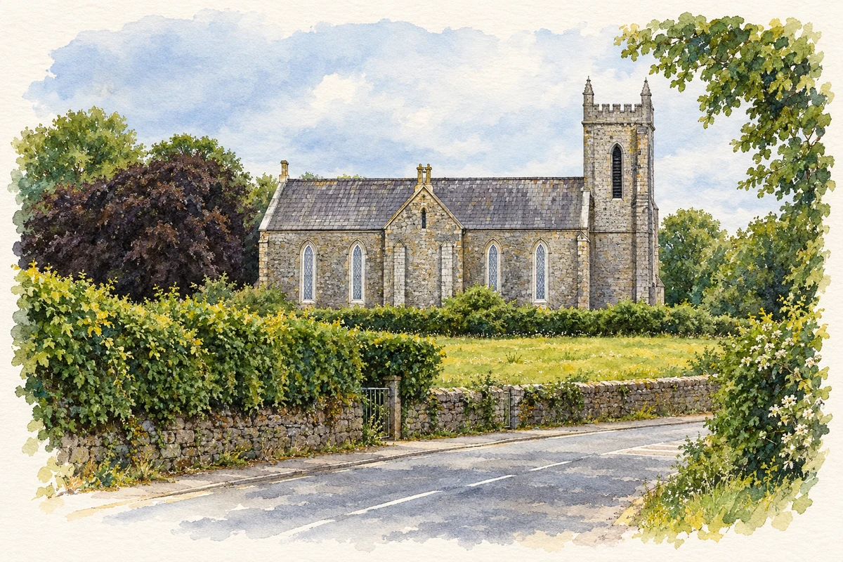
Watercolour and fine ink illustration of St Paul's Church, Killashee.
Illustration, St Paul's Church, Killashee
Recorded locationKillashee53.68001° N · 7.87904° WInteractive map supplied by OpenStreetMap.
Recorded place location · Logainm.ie

The name

These Irish name elements are associated with this record in the Logainm glossary.

An element’s translation is a clue, rather than a complete explanation of the name. Its form and meaning depend on local history and the full Irish name.

Recorded forms

  • Cill na Sí · Irish · main form · validated name
  • Killashee · English · main form

Place & story

The canal lock and harbour

Northeast of Killashee, the Royal Canal's44th Lock dates to about 1815. Its carefully dressed limestone chamber forms part of a group with Savage Bridge and a lock keeper's house. The canal widens south of the lock to form a harbour. These structures preserve the scale of investment in inland navigation when the canal was being extended towards the Shannon, with local roads and water transport meeting beside the village. [2]

A church on canal-company land

Saint Patrick's Catholic Church is dated 1829. The architectural inventory records that Fr Richard Farrell built it on a site donated by the Royal Canal Company, a direct connection between canal development and village worship. Its relatively simple exterior has pointed windows and a bellcote. Inside, a cast-iron spiral staircase and gallery railings with quatrefoil ornament provide more elaborate detail. [3]

Saint Paul’s limestone tower

West of the village, Saint Paul's Church of Ireland church was built or rebuilt around 1837–40. Its tower has battlements and corner pinnacles, while Tudor-style chimneystacks rise above the nave. Finely worked limestone and surviving iron-framed windows distinguish the building. The surrounding burial grounds contain older memorials, including a legible stone dated 1710, indicating a history of worship and burial that preceded the present church. [4]

Geographic information

Place type
Population centre
County
Longford
Barony
Moydow
Barony
Longford
Coordinates
53.68001, -7.87904
Logainm ID
1411743 ↗

Population over time

Killashee — Census 2016 settlement footprint

Population within 2016 settlement boundaries

247people · 2022

075150225300 2016: 215 people20162022: 247 people2022

Both counts use the 2016 settlement boundary, allowing like-for-like comparison. CSO supplies the 2022 count on this older boundary for comparison only. The official 2022 Built Up Area has different boundaries.

View population figures
Killashee — Census 2016 settlement footprint — census population
Census yearPopulation
2016215
2022247

Source: CSO Census 2022 Profile 1 — Appendix Table 1: Census 2022 De Facto Population for the 2016 Towns · Supporting source 1. CC BY 4.0. Retrieved 2026-10-25.

Other census areas and years

These figures use different area definitions. Read the boundary note before comparing them.

Killashee, Longford

Published census settlement populations

215people · 2016

Settlement boundaries changed during this period. Differences may reflect boundary changes as well as population change. Where a 2011 legal-town-and-environs count is shown, it has not been recalculated onto the 2016 settlement boundary.

View population figures
Killashee, Longford — census population
Census yearPopulation
2011208
2016215

Source: CSO E2016 — Population and Actual and Percentage Change 2011 to 2016. CC BY 4.0. Retrieved 2026-10-25.

Killashee, Co Longford — Census 2022 Built Up Area

Built Up Area population, 2022

247people · 2022

Built Up Areas use a new land-use definition. Their population figures cannot be compared directly with Census 2016 settlement counts.

View population figures
Killashee, Co Longford — Census 2022 Built Up Area — census population
Census yearPopulation
2022247

Source: CSO F1015 — Population, Census 2022 Built Up Areas. CC BY 4.0. Retrieved 2026-10-25.

Sources & further reading

  1. Logainm.ie — Killashee. Place names and geographic record, licensed under CC BY 4.0.
  2. 44th Lock at Killashee: NIAH 13311007 · National Inventory of Architectural Heritage
  3. Saint Patrick’s Church: NIAH 13311008 · National Inventory of Architectural Heritage
  4. Saint Paul’s Church: NIAH 13311001 · National Inventory of Architectural Heritage
  5. St Paul's Church, Killashee illustration: based on a St. Paul's Church and the N63 road, Killashee, Co. Longford by P L Chadwick. AI-assisted watercolour and ink adaptation; cream paper margins added, incidental clutter omitted and fine details simplified. Licence: CC BY-SA 2.0.

Name record retrieved 2026-10-25 · Source record modified 2025-01-10. How this page was prepared.