These Irish name elements are associated with this record in the Logainm glossary.
An element’s translation is a clue, rather than a complete explanation of the name. Its form and meaning depend on local history and the full Irish name.
Recorded forms
Droim Ineasclainn· Irish · main form · validated name
Dromiskin· English · main form
Place & story
Ronan and the monastery’s remembered beginnings
The Office of Public Works records competing traditions about the monastery's foundation: one associates it with Lugaidh, a disciple of Patrick, while another names Ronan in the seventh century. Ronan's relics were placed in a precious-metal shrine in 801, and a local holy well bears his name. The monastery endured repeated attacks and continued into the twelfth century. These associations establish the importance of the ecclesiastical site without requiring the different foundation stories to be treated as one certain biography.[2]
Why the round tower looks unusually short
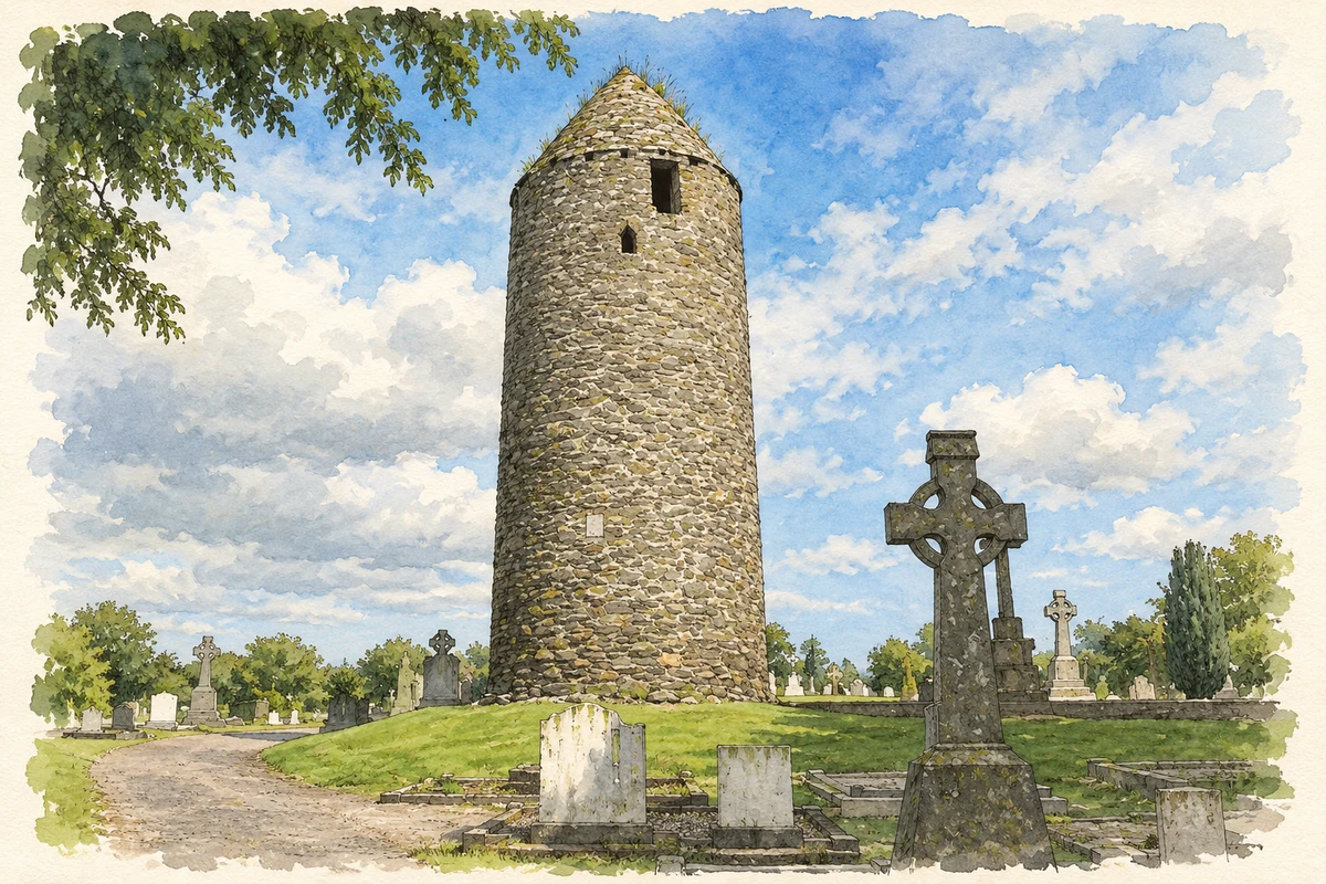
The round tower combines early medieval fabric with later rebuilding. Its raised Romanesque doorway retains carved capitals, although the supporting columns have disappeared. A cabin once built against the tower was removed in 1840, and a ground-level opening was subsequently blocked. Restoration in 1879 shortened the structure and supplied its present conical cap and the four openings beneath it. The tower's proportions therefore reflect intervention as well as medieval design. Nearby, the surviving head of a high cross was mounted on a granite shaft in 1918.[2]
A village described before the Famine
In 1837 Samuel Lewis recorded 377 inhabitants in Dromiskin village, within a much larger parish population that also included Lurgan-green. His account describes productive farmland, schools educating about four hundred children, and the rectory built in 1766. He also observed the old round tower serving as a belfry beneath a then-modern pointed roof. That description predates the later restoration and helps distinguish successive appearances of the monument. His village and parish totals refer to different areas, a distinction that also matters when comparing historical population records.[3]
Two later church designs
The former Saint Ronan's Church of Ireland church is dated 1821 in the county's architectural record and attributed to John Bowden. Its Board of First Fruits design occupies the older ecclesiastical setting. Saint Peter's Catholic church, designed by Ashlin and Coleman in 1926, adopts a different architectural language: Romanesque forms, rock-faced granite and an Italianate bell tower with a copper cupola. The county inventory also highlights its chancel mosaics. Together, these buildings extend the village's visible religious history well beyond the medieval tower and cross.[4]
Both counts use the 2016 settlement boundary, allowing like-for-like comparison. CSO supplies the 2022 count on this older boundary for comparison only. The official 2022 Built Up Area has different boundaries.
View population figures
Dromiskin — Census 2016 settlement footprint — census population
These are the historical areas published in the 2006 census report. Boundaries may differ between censuses and from modern settlements. Legal towns, environs and suburbs are shown separately; none has been combined into a modern settlement total.
View population figures
Dromiskin, Louth — Census town, CSO 2006 report — census population
These are the historical areas published in the 1996 census report. Boundaries may differ between censuses and from modern settlements. Legal towns, environs and suburbs are shown separately; none has been combined into a modern settlement total.
View population figures
Dromiskin, Louth — Census town, CSO 1996 report — census population
Figures cover the historical town area printed in the 1986 report. Boundaries may have changed between censuses. Legal town, environs and suburb totals remain separate and differ from modern settlement boundaries.
View population figures
Dromiskin, Louth — Census town, CSO 1986 report — census population
These figures use different area definitions. Read the boundary note before comparing them.
Dromiskin, Louth
Published census settlement populations
1,195people · 2016
Settlement boundaries changed during this period. Differences may reflect boundary changes as well as population change. Where a 2011 legal-town-and-environs count is shown, it has not been recalculated onto the 2016 settlement boundary.
Dromiskin Round Tower illustration: based on a Round Tower at Dromiskin, Co. Louth by Kieran Campbell. AI-assisted watercolour and ink adaptation; cream paper margins added, incidental clutter omitted and fine details simplified. Licence: CC BY-SA 2.0.
 placenames