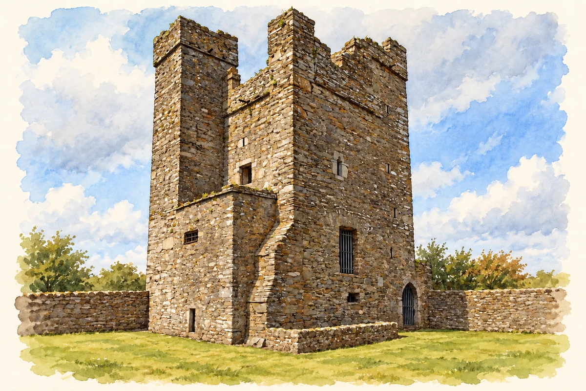
Termonfeckin combines a remarkable medieval tower house with An Grianán, where the Irish Countrywomen's Association created a lasting educational centre.
Illustration, Termonfeckin Castle
⊕Recorded locationTermonfeckin53.75980° N · 6.26869° WInteractive map supplied by OpenStreetMap.
A reliable full-name meaning has not been established here. The recorded Irish and English forms are given without an unsupported translation.
Recorded forms
Tearmann Feichín· Irish · main form · validated name
Termonfeckin· English · main form
Place & story
Stonework above the village
Termonfeckin's surviving tower house occupies high ground overlooking the village and coast. Inside are a spiral stair, a vaulted ground-floor chamber, fireplaces and garderobes. Its particularly distinctive feature is the corbelled stone roof over the upper storey, formed by projecting courses of masonry. The Office of Public Works distinguishes this building from the archbishops' castle that once stood nearer the Ballywater River and has disappeared. Keeping the two sites separate avoids transferring the history of the lost episcopal residence to the tower that survives.[2]
The house behind An Grianán
An Grianán was formerly Newtown House. The McClintock family sold the property to Ralph Smith in 1852, and the National Inventory of Architectural Heritage attributes the house's present form largely to his subsequent work. Earlier eighteenth-century fabric survives within it. Two carefully designed fronts have limestone entrance porches and balconies, while the interior includes a top-lit cantilevered staircase. Its architecture therefore reflects successive owners and alterations, rather than a country house built in one campaign and left unchanged.[3]
People & connections
Muriel Gahan’s college proposal
The Irish Countrywomen's Association had used the house for summer schools before it became the Tearman Hotel in 1945. In 1952, Muriel Gahan proposed a residential college to the W. K. Kellogg Foundation. An Grianán opened in 1954, with Dr Donal O'Sullivan leading its first course. The association's account places the centre within a longer tradition of practical learning and residential gatherings. Its establishment gave an enduring home to educational activity previously organised through summer schools, connecting this Louth village with participants from around the country.[4]
Both counts use the 2016 settlement boundary, allowing like-for-like comparison. CSO supplies the 2022 count on this older boundary for comparison only. The official 2022 Built Up Area has different boundaries.
View population figures
Termonfeckin — Census 2016 settlement footprint — census population
Termonfeckin, Louth — Census town, CSO 2006 report
2002–2006: census town
653people · 2006
These are the historical areas published in the 2006 census report. Boundaries may differ between censuses and from modern settlements. Legal towns, environs and suburbs are shown separately; none has been combined into a modern settlement total.
View population figures
Termonfeckin, Louth — Census town, CSO 2006 report — census population
Termonfeckin, Louth — Census town, CSO 1996 report
1991–1996: census town
530people · 1996
These are the historical areas published in the 1996 census report. Boundaries may differ between censuses and from modern settlements. Legal towns, environs and suburbs are shown separately; none has been combined into a modern settlement total.
View population figures
Termonfeckin, Louth — Census town, CSO 1996 report — census population
Termonfeckin, Louth — Census town, CSO 1986 report
1981–1986: census town
741people · 1986
Figures cover the historical town area printed in the 1986 report. Boundaries may have changed between censuses. Legal town, environs and suburb totals remain separate and differ from modern settlement boundaries.
View population figures
Termonfeckin, Louth — Census town, CSO 1986 report — census population
These figures use different area definitions. Read the boundary note before comparing them.
Termonfeckin, Louth
Published census settlement populations
1,579people · 2016
Settlement boundaries changed during this period. Differences may reflect boundary changes as well as population change. Where a 2011 legal-town-and-environs count is shown, it has not been recalculated onto the 2016 settlement boundary.
Termonfeckin Castle illustration: based on a Castles of Leinster: Termonfeckin, Louth (1) by Mike Searle. AI-assisted watercolour and ink adaptation; cream paper margins added, incidental clutter omitted and fine details simplified. Licence: CC BY-SA 2.0.
 placenames