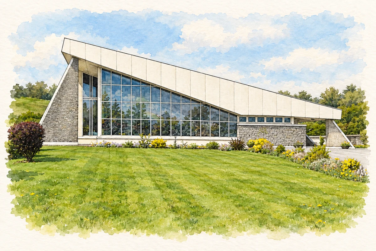
Liscasey, commonly written Lissycasey, combines twentieth-century parish architecture with an older tradition of hospitality beside the Ennis–Kilrush road.
Illustration, Our Lady of the Wayside Church, Lissycasey
⊕Recorded locationLiscasey52.75007° N · 9.14471° WInteractive map supplied by OpenStreetMap.
These Irish name elements are associated with this record in the Logainm glossary.
An element’s translation is a clue, rather than a complete explanation of the name. Its form and meaning depend on local history and the full Irish name.
Recorded forms
Lios Uí Chathasaigh· Irish · main form · validated name
Liscasey· English · main form
Lissycasey· English · main form · local name
Place & story
Brady and Quinn’s church
Lissycasey's church was dedicated in 1978 on the site of a predecessor opened in 1860. Architects Catherine Brady and John Quinn designed the new building with seating for five hundred, drawing inspiration from the reforms of the Second Vatican Council. The village's school had already moved to a new building in 1961, leaving the earlier site for the parish hall. These successive changes reshaped the places where the community learned, worshipped and gathered.[2]
People & connections
Fanny O’Dea’s roadside business
Clare Libraries' account of Fanny O'Dea describes her developing a small shop into a stopping place for travellers between Ennis and west Clare. Food and drink became central to the business. Stories about how she obtained a liquor licence give competing names for the person who granted it, so a single version should not be assumed. The later pub preserved her name and the site of her earlier enterprise, making a local businesswoman central to the village's historical identity.[3]
Folklore & tradition
Why it was unlucky to pass the door
The library records a legend explaining why travellers should stop at Fanny O'Dea's. A man being taken to execution in Ennis refused a final drink at the pub. The real murderer then confessed in Kilrush, but the messenger carrying the news arrived too late. In the story's telling, a pause at the inn would have saved the condemned man. This is an attested local tale about hospitality and fate, rather than a documented account of a particular execution.[3]
Folklore & tradition
Tobarniddaun’s local devotion
The well at Tobarniddaun, near the Boree Log, is associated with Saint Niddaun and was traditionally visited for eye complaints. The nearby cillín served as a burial place for unbaptised children, with some adults also buried there before the parish's present graveyards developed. Clare Libraries preserves these associations as part of the locality's religious landscape. The belief in the water's healing properties belongs to devotional tradition rather than demonstrated medical treatment.[2]
Both counts use the 2016 settlement boundary, allowing like-for-like comparison. CSO supplies the 2022 count on this older boundary for comparison only. The official 2022 Built Up Area has different boundaries.
View population figures
Lissycasey — Census 2016 settlement footprint — census population
These figures use different area definitions. Read the boundary note before comparing them.
Lissycasey, Clare
Published census settlement populations
325people · 2016
Settlement boundaries changed during this period. Differences may reflect boundary changes as well as population change. Where a 2011 legal-town-and-environs count is shown, it has not been recalculated onto the 2016 settlement boundary.
Our Lady of the Wayside Church, Lissycasey illustration: based on a Liscasey church by Graham Horn. AI-assisted watercolour and ink adaptation; cream paper margins added, incidental clutter omitted and fine details simplified. Licence: CC BY-SA 2.0.
 placenames