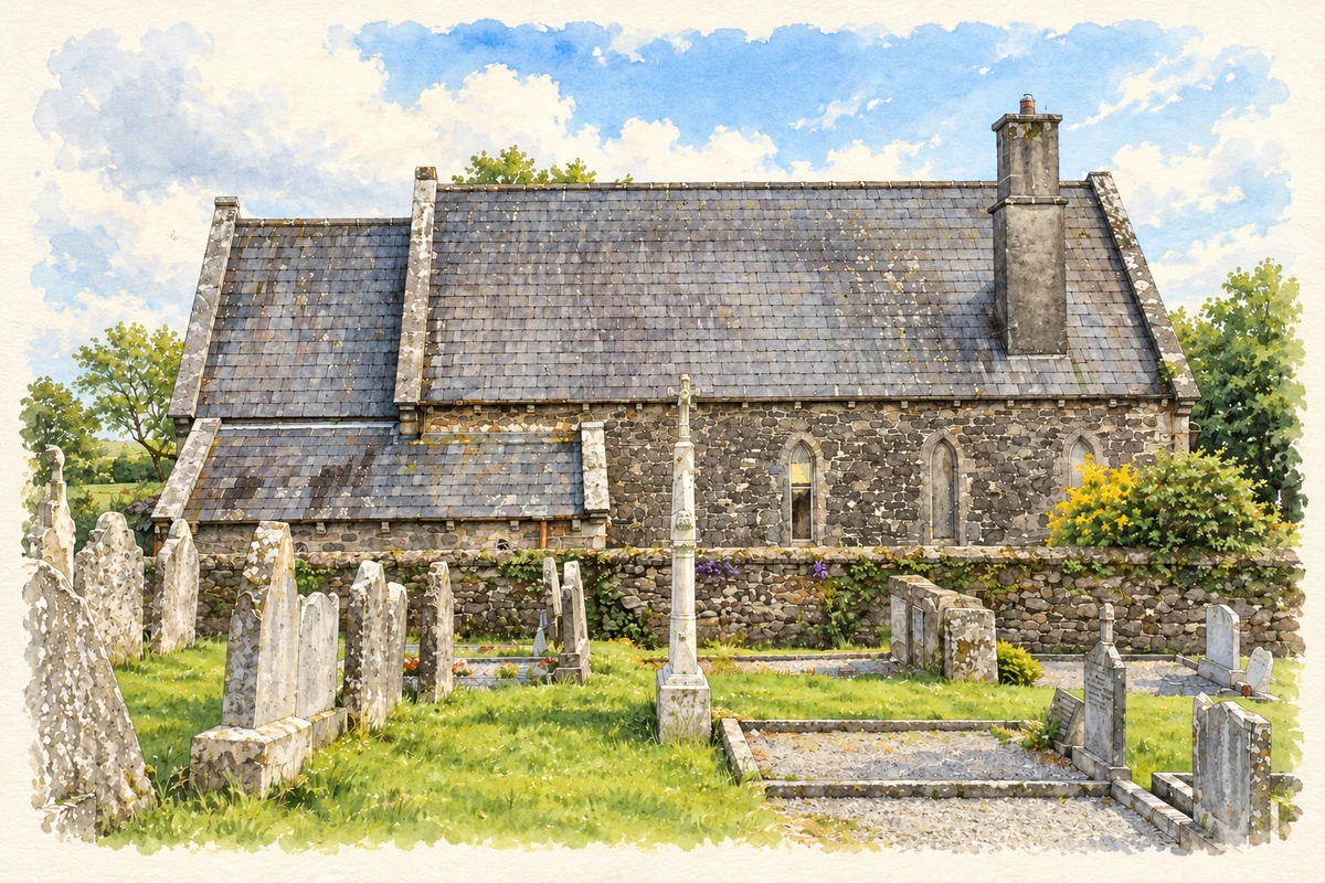
Ballynoe's churches preserve several phases of local history, from an early enclosure beneath medieval burials to a nineteenth-century church converted into a house.
Illustration, Former St John's Church, Ballynoe
⊕Recorded locationBallynoe52.05988° N · 8.09839° WInteractive map supplied by OpenStreetMap.
These Irish name elements are associated with this record in the Logainm glossary.
An element’s translation is a clue, rather than a complete explanation of the name. Its form and meaning depend on local history and the full Irish name.
Recorded forms
An Baile Nua· Irish · main form · validated name
Ballynoe· English · main form
Place & story
Lime from the Bride valley
Samuel Lewis's 1837 account places Ballynoe parish on the old road between Castlemartyr and Fermoy. Much of its land was arable or pasture, with smaller areas of bog and woodland. Farmers improved the soil with lime brought from the Bride valley. Lewis identified A. Hargrave's Ballynoe House near the village and noted the substantial houses of local farmers. His description gives the church settlement an agricultural context, with working land and transport links shaping the surrounding district.[2]
What excavation found beneath the churchyard
Excavations at Ballynoe's medieval church in 1999 examined the chancel and the ground outside its vestry before conservation work. Archaeologist Eamonn Cotter identified a former doorway whose chamfered stones suggested a late-thirteenth-century date. Cobblestones outside it represented successive raised paths. Beneath later burials lay the fill of a deep ditch, interpreted as part of an early Christian enclosure. The work revealed a sequence of boundaries, paths and interments extending beyond the surviving church walls, rather than a single construction episode.[3]
Red sandstone at St Catherine's
St Catherine's Catholic Church has a single-cell nave with a projecting entrance and bellcote. The National Inventory of Architectural Heritage records an 1820 date plaque. Red sandstone on the entrance front, porch and bellcote contrasts with the rendered main walls, while limestone quoins mark the corners. The building also has carved stone crosses and niches beside the entrance. These materials and details give the village's Catholic church a distinctive appearance within a largely agricultural setting.[4]
St John's becomes Church House
The former St John's Church of Ireland church bears the date 1855 in a stained-glass window on its western gable. It was converted to a private house around 1960. Red sandstone walls, buttresses and pointed windows retain the outline of the earlier church, alongside changes made for domestic use. Its position beside the graveyard and former glebe house preserves the relationship between three parts of the old parish complex. The dated window is an unusual detail because its inscription is intended to be read from outside.[5]
Both counts use the 2016 settlement boundary, allowing like-for-like comparison. CSO supplies the 2022 count on this older boundary for comparison only. The official 2022 Built Up Area has different boundaries.
View population figures
Ballynoe — Census 2016 settlement footprint — census population
These figures use different area definitions. Read the boundary note before comparing them.
Ballynoe, Cork
Published census settlement populations
141people · 2016
Settlement boundaries changed during this period. Differences may reflect boundary changes as well as population change. Where a 2011 legal-town-and-environs count is shown, it has not been recalculated onto the 2016 settlement boundary.
 placenames