 placenames
Haulbowline Island
Inis Sionnach
Haulbowline’s surviving naval buildings and transformed industrial ground record successive uses of an island in Cork Harbour.
The name
These Irish name elements are associated with this record in the Logainm glossary.
An element’s translation is a clue, rather than a complete explanation of the name. Its form and meaning depend on local history and the full Irish name.
Recorded forms
- Inis Sionnach · Irish · main form · validated name
- Haulbowline Island · English · main form
Place & story
The clock-tower store
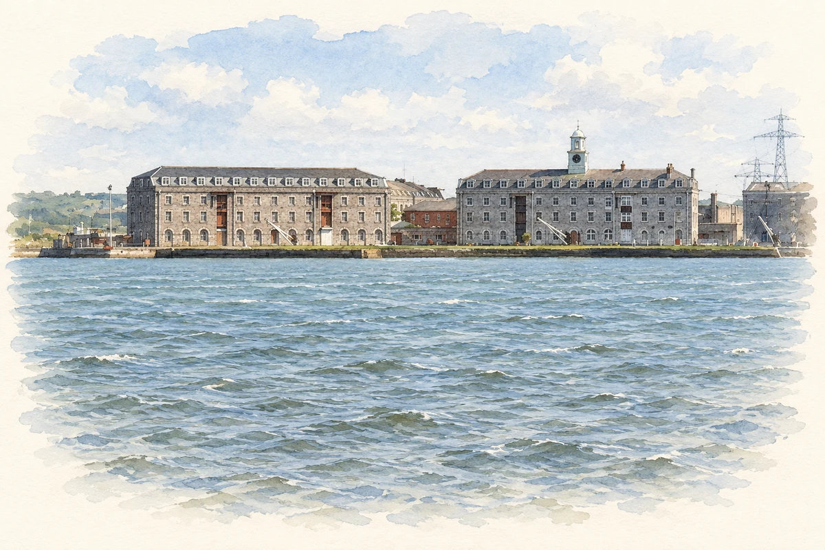
Block 6, built in 1822, belongs to the group of substantial stores erected for the Royal Navy on Haulbowline. Its twelve-bay frontage rises through three storeys with an attic, while a domed clock tower and weather vane mark the centre. Loading openings, dressed limestone details and the mansard roof combine practical storage arrangements with architectural display. The building preserves the scale of the nineteenth-century naval supply establishment. [2]
The dockyard handover in 1923
On 31 March 1923, Captain Aubrey Peebles handed the dockyard to Sir Philip Hanson, chairman of the Irish Free State Local Government Board. National Army soldiers commanded by a Commandant Love replaced the Royal Marine garrison. Daire Brunicardi’s archival account records that HMS Castor departed that afternoon with personnel aboard, while the Irish flag was raised two days later. This transfer concerned the dockyard, within continuing Treaty arrangements for British naval facilities. [3]
The steelmaking island
Haulbowline’s steelworks opened privately in 1939, entered state ownership in 1947 and closed in 2001. Employment exceeded 1,200 during its 1970s peak; the works supplied roofing material and export markets. [4]
Making a park above the East Tip
Steelmaking waste had accumulated on reclaimed foreshore at the East Tip from the early 1960s. The engineering project that converted this twenty-two-acre area into a public park capped 650,000 cubic metres of slag and other waste. Its works included an 830-metre perimeter structure in the foreshore and recovery of 350 tonnes of ferrous metal. The landscaped ground therefore covers an engineered containment system, preserving the industrial legacy beneath a new recreational surface. [5]
Geographic information
- Place type
- Population centre
- County
- Cork
- Barony
- Barrymore
- Civil parish
- Templerobin
- Within
- Haulbowline Island
- Coordinates
- 51.84597, -8.30476 (approximate)
- Logainm ID
- 1412786 ↗
Sources & further reading
- Logainm.ie — Haulbowline Island. Place names and geographic record, licensed under CC BY 4.0.
- Block 6, Haulbowline Island, record 20908746 · National Inventory of Architectural Heritage
- The take-over of the naval dockyard at Haulbowline, 1923 · Daire Brunicardi / History Ireland
- Haulbowline and Rocky Islands: County Geological Site report CK 053, 2023 · Hennessy et al. / Geological Survey Ireland
- Transforming Haulbowline Island East Tip into a Public Park · Tetra Tech
- Naval stores on Haulbowline Island, as photographed in 2012 illustration: based on a Naval Stores buildings, Haulbowline Island by David Hawgood. AI-assisted watercolour and ink adaptation; cream paper margins added, incidental clutter omitted and fine details simplified. Licence: CC BY-SA 2.0.
Name record retrieved 2026-10-25 · Source record modified 2025-01-10. How this page was prepared.