 placenames
Ballygorman
Baile Uí Ghormáin
Ballygorman’s shore preserves a church, cave and holy-well tradition within the wider maritime landscape of Malin Head.
The name
These Irish name elements are associated with this record in the Logainm glossary.
An element’s translation is a clue, rather than a complete explanation of the name. Its form and meaning depend on local history and the full Irish name.
Recorded forms
- Baile Uí Ghormáin · Irish · main form · validated name
- Ballygorman · English · main form
Place & story
A northern village in 1837
Samuel Lewis recorded 227 inhabitants at Ballygorman in 1837. His account placed the village within Cloncha parish and described the surrounding headland’s developing maritime infrastructure: an Admiralty signal tower and a small harbour being excavated from solid rock. Coastguard stations operated at Malin Head and Glengad. The entry captures a coastal community at a time when observation, navigation and harbour works were changing the uses of this exposed northern shore. [2]
The church and Wee House of Malin
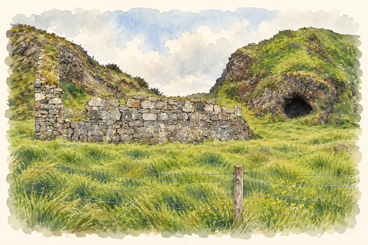
On Ballygorman’s shore, Saint Mahar’s, also called Gorman’s Church, survives as a late medieval ruin on a raised beach. A carved human face marks a corner between its east gable and south wall. A small cave cut into the cliff southwest of the church is known as the Wee House of Malin. The nearby spring-fed holy well is covered at high tide, linking this group of religious sites closely with the changing shoreline. [3]
The O’Gormans and the Holy Stone
Donegal County Archives records a local tradition, drawn from Brian Bonner’s 1984 history, that Saint Muirdhealach entrusted a healing stone to the O’Gormans of Ballygorman. Rival branches of the family disputed its possession, with the Ballyhillion branch taking it and the Ballygorman family recovering it by force. In the story, Father Neil O’Flaherty eventually confiscated the stone. Its later whereabouts were unknown. The account belongs to the shore’s recorded devotional folklore. [3]
Geographic information
- Place type
- Population centre
- County
- Donegal
- Barony
- Inishowen East
- Civil parish
- Clonca
- Within
- Ardmalin
- Coordinates
- 55.34893, -7.32210 (approximate)
- Logainm ID
- 1412909 ↗
Sources & further reading
- Logainm.ie — Ballygorman. Place names and geographic record, licensed under CC BY 4.0.
- Ballygorman, A Topographical Dictionary of Ireland, 1837 · Samuel Lewis
- Malin Head: An Enchanting Place, A Colourful Past, pages 12–15 · Irene Haggan, Donegal County Archives
- Old church ruins and Wee House of Malin, near Ballygorman, County Donegal illustration: based on a Church and Malin Well by Kenneth Allen. AI-assisted watercolour and ink adaptation; cream paper margins added, incidental clutter omitted and fine details simplified. Licence: CC BY-SA 2.0.
Name record retrieved 2026-10-25 · Source record modified 2025-01-10. How this page was prepared.