These Irish name elements are associated with this record in the Logainm glossary.
An element’s translation is a clue, rather than a complete explanation of the name. Its form and meaning depend on local history and the full Irish name.
Recorded forms
Bun na Leaca· Irish · main form · validated name
Brinlack· English · main form
Place & story
Teach Mhuiris and coastal thatch
Teach Mhuiris, a small house dating to about 1860, preserves a building tradition adapted to this exposed coast. Ropes secured to stone fixtures hold down its rounded thatched roof. An attached outbuilding and a rear half-door retain features of domestic working life. The architectural inventory records its restoration as a cultural centre and names its last resident, Muiris, who died in 1979. It also notes a local memory of the house as a gathering place.[2]
The church southeast of Brinlack
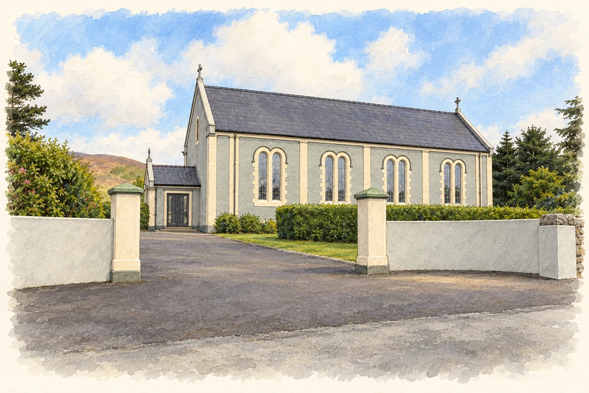
In the countryside southeast of Bun na Leaca, Saint Colmcille's Church dates to 1933. Its Romanesque details include a rounded chancel arch with chevron ornament, while a timber gallery and exposed roof trusses give structure to the interior. Stained glass in the polygonal apse adds colour. The church belongs to the wider Brinlack and Cnoc Fola community rather than standing at the centre of the named settlement.[3]
A cottage used for copper craft
A 2022 newspaper interview documented another use of Teach Mhuiris: Neil Ferry's copper-art workshop. Ferry described developing the craft after moving from Dublin to his father's home area. His work included building portraits and club crests made from drawings or photographs. The dated account connects the cottage's conservation with a new working craft, without treating the historic house solely as a display of the past.[4]
Both counts use the 2016 settlement boundary, allowing like-for-like comparison. CSO supplies the 2022 count on this older boundary for comparison only. The official 2022 Built Up Area has different boundaries.
View population figures
Bun Na Leaca — Census 2016 settlement footprint — census population
Bun na Leaca, Donegal — Census town, CSO 2006 report
2002–2006: census town
392people · 2006
These are the historical areas published in the 2006 census report. Boundaries may differ between censuses and from modern settlements. Legal towns, environs and suburbs are shown separately; none has been combined into a modern settlement total.
View population figures
Bun na Leaca, Donegal — Census town, CSO 2006 report — census population
These figures use different area definitions. Read the boundary note before comparing them.
Bun na Leaca, Donegal
Published census settlement populations
402people · 2016
Settlement boundaries changed during this period. Differences may reflect boundary changes as well as population change. Where a 2011 legal-town-and-environs count is shown, it has not been recalculated onto the 2016 settlement boundary.
Teach Pobail Cholmcille Naofa, Cnoc Fola, near Brinlack, County Donegal illustration: based on a Photograph of Teach Pobail Cholmcille Naofa, Cnoc Fola by Kenneth Allen. AI-assisted watercolour and ink adaptation; cream paper margins added, incidental clutter omitted and fine details simplified. Licence: CC BY-SA 2.0.
 placenames