 placenames
Ballydugan
Baile Uí Dhúgáin
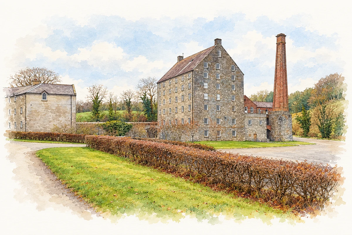
A late eighteenth-century flour mill, its lake and a cluster of traditional cottages show how industrial and domestic buildings shaped Ballydugan.
The name
These Irish name elements are associated with this record in the Logainm glossary.
An element’s translation is a clue, rather than a complete explanation of the name. Its form and meaning depend on local history and the full Irish name.
Recorded forms
- Baile Uí Dhúgáin · Irish · main form · validated name
- Ballydugan · English · main form
Place & story
The flour mill
John Auchinleck built Ballydugan’s flour mill in 1792. The tall building had closed by 1857 and remained vacant for roughly 130 years. Its revival began when a local building contractor bought it in the late 1980s. Ulster Architectural Heritage records a painstaking twelve-year restoration that converted the mill into accommodation, a restaurant and a venue for weddings and conferences, giving the industrial landmark a new economic purpose. [2]
Water and steam
Water channelled from Ballydugan Lake powered the mill. The lake supply was sufficient for only eight months of the year, with a steam engine providing power during the remaining four. The surviving outfall helps explain a landscape that was organised around production: the lake was a source of energy as well as a body of water beside the settlement. [3]
A cluster of cottages
The mill was not the only historic building group to find another use. Nearby, early nineteenth-century dwellings and outbuildings formed a clachan, or cluster of traditional cottages. After years of vacancy they were converted into holiday accommodation. The conservation account records that many historic features were retained and that the work reused building materials and supported local skills, preserving a smaller-scale counterpart to the mill. [2]
Geographic information
- Place type
- Population centre
- County
- Down
- Barony
- Lecale Upper
- Civil parish
- Down
- Within
- Ballydugan
- Coordinates
- 54.30578, -5.75670 (approximate)
- Logainm ID
- 1413112 ↗
Sources & further reading
- Logainm.ie — Ballydugan. Place names and geographic record, licensed under CC BY 4.0.
- Lose or Reuse: Managing Heritage Sustainably, p37 · Ulster Architectural Heritage
- The outfall of Ballydugan Lake, photographed2 October2014 · Eric Jones, Geograph
- Ballydugan Mill, County Down illustration: based on a The former Ballydugan Grain Mill (17 November 2018) by Eric Jones. AI-assisted watercolour and ink adaptation; cream paper margins added, incidental clutter omitted and fine details simplified. Licence: CC BY-SA 2.0.
Name record retrieved 2026-10-25 · Source record modified 2019-10-08. How this page was prepared.