 placenames
Ballygrainey
Baile na Gréine
Ballygrainey’s Presbyterian church at Six Road Ends provides a focus for the surrounding North Down and Ards community. Its building, wartime memorial and early connections with another coastal congregation preserve distinct parts of that local history.
The name
These Irish name elements are associated with this record in the Logainm glossary.
An element’s translation is a clue, rather than a complete explanation of the name. Its form and meaning depend on local history and the full Irish name.
Recorded forms
- Baile na Gréine · Irish · main form · validated name
- Ballygrainey · English · main form
Place & story
The church at Six Road Ends
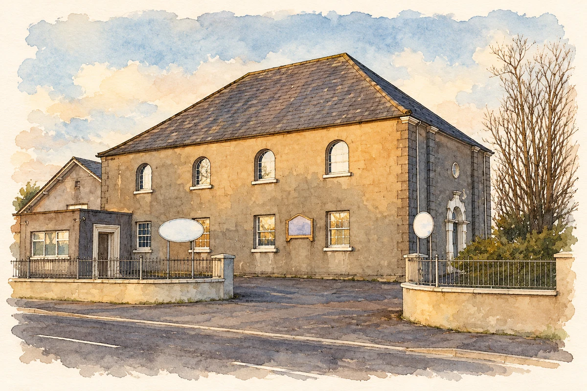
Ballygrainey Presbyterian Church stands on Gransha Road at Six Road Ends. A dated photographic record identifies the building as originating in 1837, while an official Northern Ireland Assembly return records it as a Grade B2 building under reference HB23/04/001. The congregation’s own account describes a community drawn from across North Down and Ards. The church therefore serves a wider rural district as well as the locality whose name it carries. [2] [3] [4]
A local record of the First World War
A framed roll of honour inside the church commemorates thirty-three people associated with the First World War. The Imperial War Museums register records seven as having died and twenty-six as having served. The document includes names, home places, ranks and regiments, with information about those killed, wounded or taken prisoner. A leafy border surrounds the list beneath a Union Jack. It preserves a congregational record of wartime experience rather than simply a list of military fatalities. [5]
Helping establish worship at Groomsport
Ballygrainey’s ministry also reached beyond its own congregation. Groomsport’s church history records that, in 1839, ministers from Ballygrainey and Donaghadee were to assist the existing monthly preaching there, allowing services to take place more frequently. [6]
Geographic information
- Place type
- Population centre
- County
- Down
- Barony
- Ards Lower
- Civil parish
- Bangor
- Within
- Ballygrainey
- Coordinates
- 54.62720, -5.64610 (approximate)
- Logainm ID
- 1413113 ↗
Sources & further reading
- Logainm.ie — Ballygrainey. Place names and geographic record, licensed under CC BY 4.0.
- Ballygrainey Presbyterian Church, photographed 11 April 2010 · Rossographer
- Listed buildings return, 20 June 2014, page 3, HB23/04/001 · Northern Ireland Assembly
- About Ballygrainey Presbyterian Church · Ballygrainey Presbyterian Church
- Ballygrainey Presbyterian Church roll of honour, WMR 86100 · Imperial War Museums
- Our History: the early Groomsport preaching community · Groomsport Presbyterian Church
- Ballygrainey Presbyterian Church, County Down illustration: based on a Ballygrainey Presbyterian Church by Rossographer. AI-assisted watercolour and ink adaptation; cream paper margins added, incidental clutter omitted and fine details simplified. Licence: CC BY-SA 2.0.
Name record retrieved 2026-10-25 · Source record modified 2019-10-08. How this page was prepared.