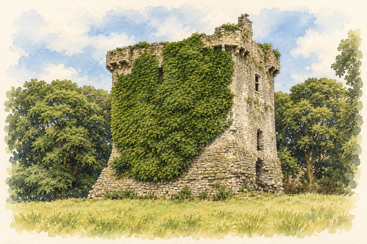
Shrule stands at a crossing of the Black River on the Mayo–Galway boundary. Its castle and churches preserve a long local history, while accounts of fighting gave the river a powerful place in oral tradition.
Illustration, surviving ruins of Shrule Castle
⊕Recorded locationShrule53.52530° N · 9.08827° WInteractive map supplied by OpenStreetMap.
A reliable full-name meaning has not been established here. The recorded Irish and English forms are given without an unsupported translation.
Recorded forms
Sruthair· Irish · main form · validated name
Shrule· English · main form
Place & story
A castle guarding the river
Shrule Castle stands in a district long associated with the Burke family. The nineteenth-century Ordnance Survey description attributes both the castle and the older church to the Burkes and records the manor's transfer to the Earl of Clanricarde at the beginning of James I's reign. The crossing had already been fought over in 1570, when Crown forces besieged the castle and a relieving force challenged them. Its position beside the river placed the stronghold on an important route between the surrounding territories.[2]
The refugees of February 1642
During the upheaval following the rebellion of 1641, Protestant refugees from Mayo were being escorted towards Galway. They included John Maxwell, the Church of Ireland bishop of Killala, with his family. At Shrule in February 1642, members of the escort attacked the party. A letter from the Earl of Clanricarde dated 19 February records a report from his tenant Pierce Lynch, who had witnessed killings on and beside the bridge. Survivors received assistance from Ulick Burke of Castlehacket and the friars of Ross Abbey. The episode left Shrule associated with one of the region's most notorious wartime atrocities.[3]
The stone shell of St Colman's
St Colman's medieval church survives as a stone shell. Its pointed doorways and lancet windows belong to the Gothic architectural tradition. The parish's historical account compares its arrangement with churches at Ballinrobe and Burriscarra, noting opposing doors near the western end and windows in the eastern wall. Documentary evidence places the church among the possessions of Cong Abbey by 1400. The surviving masonry records the building's form, while the timber, furnishings and other perishable elements of its interior have disappeared.[4]
Folklore & tradition
A stream of blood in local memory
John O'Donovan recorded a nineteenth-century tradition linking Shrule's name to a stream of blood said to have flowed beside the castle after the fighting of 1570. He presented it as a local explanation of the name, rather than its linguistic derivation. The attestation connects the castle and river with the remembered violence of an earlier battle, distinct from the later massacre of 1642.[2]
Both counts use the 2016 settlement boundary, allowing like-for-like comparison. CSO supplies the 2022 count on this older boundary for comparison only. The official 2022 Built Up Area has different boundaries.
View population figures
Shrule — Census 2016 settlement footprint — census population
These are the historical areas published in the 2006 census report. Boundaries may differ between censuses and from modern settlements. Legal towns, environs and suburbs are shown separately; none has been combined into a modern settlement total.
View population figures
Shrule, Mayo — Census town, CSO 2006 report — census population
These are the historical areas published in the 1996 census report. Boundaries may differ between censuses and from modern settlements. Legal towns, environs and suburbs are shown separately; none has been combined into a modern settlement total.
View population figures
Shrule, Mayo — Census town, CSO 1996 report — census population
Figures cover the historical town area printed in the 1986 report. Boundaries may have changed between censuses. Legal town, environs and suburb totals remain separate and differ from modern settlement boundaries.
View population figures
Shrule, Mayo — Census town, CSO 1986 report — census population
These figures use different area definitions. Read the boundary note before comparing them.
Shrule, Mayo
Published census settlement populations
432people · 2016
Settlement boundaries changed during this period. Differences may reflect boundary changes as well as population change. Where a 2011 legal-town-and-environs count is shown, it has not been recalculated onto the 2016 settlement boundary.
Shrule Castle illustration: based on a Castles of Connacht: Shrule, Mayo - revisited (1) by Mike Searle. AI-assisted watercolour and ink adaptation; cream paper margins added, incidental clutter omitted and fine details simplified. Licence: CC BY-SA 2.0.
 placenames