These Irish name elements are associated with this record in the Logainm glossary.
An element’s translation is a clue, rather than a complete explanation of the name. Its form and meaning depend on local history and the full Irish name.
Recorded forms
Ráth Eoghain· Irish · main form · validated name
Rathowen· English · main form
Place & story
A Tuesday market on the Longford road
In 1837, Samuel Lewis counted 605 inhabitants in Rathowen and described a settlement dominated by thatched houses: ninety-seven had thatch and twelve had slate roofs. A Tuesday market operated at the market house, and annual fairs took place in May and December. The town also had a post service, police station and two churches. A small school operated in the Catholic chapel, linking education with worship before the later school buildings.[2]
Saint Thomas’s and the First Fruits pattern
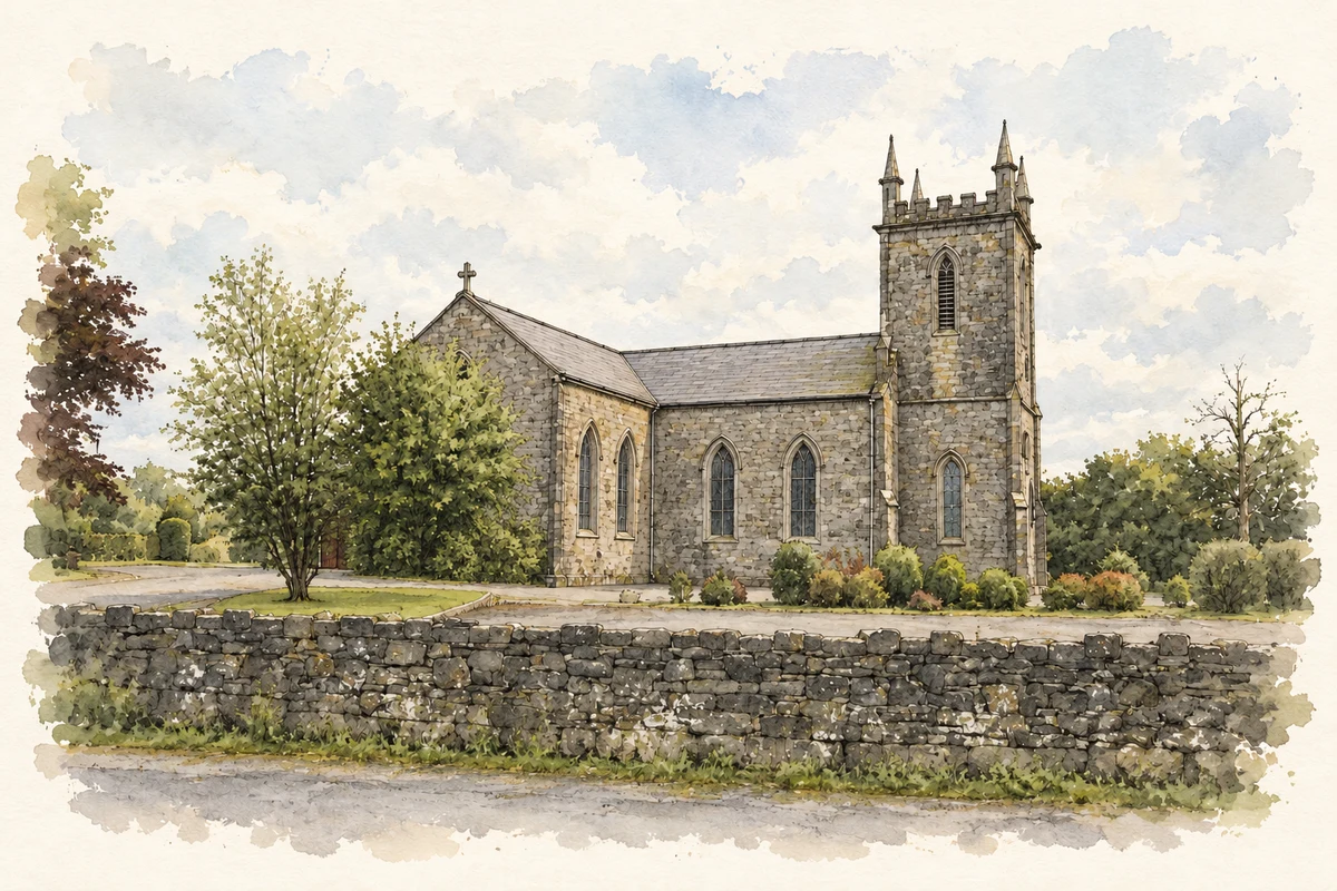
Saint Thomas’s Church of Ireland church was built in 1814 with a three-bay nave and a square, three-stage tower. Small entrance vestibules were added beside the tower around 1821. Battlements and corner pinnacles repeat across the tower and lower additions, while pointed windows contain Y-shaped tracery. The national architectural inventory identifies its form as a version of a standard plan approved by the Board of First Fruits.[3]
Saint Mary’s foundation and restoration
Saint Mary’s Catholic church was erected in 1846 under Father James O’Reilly on land given by A. C. Bond of Ardglas. An inscription above the door records both contributions. A major restoration followed in 1936–38, providing a new roof and windows, work against damp, and a gallery above the main entrance. The Irish Architectural Archive also records a stained-glass east window by Mayer and Company, depicting the Sacred Heart, Saint Joseph and the Virgin.[4]
Both counts use the 2016 settlement boundary, allowing like-for-like comparison. CSO supplies the 2022 count on this older boundary for comparison only. The official 2022 Built Up Area has different boundaries.
View population figures
Rathowen — Census 2016 settlement footprint — census population
These figures use different area definitions. Read the boundary note before comparing them.
Rathowen, Westmeath
Published census settlement populations
150people · 2016
Settlement boundaries changed during this period. Differences may reflect boundary changes as well as population change. Where a 2011 legal-town-and-environs count is shown, it has not been recalculated onto the 2016 settlement boundary.
Church at Rathowen, County Westmeath illustration: based on a Church, Rathowen by Richard Webb. AI-assisted watercolour and ink adaptation; cream paper margins added, incidental clutter omitted and fine details simplified. Licence: CC BY-SA 2.0.
 placenames