These Irish name elements are associated with this record in the Logainm glossary.
An element’s translation is a clue, rather than a complete explanation of the name. Its form and meaning depend on local history and the full Irish name.
Recorded forms
Muine Mheá· Irish · main form · validated name
Monivea· English · main form
Place & story
An estate and its linen industry
The Ffrench family acquired the Monivea estate from the O'Kellys in the early seventeenth century. After Cromwellian confiscation, they bought it back in 1702. The University of Galway's Landed Estates research records their eighteenth-century involvement in linen manufacture and county parliamentary representation. By the 1870s the estate extended over 10,000 acres. Kathleen Ffrench later sold a substantial part to the Land Commission in 1905, marking a change in the relationship between the family and the surrounding countryside.[2]
The house around the tower
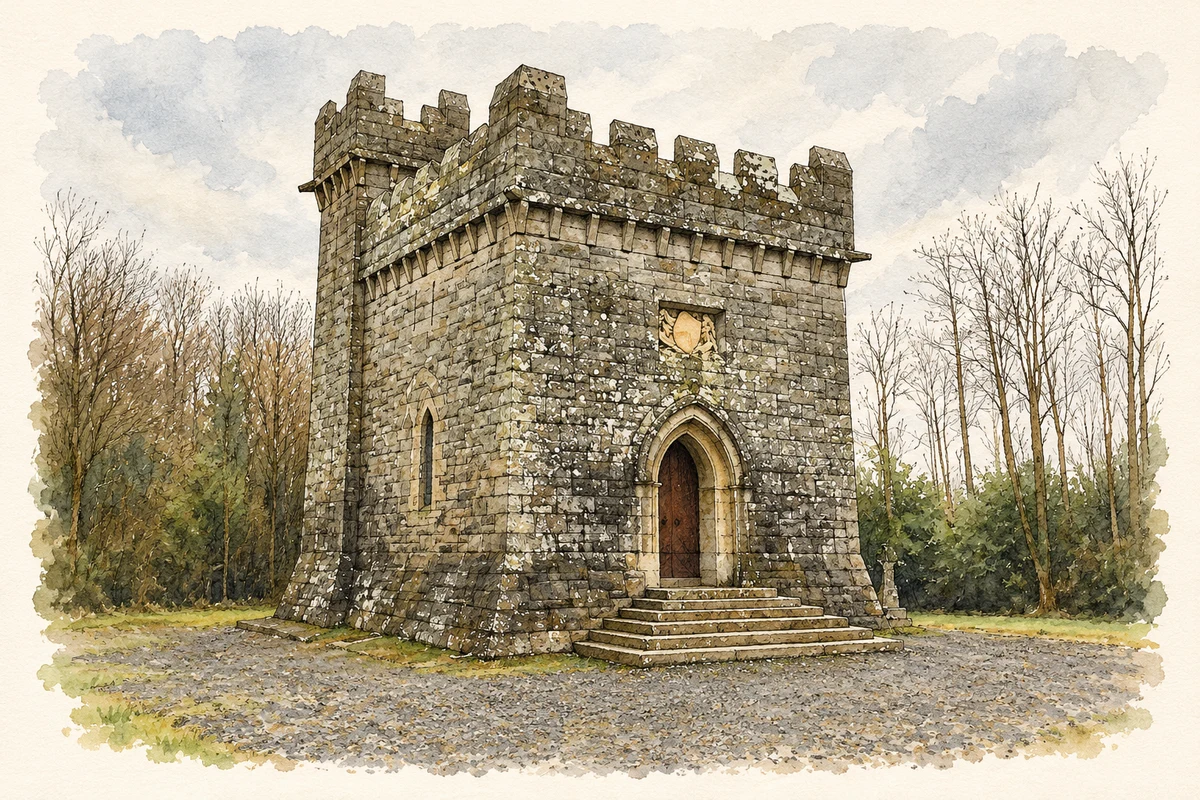
Monivea's former residence incorporated an O'Kelly tower house enlarged by the Ffrenches in the eighteenth century. The later domestic additions have disappeared, leaving the tower as the principal surviving element. The nearby mausoleum consciously echoes the older fortified building, carrying its architectural outline into a very different kind of monument.[3]
People & connections
Kathleen Ffrench and the mausoleum
After Robert Percy Ffrench died in 1896, his daughter Kathleen commissioned the mausoleum in a clearing in the estate woods. Monivea Heritage Association records the practical journey of its Wicklow granite: by rail to Athenry, then by horse and cart to the building site. The entrance leads to a chapel, with the family burial crypt below. A recumbent figure of Robert, carved in Carrara marble by Francesco Jerace, and stained glass made by Mayer of Munich give the interior an international artistic character. Kathleen was eventually buried beside her father. This was both a personal memorial and a substantial building project involving local labour.[4]
Both counts use the 2016 settlement boundary, allowing like-for-like comparison. CSO supplies the 2022 count on this older boundary for comparison only. The official 2022 Built Up Area has different boundaries.
View population figures
Monivea — Census 2016 settlement footprint — census population
These are the historical areas published in the 2006 census report. Boundaries may differ between censuses and from modern settlements. Legal towns, environs and suburbs are shown separately; none has been combined into a modern settlement total.
View population figures
Monivea, Galway — Census town, CSO 2006 report — census population
These are the historical areas published in the 1996 census report. Boundaries may differ between censuses and from modern settlements. Legal towns, environs and suburbs are shown separately; none has been combined into a modern settlement total.
View population figures
Monivea, Galway — Census town, CSO 1996 report — census population
Figures cover the historical town area printed in the 1986 report. Boundaries may have changed between censuses. Legal town, environs and suburb totals remain separate and differ from modern settlement boundaries.
View population figures
Monivea, Galway — Census town, CSO 1986 report — census population
These figures use different area definitions. Read the boundary note before comparing them.
Monivea, Galway
Published census settlement populations
308people · 2016
Settlement boundaries changed during this period. Differences may reflect boundary changes as well as population change. Where a 2011 legal-town-and-environs count is shown, it has not been recalculated onto the 2016 settlement boundary.
 placenames