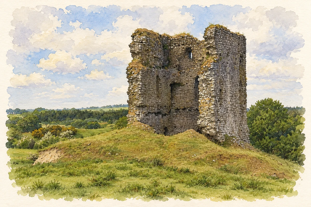
Moylough's castle overlooks the low ground west of the village. Its later history includes coach-road trade and a surviving autograph book that records a local woman's experience of Irish-language education.
Illustration, Moylough Castle remains, as photographed in 2010
⊕Recorded locationMoylough53.48615° N · 8.56769° WInteractive map supplied by OpenStreetMap.
These Irish name elements are associated with this record in the Logainm glossary.
An element’s translation is a clue, rather than a complete explanation of the name. Its form and meaning depend on local history and the full Irish name.
Recorded forms
Maigh Locha· Irish · main form · validated name
Moylough· English · main form
Place & story
The hall house west of the village
Moylough Castle stands on slightly raised ground west of the village, overlooking marshy land beside Summerville Lough. It is a medieval hall house, probably built in the first half of the thirteenth century. The local limestone walls are about two metres thick and strengthened by a sloping base. A recess beside the entrance accommodated the door when opened. Timber floors once divided its upper levels. The surviving structure records an early form of fortified residence, though the identity of its original builder remains uncertain.[2]
A stop on the coach road
Samuel Lewis described Moylough in 1837 as a village of about five hundred inhabitants, also known as Newtown-Bellew. It stood on the Dublin–Tuam mail-coach road, with a daily post connection to Castleblakeney. Five annual fairs traded cattle and pigs as well as linen, yarn and wool. A coach to Dublin and a car service to Ballinasloe passed through the parish each day. These connections placed the village within a wider network of passenger travel, postal services and agricultural commerce.[3]
People & connections
Katie Higgins and the language revival
Kathleen, known as Katie, Higgins was born at Lakeview, Moylough, in 1908. An autograph book given to her by Binetta Carr of Lakeview House accompanied her to Irish-language education at Spiddal in 1927. Its entries refer to the Irish language, the national flag and camogie, preserving the interests and friendships of a young woman growing up after independence. Her daughter Bridie Scanlon later donated the book to the National Folklore Collection. Its recorded provenance connects a surviving personal object with Moylough's place in the cultural life of the early Free State.[4]
Both counts use the 2016 settlement boundary, allowing like-for-like comparison. CSO supplies the 2022 count on this older boundary for comparison only. The official 2022 Built Up Area has different boundaries.
View population figures
Moylough — Census 2016 settlement footprint — census population
These are the historical areas published in the 2006 census report. Boundaries may differ between censuses and from modern settlements. Legal towns, environs and suburbs are shown separately; none has been combined into a modern settlement total.
View population figures
Moylough, Galway — Census town, CSO 2006 report — census population
These are the historical areas published in the 1996 census report. Boundaries may differ between censuses and from modern settlements. Legal towns, environs and suburbs are shown separately; none has been combined into a modern settlement total.
View population figures
Moylough, Galway — Census town, CSO 1996 report — census population
Figures cover the historical town area printed in the 1986 report. Boundaries may have changed between censuses. Legal town, environs and suburb totals remain separate and differ from modern settlement boundaries.
View population figures
Moylough, Galway — Census town, CSO 1986 report — census population
These figures use different area definitions. Read the boundary note before comparing them.
Moylough, Galway
Published census settlement populations
518people · 2016
Settlement boundaries changed during this period. Differences may reflect boundary changes as well as population change. Where a 2011 legal-town-and-environs count is shown, it has not been recalculated onto the 2016 settlement boundary.
 placenames