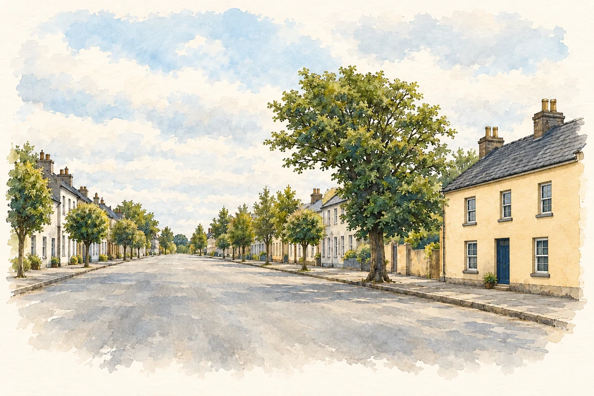
Clonmellon’s broad main street belongs to its market-town history, while the neighbouring Killua estate contains monuments whose appearance can be misleading.
Illustration, Main Street, Clonmellon
⊕Recorded locationClonmellon53.66426° N · 7.01664° WInteractive map supplied by OpenStreetMap.
A reliable full-name meaning has not been established here. The recorded Irish and English forms are given without an unsupported translation.
Recorded forms
Ráistín· Irish · main form · validated name
Clonmellon· English · main form
Place & story
The Chapman market town
Clonmellon's community action plan traces its late eighteenth-century development to Sir Benjamin Chapman of Killua Castle. By 1837 it was an established market town. Its broad main street focused activity on the market square, while a rise halfway along the street interrupted the long view through the settlement. That surviving layout records the practical needs of a trading centre and the influence of the adjoining estate. It also helps explain why the village has a more formal street pattern than settlements that grew around scattered lanes.[2]
The Raleigh obelisk
An obelisk in the Killua grounds bears an inscription recording its erection by Sir Thomas Chapman in 1810. The architectural inventory describes a limestone monument roughly ten metres high, positioned prominently on a small hill. It commemorates the tradition crediting Sir Walter Raleigh with introducing the potato to Ireland. The monument establishes that the Chapman family wished to celebrate that association; it does not establish where or by whom potatoes were first planted. Its carefully chosen position also made it an ornamental feature in views across the estate.[3]
A picturesque ruin and a real burial ground
Noel French's 1987 survey of Killua churchyard identifies the surviving west-end church ruin as a deliberate estate construction made from stones brought from Moyagher church. The burial ground itself contains genuine memorials, including eighteenth- and nineteenth-century inscriptions, and served as a Chapman family burial place. This distinction matters when reading the landscape: old stones can have been rearranged to create a picturesque scene. French's recorded inscriptions provide a separate body of evidence for the people commemorated there, rather than requiring the visible ruin to be an untouched medieval building.[4]
Both counts use the 2016 settlement boundary, allowing like-for-like comparison. CSO supplies the 2022 count on this older boundary for comparison only. The official 2022 Built Up Area has different boundaries.
View population figures
Clonmellon — Census 2016 settlement footprint — census population
Clonmellon, Westmeath — Census town, CSO 2006 report
2002–2006: census town
547people · 2006
These are the historical areas published in the 2006 census report. Boundaries may differ between censuses and from modern settlements. Legal towns, environs and suburbs are shown separately; none has been combined into a modern settlement total.
View population figures
Clonmellon, Westmeath — Census town, CSO 2006 report — census population
Clonmellon, Westmeath — Census town, CSO 1996 report
1991–1996: census town
272people · 1996
These are the historical areas published in the 1996 census report. Boundaries may differ between censuses and from modern settlements. Legal towns, environs and suburbs are shown separately; none has been combined into a modern settlement total.
View population figures
Clonmellon, Westmeath — Census town, CSO 1996 report — census population
Clonmellon, Westmeath — Census town, CSO 1986 report
1981–1986: census town
334people · 1986
Figures cover the historical town area printed in the 1986 report. Boundaries may have changed between censuses. Legal town, environs and suburb totals remain separate and differ from modern settlement boundaries.
View population figures
Clonmellon, Westmeath — Census town, CSO 1986 report — census population
These figures use different area definitions. Read the boundary note before comparing them.
Clonmellon, Westmeath
Published census settlement populations
664people · 2016
Settlement boundaries changed during this period. Differences may reflect boundary changes as well as population change. Where a 2011 legal-town-and-environs count is shown, it has not been recalculated onto the 2016 settlement boundary.
Main Street, Clonmellon illustration: based on a The wide main street of Clonmellon, Westmeath by Eric Jones. AI-assisted watercolour and ink adaptation; cream paper margins added, incidental clutter omitted and fine details simplified. Licence: CC BY-SA 2.0.
 placenames