These Irish name elements are associated with this record in the Logainm glossary.
An element’s translation is a clue, rather than a complete explanation of the name. Its form and meaning depend on local history and the full Irish name.
Recorded forms
Cionn Átha Gad· Irish · main form · validated name
Kinnegad· English · main form
Place & story
The road to Athlone
Samuel Lewis's 1837 gazetteer describes Kinnegad as a post town on the Dublin-to-Athlone road. Its 115 houses and central market house served a wider agricultural district. A fair took place on 9 May, although an older patent had authorised three fairs and a weekly market. Lewis also recorded a police station and dispensary. His figures distinguish the 670 people in the town from the larger district parish, an important distinction when comparing this account with family records or later population returns.[2]
People & connections
James Weale visits the school
In a letter dated 4 October 1829, Crown land official James Weale described a visit to Kinnegad's school. He counted seventy-one children, forty-seven of them Catholic, in an institution established by a Protestant society. Weekly fees varied from one penny to sixpence according to class. He reported that the teachers could teach bookkeeping, geography and history, and that both the clergyman and priest visited regularly. His letter provides a particular observer's account of local education, rather than a claim that every school in the district worked in the same way.[3]
McNamara’s church on the main street
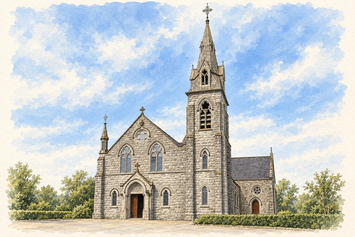
The Church of Our Lady of the Immaculate Conception was built around 1900–1910 to designs by T. F. McNamara. An archaeological assessment prepared for Kinnegad's community library identifies its subdued Gothic Revival design and commanding scale as important features of the town centre. Nearby stands the contemporary parochial house, whose authorship is less certain. The church's prominent position belongs to a later architectural layer than the market town Lewis described, showing how religious building reshaped the main street at the beginning of the twentieth century.[4]
Both counts use the 2016 settlement boundary, allowing like-for-like comparison. CSO supplies the 2022 count on this older boundary for comparison only. The official 2022 Built Up Area has different boundaries.
View population figures
Kinnegad — Census 2016 settlement footprint — census population
Kinnegad, Westmeath — Census town, CSO 2006 report
2002–2006: census town
2,245people · 2006
These are the historical areas published in the 2006 census report. Boundaries may differ between censuses and from modern settlements. Legal towns, environs and suburbs are shown separately; none has been combined into a modern settlement total.
View population figures
Kinnegad, Westmeath — Census town, CSO 2006 report — census population
Kinnegad, Westmeath — Census town, CSO 1996 report
1991–1996: census town
517people · 1996
These are the historical areas published in the 1996 census report. Boundaries may differ between censuses and from modern settlements. Legal towns, environs and suburbs are shown separately; none has been combined into a modern settlement total.
View population figures
Kinnegad, Westmeath — Census town, CSO 1996 report — census population
Kinnegad, Westmeath — Census town, CSO 1986 report
1981–1986: census town
433people · 1986
Figures cover the historical town area printed in the 1986 report. Boundaries may have changed between censuses. Legal town, environs and suburb totals remain separate and differ from modern settlement boundaries.
View population figures
Kinnegad, Westmeath — Census town, CSO 1986 report — census population
These figures use different area definitions. Read the boundary note before comparing them.
Kinnegad, Westmeath
Published census settlement populations
2,745people · 2016
Settlement boundaries changed during this period. Differences may reflect boundary changes as well as population change. Where a 2011 legal-town-and-environs count is shown, it has not been recalculated onto the 2016 settlement boundary.
Saint Mary's Catholic Church, Kinnegad illustration: based on a Eglise Kinnegad by Cqui. AI-assisted watercolour and ink adaptation; cream paper margins added, incidental clutter omitted and fine details simplified. Licence: CC BY-SA 3.0.
 placenames