Nurney's history reaches from medieval farming to nineteenth-century river drainage, with local memories preserved in a book assembled from photographs and family archives.
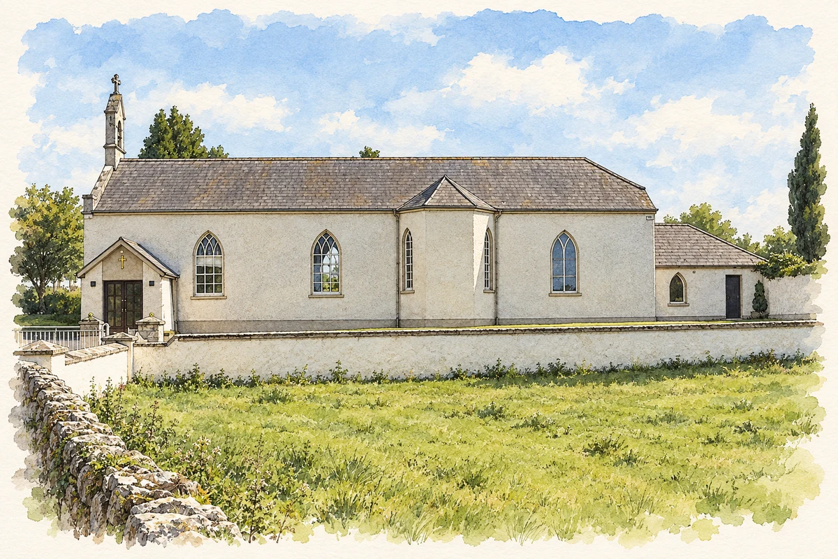
Illustration, Church of the Sacred Heart, Nurney
⊕Recorded locationNurney53.09410° N · 6.94746° WInteractive map supplied by OpenStreetMap.
A reliable full-name meaning has not been established here. The recorded Irish and English forms are given without an unsupported translation.
Recorded forms
An Urnaí· Irish · main form · validated name
Nurney· English · main form
Place & story
Fields beside the medieval church
Archaeological testing in July 2002 uncovered traces of medieval activity south and west of Nurney's ruined church and graveyard. Pottery occurred beside a curving ditch and at the bottom of two cultivation furrows. Eight parallel furrows suggested a medieval field system. The discovery adds a picture of cultivated land to the area's better-known church and castle sites: people were working these fields as well as building the monuments whose locations survive in the historical record.[2]
Nurney in 1837
Samuel Lewis recorded 622 inhabitants in the parish in 1837, with extensive bogland and improving agriculture. He described Nurney House as a former castle adapted into a residence and noted that a new church was being built. His account also places a Catholic chapel beside the old church ruins and burial ground.[3]
The Sacred Heart church
The Church of the Sacred Heart stands above the river, its road-facing gable topped by a cut-stone bellcote. Slender pointed windows punctuate the exterior, including timber sash windows with traceried heads. Inside, the architectural inventory records a timber gallery supported on cast-iron columns and a marble altar with a pedimented reredos. The building's relatively plain walls make these details particularly noticeable. Twentieth-century porches and renovations added further layers to the church.[4]
Drainage and recreation
Nurney Bridge bears the date 1876. Its single stone arch belongs to the Board of Works' Kildare River drainage scheme, linking a familiar village crossing to a larger programme of water management. Another dated structure records recreation: the concrete handball alley was built in 1935, with a metal viewing gallery added around 1980. Both appear in the council's architectural assessment of the village.[5]
People & connections
Paud O'Connor's village archive
Paud O'Connor grew up in Nurney after his family moved there in 1951, when his father became principal of the national school. During the first pandemic lockdown he assembled photographs, maps and archive material into Much About Nurney: A Kildare Pastoral. Reissued in 2021, the 252-page book follows local families, schools, rural electrification and the GAA. O'Connor's account of the project describes an interest in everyday life and the changes witnessed across generations.[6]
Both counts use the 2016 settlement boundary, allowing like-for-like comparison. CSO supplies the 2022 count on this older boundary for comparison only. The official 2022 Built Up Area has different boundaries.
View population figures
Nurney — Census 2016 settlement footprint — census population
These are the historical areas published in the 2006 census report. Boundaries may differ between censuses and from modern settlements. Legal towns, environs and suburbs are shown separately; none has been combined into a modern settlement total.
View population figures
Nurney, Kildare — Census town, CSO 2006 report — census population
These figures use different area definitions. Read the boundary note before comparing them.
Nurney, Kildare
Published census settlement populations
456people · 2016
Settlement boundaries changed during this period. Differences may reflect boundary changes as well as population change. Where a 2011 legal-town-and-environs count is shown, it has not been recalculated onto the 2016 settlement boundary.
 placenames