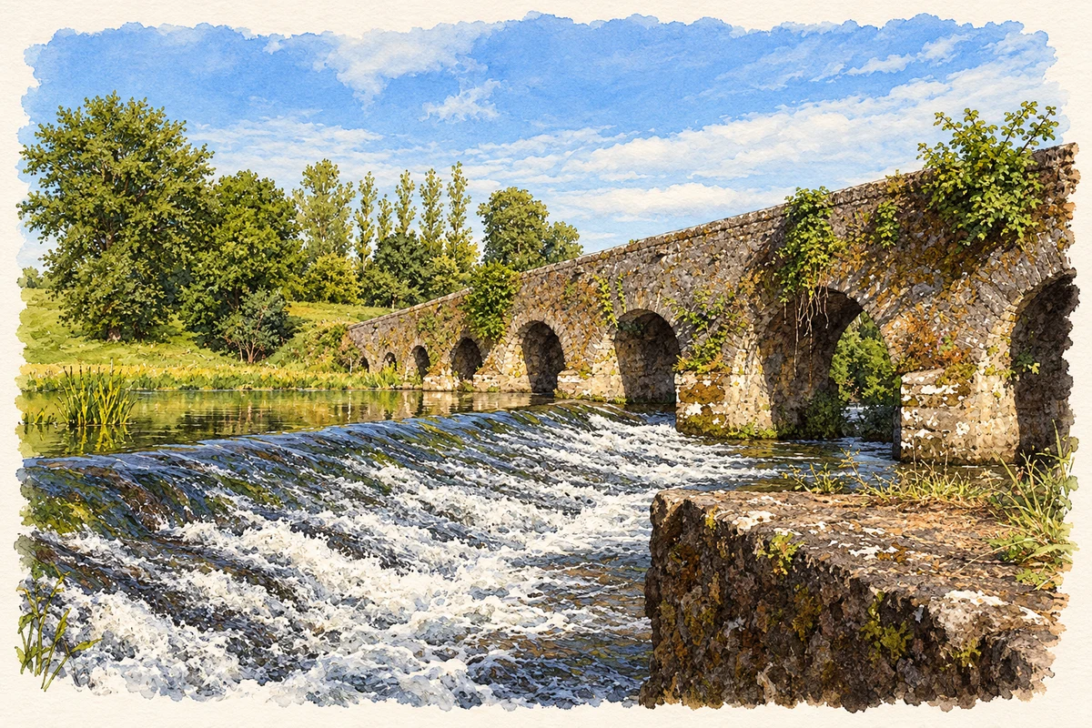
Glanworth's castle and bridge face one another across the Funshion. Excavation reveals successive medieval building campaigns, while modern reporting records the difficulty of keeping a narrow historic crossing in use.
Illustration, Glanworth Bridge and weir
⊕Recorded locationGlanworth52.18828° N · 8.35808° WInteractive map supplied by OpenStreetMap.
A reliable full-name meaning has not been established here. The recorded Irish and English forms are given without an unsupported translation.
Recorded forms
Gleannúir· Irish · main form · validated name
Glanworth· English · main form
Place & story
The castle uncovered
Excavations before conservation examined Glanworth Castle's thirteenth-century keep and western defences. Traces of a mortar floor survived inside the keep. Its original wooden first floor had later been replaced by two stone barrel vaults. Archaeologists also identified a gatehouse whose passage once held a double-leaf gate secured with a drawbar. Successive alterations blocked that entrance and eventually transformed the building into a tower house, adding a five-storey garderobe turret. A kitchen and large bread oven reveal further changes to domestic life within the fortified enclosure. Finds included imported pottery, coins and cannonball fragments.[2]
Thirteen arches across the Funshion
The limestone bridge has thirteen round arches and a carriageway only about three metres wide. Its piers stand on rock in the riverbed, with pointed cutwaters on the upstream side. The long, slightly humped profile and narrow road preserve an early form of river crossing beside the castle. Corbels at the springing of the arches retain evidence of the supports used during construction. Together, bridge and castle form a closely connected group around the river.[3]
A village vote on the crossing
In October 1975 RTÉ reported that Glanworth's households would be asked to decide the bridge's future through a plebiscite. The narrow crossing created difficulties for modern traffic and pedestrians, and some heavy farm machinery needed to take a four-mile detour. Replacing the bridge had been ruled out on historical grounds. The report captures a specific local debate over transport and preservation, as a structure built for earlier forms of travel remained part of the working road network.[4]
Both counts use the 2016 settlement boundary, allowing like-for-like comparison. CSO supplies the 2022 count on this older boundary for comparison only. The official 2022 Built Up Area has different boundaries.
View population figures
Glanworth — Census 2016 settlement footprint — census population
These are the historical areas published in the 2006 census report. Boundaries may differ between censuses and from modern settlements. Legal towns, environs and suburbs are shown separately; none has been combined into a modern settlement total.
View population figures
Glanworth, Cork — Census town, CSO 2006 report — census population
These are the historical areas published in the 1996 census report. Boundaries may differ between censuses and from modern settlements. Legal towns, environs and suburbs are shown separately; none has been combined into a modern settlement total.
View population figures
Glanworth, Cork — Census town, CSO 1996 report — census population
Figures cover the historical town area printed in the 1986 report. Boundaries may have changed between censuses. Legal town, environs and suburb totals remain separate and differ from modern settlement boundaries.
View population figures
Glanworth, Cork — Census town, CSO 1986 report — census population
These figures use different area definitions. Read the boundary note before comparing them.
Glanworth, Cork
Published census settlement populations
603people · 2016
Settlement boundaries changed during this period. Differences may reflect boundary changes as well as population change. Where a 2011 legal-town-and-environs count is shown, it has not been recalculated onto the 2016 settlement boundary.
 placenames