A reliable full-name meaning has not been established here. The recorded Irish and English forms are given without an unsupported translation.
Recorded forms
An Craoslach· Irish · main form · validated name
Creeslough· English · main form
Place & story
Saint Michael’s and Muckish
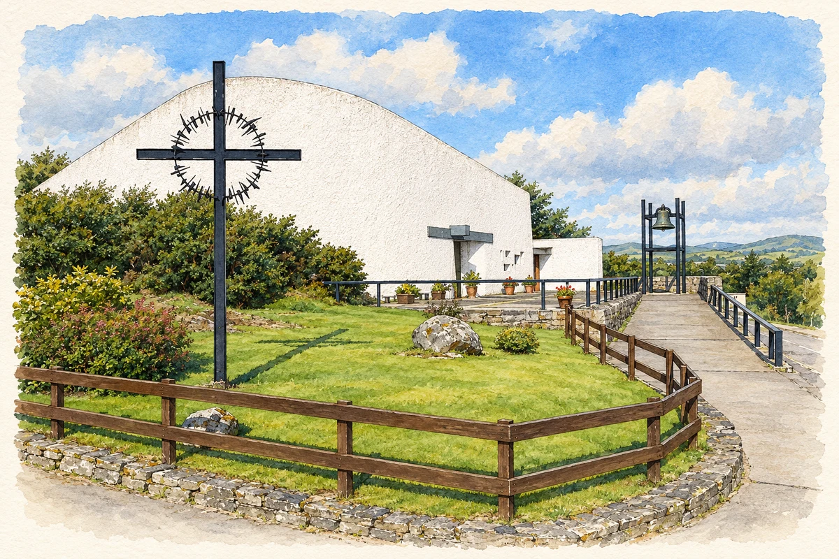
Saint Michael’s Church was designed by Liam McCormick and completed in 1971. Its outline responds to nearby Muckish Mountain, an association documented by the community heritage project Creeslough View. Local filmmaking has preserved another perspective on its construction. Canon Tommy Doherty filmed the building process on an 8mm camera, from the undeveloped site through to its opening and consecration by Bishop Anthony McFeely. Footage supplied by his nephew and the diocesan archive became part of Eamonn McFadden’s film The Church & The Mountain.[2][3]
People & connections
Bridie Gallagher’s first audiences
Bridie Gallagher was born in Creeslough in 1924 and began singing in the local hall with a céilí band. Her later career took her to international audiences, with recordings including The Boys from County Armagh and The Homes of Donegal. Creeslough celebrated her career in 2000 with a gathering and commemorative plaque. Donegal County Council also held a civic reception. The hall and the village tribute place her public career within a specific local musical community.[4]
The MacSweeneys at Doe
Doe Castle stands outside Creeslough on an inlet of Sheephaven Bay. It served as a stronghold for successive MacSweeney chiefs. The Office of Public Works records Eoghan Óg II sheltering survivors of the Spanish Armada in 1588, and Maolmhuire an Bhata Bhuí joining Red Hugh O’Donnell’s forces at Kinsale in 1601. A carved MacSweeney grave slab dated 1544 survives inside the tower house. These associations connect a nearby landmark with the political and military history of Tyrconnell.[5]
The loss remembered in the village
An explosion in Creeslough on 7 October 2022 killed ten people. The Garda statement issued two days later confirmed that the dead included adults, two teenagers and a young child. In October 2024, RTÉ reported the bells of Saint Michael’s ringing at 3.17pm to mark the second anniversary. The commemoration made the church part of the village’s shared remembrance, alongside its architectural and religious roles.[6][7]
Both counts use the 2016 settlement boundary, allowing like-for-like comparison. CSO supplies the 2022 count on this older boundary for comparison only. The official 2022 Built Up Area has different boundaries.
View population figures
Creeslough — Census 2016 settlement footprint — census population
Creeslough, Donegal — Census town, CSO 2006 report
2002–2006: census town
327people · 2006
These are the historical areas published in the 2006 census report. Boundaries may differ between censuses and from modern settlements. Legal towns, environs and suburbs are shown separately; none has been combined into a modern settlement total.
View population figures
Creeslough, Donegal — Census town, CSO 2006 report — census population
Creeslough, Donegal — Census town, CSO 1996 report
1991–1996: census town
300people · 1996
These are the historical areas published in the 1996 census report. Boundaries may differ between censuses and from modern settlements. Legal towns, environs and suburbs are shown separately; none has been combined into a modern settlement total.
View population figures
Creeslough, Donegal — Census town, CSO 1996 report — census population
Creeslough, Donegal — Census town, CSO 1986 report
1981–1986: census town
340people · 1986
Figures cover the historical town area printed in the 1986 report. Boundaries may have changed between censuses. Legal town, environs and suburb totals remain separate and differ from modern settlement boundaries.
View population figures
Creeslough, Donegal — Census town, CSO 1986 report — census population
These figures use different area definitions. Read the boundary note before comparing them.
Creeslough, Donegal
Published census settlement populations
393people · 2016
Settlement boundaries changed during this period. Differences may reflect boundary changes as well as population change. Where a 2011 legal-town-and-environs count is shown, it has not been recalculated onto the 2016 settlement boundary.
 placenames