These Irish name elements are associated with this record in the Logainm glossary.
An element’s translation is a clue, rather than a complete explanation of the name. Its form and meaning depend on local history and the full Irish name.
Recorded forms
Dún Cionnaola· Irish · main form · validated name
Dunkineely· English · main form
Place & story
Saint Peter’s distinctive tower
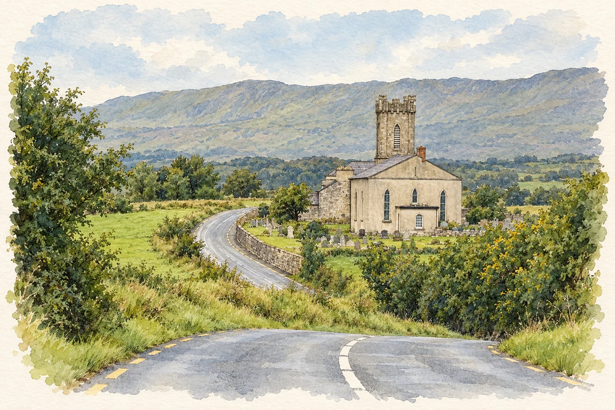
Saint Peter’s Church of Ireland church stands west of Dunkineely at Beaugreen Glebe. Built in 1826–27, it follows the familiar arrangement of a hall attached to a western tower, but its tower parapet has unusually elongated corner shafts. The architectural inventory records timber Y-tracery, stained glass and a timber gallery among the surviving features. The graveyard contains upright stones, table tombs and recumbent memorials, with iron railings enclosing some plots. The ashlar gateway and wrought-iron gates complete this early nineteenth-century group.[2]
A Methodist presence on Main Street
The Methodist Historical Society’s index records two successive Dunkineely churches, dated 1828 and 1856. The Methodist Church in Ireland’s directory locates the continuing congregation on Main Street and places it in the Dunkineely and Ardara circuit. These records establish a separate strand of local religious life alongside the Church of Ireland parish, with congregations linked across more than one settlement. The two dates in the historical index refer to successive church entries, rather than a single claimed foundation date for all Methodism in the district.[3][4]
Repairing Old Killaghtee
Nearby Old Killaghtee, also known as Spamount graveyard, contains church remains and a cross-inscribed slab. Dunkineely Community Ltd records the site’s adoption under the Adopt a Monument scheme in 2022 by a group bringing together local churches, farmers and community members. A conservation survey identified vulnerable mortar, the south wall and the east window. Repair work followed in 2023 using compatible mortar and stones recovered from the collapsed wall. This documented conservation effort adds a recent chapter to an older shared burial place.[5]
George Halpin’s harbour light
Farther along the Saint John’s Point peninsula, the lighthouse marks the northern side of the route from Donegal Bay towards Killybegs Harbour. Merchants and traders petitioned for it in 1825. George Halpin designed the granite tower and supervised its construction, with the light first shown on 4 November 1831 before the buildings were fully finished. Irish Lights records automatic operation from 1932 and conversion to electricity in 1962. The low white tower belongs to this Donegal headland; it is distinct from the much taller lighthouse of the same name in County Down.[6]
Both counts use the 2016 settlement boundary, allowing like-for-like comparison. CSO supplies the 2022 count on this older boundary for comparison only. The official 2022 Built Up Area has different boundaries.
View population figures
Dunkineely — Census 2016 settlement footprint — census population
Dunkineely, Donegal — Census town, CSO 2006 report
2002–2006: census town
363people · 2006
These are the historical areas published in the 2006 census report. Boundaries may differ between censuses and from modern settlements. Legal towns, environs and suburbs are shown separately; none has been combined into a modern settlement total.
View population figures
Dunkineely, Donegal — Census town, CSO 2006 report — census population
Dunkineely, Donegal — Census town, CSO 1996 report
1991–1996: census town
395people · 1996
These are the historical areas published in the 1996 census report. Boundaries may differ between censuses and from modern settlements. Legal towns, environs and suburbs are shown separately; none has been combined into a modern settlement total.
View population figures
Dunkineely, Donegal — Census town, CSO 1996 report — census population
Dunkineely, Donegal — Census town, CSO 1986 report
1981–1986: census town
442people · 1986
Figures cover the historical town area printed in the 1986 report. Boundaries may have changed between censuses. Legal town, environs and suburb totals remain separate and differ from modern settlement boundaries.
View population figures
Dunkineely, Donegal — Census town, CSO 1986 report — census population
These figures use different area definitions. Read the boundary note before comparing them.
Dunkineely, Donegal
Published census settlement populations
361people · 2016
Settlement boundaries changed during this period. Differences may reflect boundary changes as well as population change. Where a 2011 legal-town-and-environs count is shown, it has not been recalculated onto the 2016 settlement boundary.
Saint Peter's Church, Beaugreen Glebe, Dunkineely illustration: based on a Church at Beaugreen Glebe, Dunkineely by louise price. AI-assisted watercolour and ink adaptation; cream paper margins added, incidental clutter omitted and fine details simplified. Licence: CC BY-SA 2.0.
 placenames