 placenames
Corcreeghagh
An Chorr Chríochach
A ruined Catholic chapel and surviving agricultural records preserve parts of Corcreeghagh’s history in County Louth.
The name
These Irish name elements are associated with this record in the Logainm glossary.
An element’s translation is a clue, rather than a complete explanation of the name. Its form and meaning depend on local history and the full Irish name.
Recorded forms
- An Chorr Chríochach · Irish · main form
- Corcreeghagh · English · main form
- Corcreaghy · English · main form · local name
Place & story
The old chapel
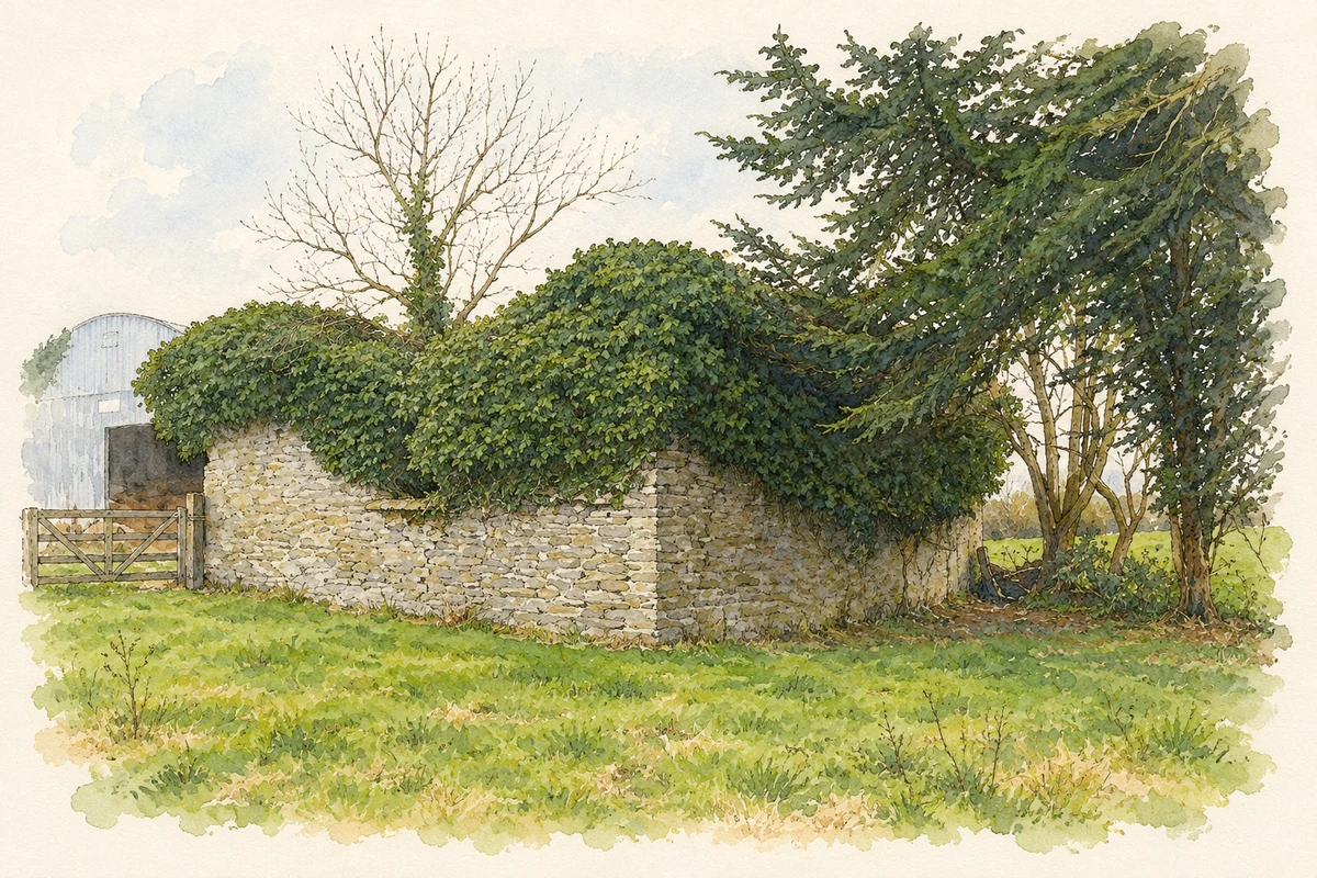
The ruined Catholic church at Corcreeghagh remained in use into the early twentieth century, according to Kieran Campbell’s field record. His 2008 account describes a rectangular building with entrances at both ends of its southern wall, pointed windows in the long walls and a single window in each gable. The church stands close to the settlement, retaining the outline of a place where the local congregation once gathered. [2]
The townland in the census
The 1901 census report counted 62 people in Corcreeghagh townland, evenly divided between 31 men and 31 women. Twelve houses were recorded, all inhabited. The comparative figures give 87 residents in 1881 and 64 in 1891, showing a substantial decline before the turn of the century. These are townland totals, encompassing the surrounding rural area as well as the small settlement. [3]
Farms on the map
Corcreeghagh appears on a 1940s agricultural map preserved by Louth County Archives, covering Ordnance Survey sheets 10 and 10 A. The surrounding townlands include Drumgur, Edenaquin, Sandfield and Lannat. This series of maps recorded farmers’ names and holding boundaries at a scale of six inches to the mile. Preserved with tillage and fertiliser scheme records, it offers another view of the district through the land its residents worked. [4]
Geographic information
Sources & further reading
- Logainm.ie — Corcreeghagh. Place names and geographic record, licensed under CC BY 4.0.
- Church at Corcreeghagh, Co. Louth,7 March2008 · Kieran Campbell
- Census of Ireland1901: County Louth, Table VII, p.19 · Census Commissioners for Ireland
- Louth Tillage & Fertiliser Schemes’ Records: PP00293/005/010 · Louth County Archives Service
- Ruined Catholic chapel at Corcreeghagh, County Louth illustration: based on a Ruined church, Corcreeghagh by Kieran Campbell. AI-assisted watercolour and ink adaptation; cream paper margins added, incidental clutter omitted and fine details simplified. Licence: CC BY-SA 2.0. Additional reference: Church at Corcreeghagh, Co. Louth by Kieran Campbell, CC BY-SA 2.0.
Name record retrieved 2026-10-25 · Source record modified 2026-08-12. How this page was prepared.