 placenames
Kilcurly
Cill Choirle
Kilcurly's church and field names preserve nineteenth-century community history, while recent archaeological testing has added evidence of much earlier activity.
The name
These Irish name elements are associated with this record in the Logainm glossary.
An element’s translation is a clue, rather than a complete explanation of the name. Its form and meaning depend on local history and the full Irish name.
Recorded forms
- Cill Choirle · Irish · main form · validated name
- Kilcurly · English · main form
- Kilcurley · English · main form · local name
- Kilkerley · English · main form · local name
Place & story
The church and its Dundalk-made gates
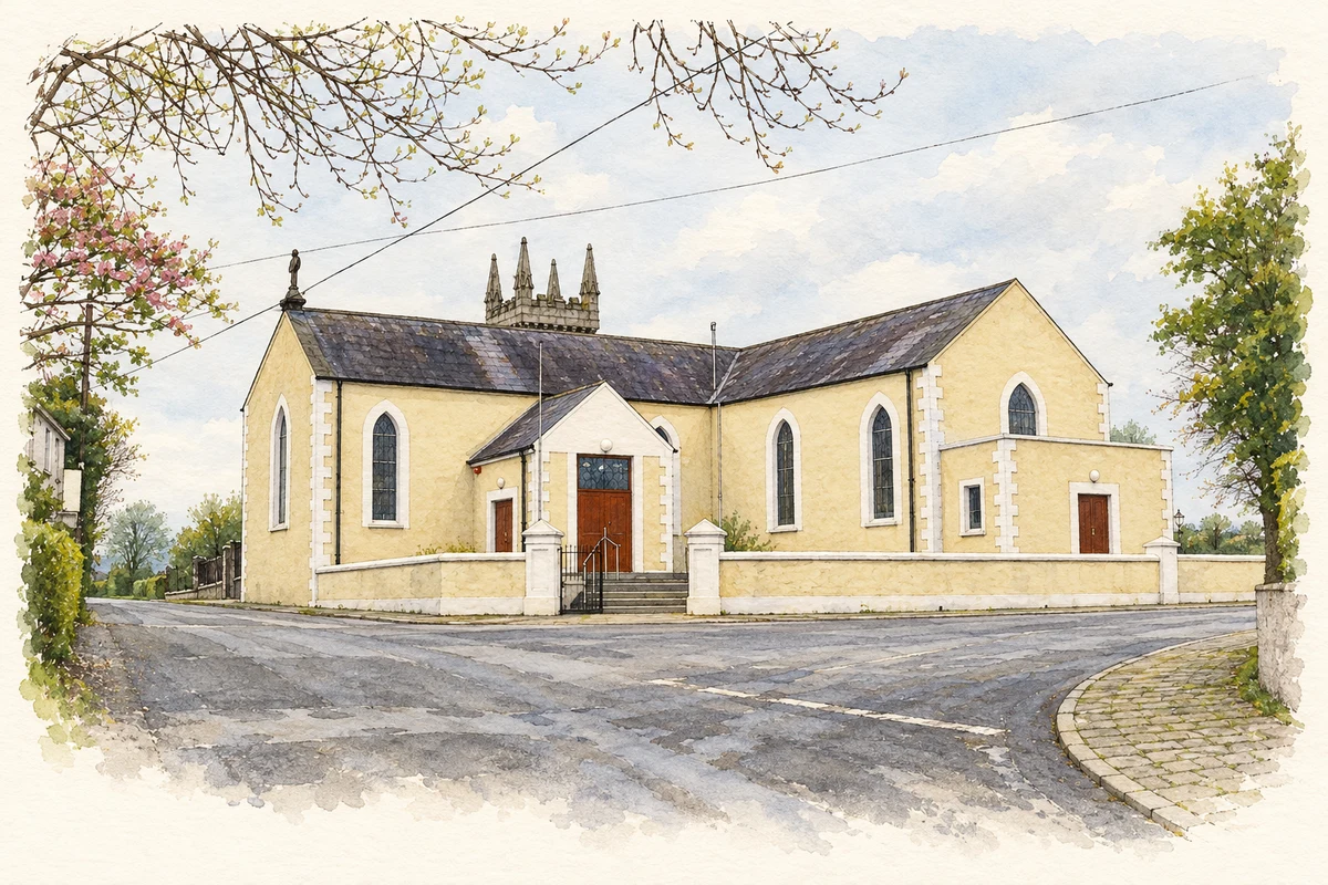
The Church of the Immaculate Conception at Kilcurly dates from around 1820, with later additions including its stone tower. The National Inventory contrasts the church's rendered walls with the tower's detailed limestone work and diamond-pattern glazing. Wrought-iron gates carry the mark of Crawford of Dundalk and the date 1843. Beyond the church, a curving tree-lined avenue leads towards the graveyard, extending the site's presence beyond the building itself. [2]
Field names around Kilcurly House
A 2014 Louth Field Name Project visit documented names organised around Kilcurly House, distinguishing near and far fields and their relationship to the road. Other names identified grazing areas for calves and bullocks. The researchers also recorded an older landscape beneath that estate pattern, including a burial ground, a crannóg and souterrains. Their account preserves everyday agricultural naming alongside archaeological features that could otherwise remain disconnected on a map. [3]
A burnt mound found in 2024
Archaeologist Linda Clarke's report on testing in July and August 2024 records a previously unknown burnt mound in Kilcurly. Roughly ten metres across, it contained heat-shattered stones and charcoal near a stream later adapted as a mill race. The testing avoided protected zones around the known burial ground and crannóg. Its findings therefore add a distinct discovery to the townland's archaeological record without claiming to have excavated those earlier recorded monuments. [4]
Geographic information
- Place type
- Population centre
- County
- Louth
- Barony
- Dundalk Upper
- Civil parish
- Dunbin
- Coordinates
- 54.00580, -6.46637
- Logainm ID
- 1414220 ↗
Sources & further reading
- Logainm.ie — Kilcurly. Place names and geographic record, licensed under CC BY 4.0.
- Catholic Church of the Immaculate Conception, NIAH 13900607 · National Inventory of Architectural Heritage
- Kilcurly field names, 21 January 2014 · Louth Field Name Project
- 2024:660, Kilcurly, Louth, licence 24E0546 · Linda Clarke, Archaeological Consultancy Services Unit; Excavations.ie
- The Church of the Immaculate Conception at Kilcurly, as photographed in 2009 illustration: based on a Church at Kilkerley, Co. Louth by Kieran Campbell. AI-assisted watercolour and ink adaptation; cream paper margins added, incidental clutter omitted and fine details simplified. Licence: CC BY-SA 2.0.
Name record retrieved 2026-10-25 · Source record modified 2026-08-12. How this page was prepared.