Clonygowan’s surviving dovecote and railway bridge preserve different nineteenth-century ambitions, while local publishing and the Gooseberry Fair reflect community life.
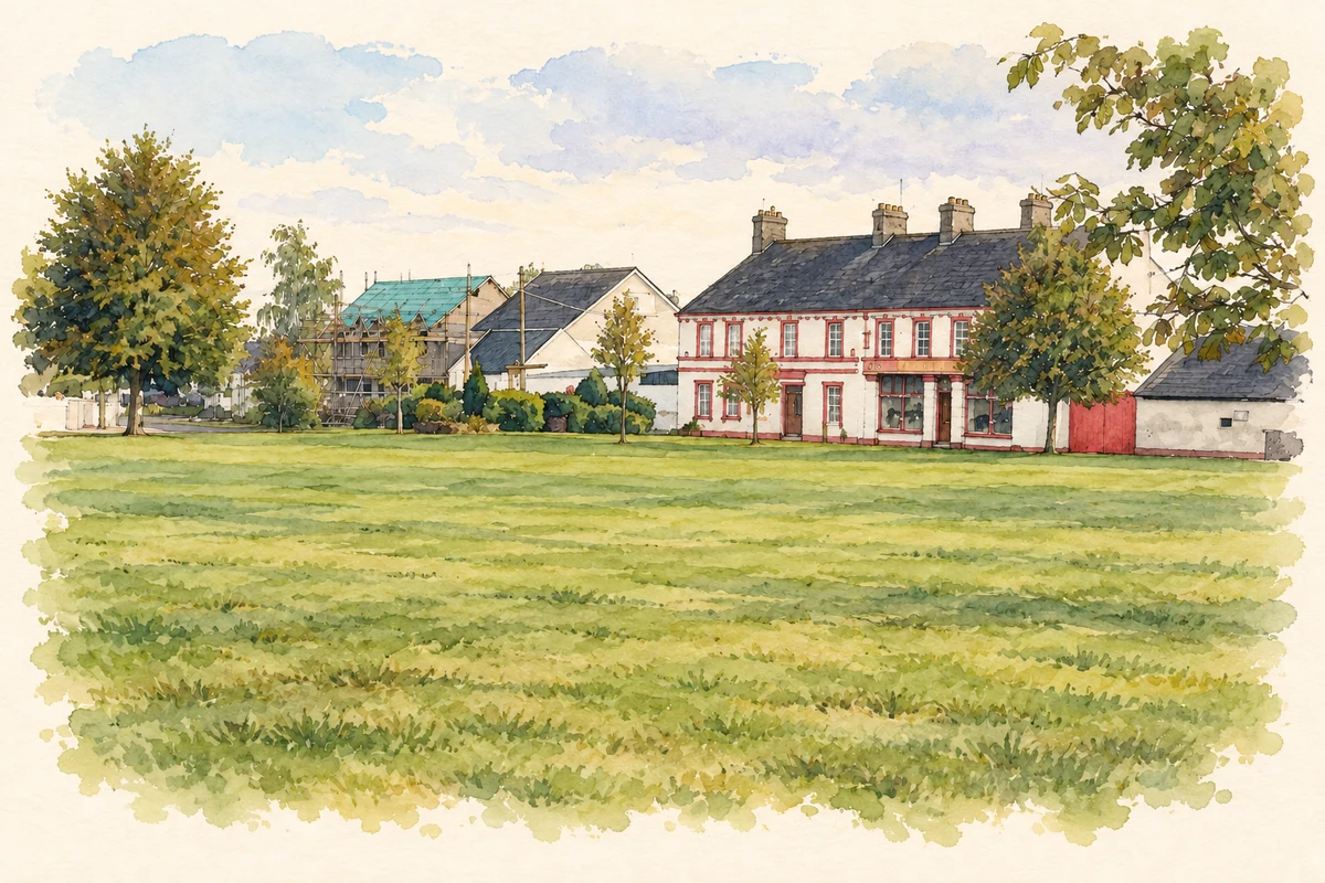
Illustration of Fair Green and its village frontage, Clonygowan, based on a 2007 photograph.
⊕Recorded locationClonygowan53.18639° N · 7.27982° WInteractive map supplied by OpenStreetMap.
These Irish name elements are associated with this record in the Logainm glossary.
An element’s translation is a clue, rather than a complete explanation of the name. Its form and meaning depend on local history and the full Irish name.
Recorded forms
Cluain na nGamhan· Irish · main form · validated name
Clonygowan· English · main form
Cloneygowan· English · main form · local name
Place & story
The house disappears, the dovecote remains
Clonygowan House has disappeared, but its dovecote survives. Built around 1830, the square structure is raised on piers joined by arches, with a slate roof and brick details framing its openings. It supplied birds for the estate table while serving as an ornamental feature visible from the house. This combination of practical purpose and deliberate display makes it more than an isolated garden folly: it preserves part of the working arrangements of the former estate.[2]
The railway’s limestone bridge
A single-arch railway bridge built around 1854 carries the Portarlington–Tullamore route through Clonygowan. Its rock-faced limestone supports and rusticated arch stones give it a substantial appearance, while sloping wing walls meet the surrounding ground. The bridge belongs to the Athlone branch developed by the Great Southern and Western Railway. It records the extension of the railway network through the district, a different form of nineteenth-century investment from the nearby estate buildings.[3]
People & connections
P. J. Goode records his home district
Native villager P. J. Goode first published a history of Cloneygowan and its district in 1995. An expanded edition appeared in 2024, bringing together accounts of local places, families, schools and commemorations. Offaly History's description identifies it as the first volume of a larger project. The book gives the community a named local historian and a record assembled across generations, while its district-wide scope extends beyond the village itself.[4]
The Gooseberry Fair as a community fundraiser
A 2018 parish notice announced Cloneygowan's Gooseberry Fair for 19 August, beginning with a parade from the village green. Its proceeds were intended for the senior citizens' Christmas party. This contemporary record documents the fair's role as a social gathering and fundraiser. It provides a firm example of the modern event without requiring an unsupported claim that every feature of the present fair survives unchanged from an older market.[5]
Both counts use the 2016 settlement boundary, allowing like-for-like comparison. CSO supplies the 2022 count on this older boundary for comparison only. The official 2022 Built Up Area has different boundaries.
View population figures
Clonygowan — Census 2016 settlement footprint — census population
These figures use different area definitions. Read the boundary note before comparing them.
Clonygowan, Offaly
Published census settlement populations
198people · 2016
Settlement boundaries changed during this period. Differences may reflect boundary changes as well as population change. Where a 2011 legal-town-and-environs count is shown, it has not been recalculated onto the 2016 settlement boundary.
Fair Green, Clonygowan, County Offaly illustration: based on a Clonygowan, County Offaly by Sarah777. AI-assisted watercolour and ink adaptation; cream paper margins added, incidental clutter omitted and fine details simplified. Licence: CC BY-SA 2.0.
 placenames