A reliable full-name meaning has not been established here. The recorded Irish and English forms are given without an unsupported translation.
Recorded forms
Críonchoill· Irish · main form · validated name
Crinkill· English · main form
Crinkle· English · main form · local name
Place & story
A village shaped by the garrison
Birr’s permanent barracks was built at Crinkill in the early nineteenth century and completed in 1812. It could accommodate roughly a thousand soldiers, whose presence encouraged village trade and development. Military Road and Whiteford Road served the movement of troops. As the complex grew it acquired facilities including a hospital, prison, married quarters and a canteen. From 1881 it was the depot of the newly formed Leinster Regiment, linking the village with soldiers serving far beyond Ireland.[2]
The surviving walls and gates
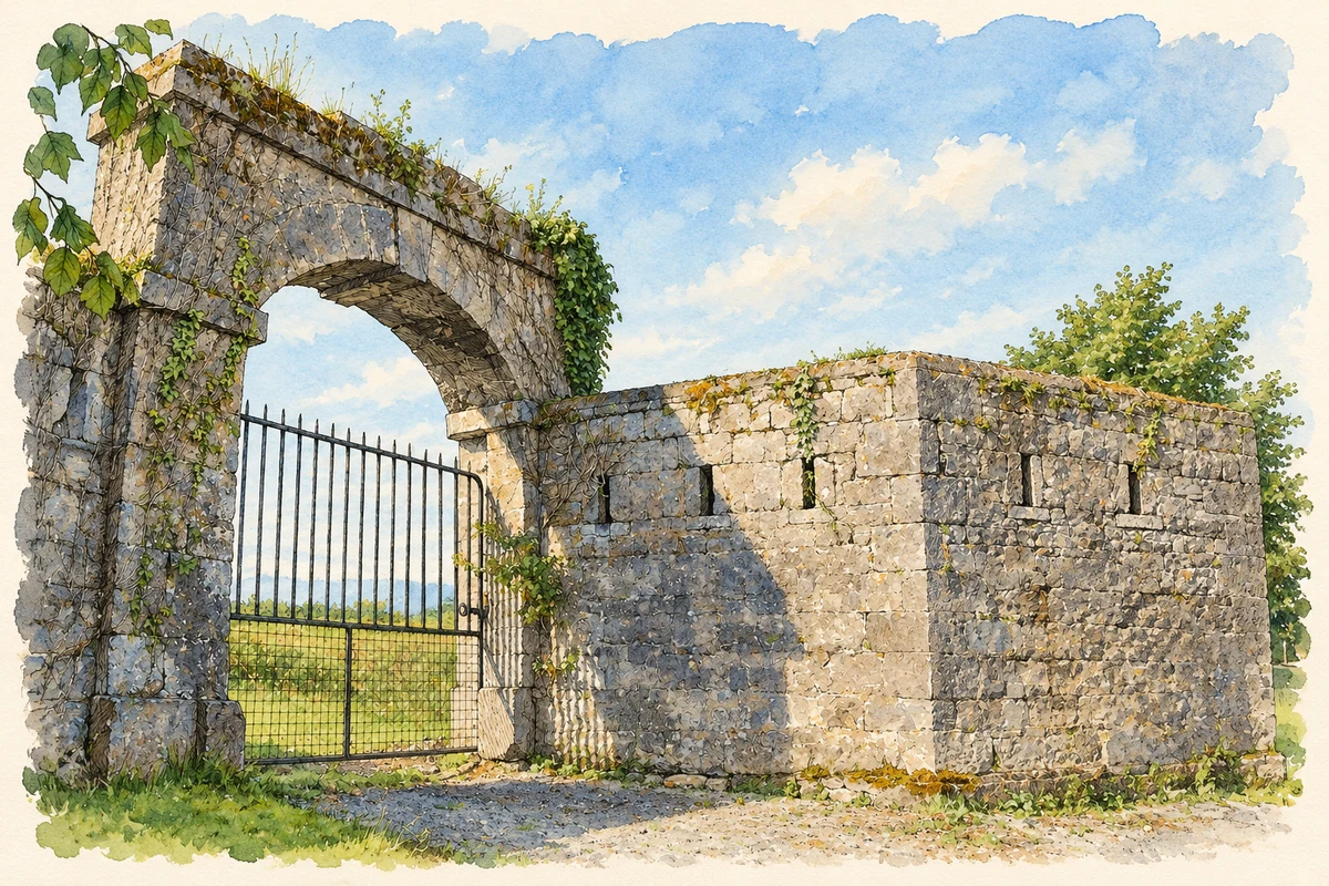
The barracks perimeter walls and entrances remain the most substantial visible reminders of the complex. The National Inventory of Architectural Heritage records stone walls with projecting defensive works and gun loops on the northern and western sides. A round-headed northern entrance has dressed stone blocks and a central keystone, while a segmental arch marks the western entrance. These surviving features show how the barracks controlled access and protected its perimeter, even after the principal buildings disappeared.[3]
Fire and the dispersal of the buildings
The barracks burned on 14 July 1922 during the Civil War. Stephen Callaghan’s centenary history describes the destruction of the accommodation blocks and garrison church, followed by years of dereliction. Although rebuilding was discussed, the ruins were eventually sold for stone. Material from the church went to Mount Saint Joseph’s at Roscrea, where it was used in part of the steeple. Some remaining blocks and the central arch and cupola were demolished in the 1980s. The surviving boundary is therefore the remnant of a complex dismantled over many decades.[4]
Both counts use the 2016 settlement boundary, allowing like-for-like comparison. CSO supplies the 2022 count on this older boundary for comparison only. The official 2022 Built Up Area has different boundaries.
View population figures
Crinkle — Census 2016 settlement footprint — census population
These figures use different area definitions. Read the boundary note before comparing them.
Crinkle, Offaly
Published census settlement populations
682people · 2016
Settlement boundaries changed during this period. Differences may reflect boundary changes as well as population change. Where a 2011 legal-town-and-environs count is shown, it has not been recalculated onto the 2016 settlement boundary.
Military barracks gateway ruins, Crinkill, County Offaly illustration: based on a File:The Military Barracks, Crinkle.jpg by celtjan. AI-assisted watercolour and ink adaptation; cream paper margins added, incidental clutter omitted and fine details simplified. Licence: CC BY-SA 3.0.
 placenames