A reliable full-name meaning has not been established here. The recorded Irish and English forms are given without an unsupported translation.
Recorded forms
Dúthamhlacht· Irish · main form · validated name
Doohamlat· English · main form
Doohamlet· English · main form · local name
Place & story
All Saints’ two building phases
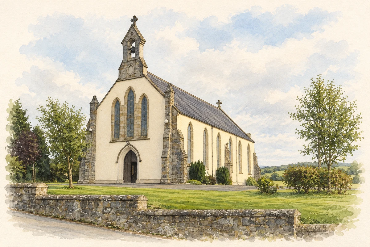
All Saints’ Catholic Church was first built in 1857–60 and rebuilt in 1882, the date marked on its later fabric. The architectural inventory describes a modest Gothic church whose sandstone bellcote, buttresses and cross finials reward close attention. An exposed scissors-truss timber roof spans the interior. Decorative porch doors, carved confessionals and a Crucifixion window at the chancel add further layers of craftsmanship within its simple plan.[2]
Restoring the floor one tile at a time
A renovation committee formed in 2019 after mould had blackened the church interior. Northern Sound’s October 2021 report describes the work as funded by donations and carried out through volunteering. The original terrazzo floor was a particular part of the project: tiles were lifted individually, cleaned and returned to their places. Committee chair Gerard Duffy spoke as the completed works were being presented to the public, giving a named local voice to the restoration.[3]
People & connections
Joanne Loughman’s village crest
For Doohamlet O’Neills’ centenary in 2006, local designer Joanne Loughman created a crest drawing on the district’s history. The village’s own account explains its church bellcote, barley head and blue flax flower as references to worship, grain milling and the former flax trade. Black and blue recall club colours adopted in 1969, while the white border links them with Monaghan. The design records how a community chose to represent its past in a new emblem.[4]
The creamery becomes a community centre
Doohamlet’s community centre began as the local creamery, converted to public use in 1966. The contractor’s account of its later redevelopment records renovation and a substantial extension in 2020. The scheme restored the hall, added meeting and office accommodation and improved the kitchen. A heat pump using the adjacent river and roof-mounted solar panels formed part of the new services, giving an older working building another phase of community use.[5]
Both counts use the 2016 settlement boundary, allowing like-for-like comparison. CSO supplies the 2022 count on this older boundary for comparison only. The official 2022 Built Up Area has different boundaries.
View population figures
Doohamlat — Census 2016 settlement footprint — census population
These figures use different area definitions. Read the boundary note before comparing them.
Doohamlat, Monaghan
Published census settlement populations
257people · 2016
Settlement boundaries changed during this period. Differences may reflect boundary changes as well as population change. Where a 2011 legal-town-and-environs count is shown, it has not been recalculated onto the 2016 settlement boundary.
All Saints' Church, Doohamlat illustration: based on a All Saints', Doohamlet, Co. Monaghan by Kieran Campbell. AI-assisted watercolour and ink adaptation; cream paper margins added, incidental clutter omitted and fine details simplified. Licence: CC BY-SA 2.0.
 placenames