These Irish name elements are associated with this record in the Logainm glossary.
An element’s translation is a clue, rather than a complete explanation of the name. Its form and meaning depend on local history and the full Irish name.
Recorded forms
Baile an Fhantaigh· Irish · main form · validated name
Ballinunty· English · main form
Ballynonty· English · main form · local name
Place & story
Cabins and a sessions house
Lewis’s 1837 account, under the spelling Ballinonty, placed the hamlet at the north-western edge of the Slieveardagh coalfield. He counted twelve houses or cabins occupied by coal workers and recorded a population of 171. The settlement also had a dispensary and a sessions house, used for weekly petty sessions and occasional road sessions. Coal employment thus existed alongside administrative and medical services in a very small rural centre.[2]
The mine photographed in wartime
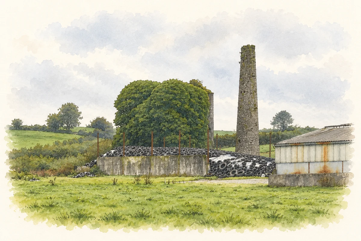
The Ballynonty mine was developed again during the Second World War. The Tipperary Coalmines archive presents photographs by Clonmel photographer M. A. Keating documenting the work in 1941 and 1942, including offices, a weighbridge and compressor facilities. Its account records that the Ballynonty and Lickfinn workings had become uneconomic by 1948, when operations moved towards the Copper Basin at Ballingarry. A spoil heap and the ruined manager’s house preserve traces of this later mining phase.[3]
A garden for local remembrance
A community garden of remembrance provides a more recent landmark in the village. The Slieveardagh local account records neighbours and volunteers working together to create it for people killed on roads in the surrounding district. Photographs of those commemorated formed part of the garden’s design. Its purpose was to give bereaved families a place to visit and to preserve local memory through a shared public space.[4]
Both counts use the 2016 settlement boundary, allowing like-for-like comparison. CSO supplies the 2022 count on this older boundary for comparison only. The official 2022 Built Up Area has different boundaries.
View population figures
Ballynonty — Census 2016 settlement footprint — census population
These figures use different area definitions. Read the boundary note before comparing them.
Ballynonty, South Tipperary
Published census settlement populations
152people · 2016
Settlement boundaries changed during this period. Differences may reflect boundary changes as well as population change. Where a 2011 legal-town-and-environs count is shown, it has not been recalculated onto the 2016 settlement boundary.
Mardyke mine engine house and chimney, near Ballinunty, County Tipperary illustration: based on a Mardyke engine house and chimney, page2 top photograph, Ballynunty-Mardyke geological site report (2019) by Geological Survey Ireland; audit authors Vincent Gallagher, Robert Meehan, Matthew Parkes, Ronan Hennessy and Siobhán Power. AI-assisted watercolour and fine ink adaptation; unaltered embedded report photograph extracted for reference, paper margins added, wires omitted and fine detail simplified. Contains Irish Public Sector Data (Geological Survey Ireland) licensed under a Creative Commons Attribution 4.0 International (CC BY 4.0) licence Licence: CC BY 4.0.
 placenames