 placenames
Carrickbeg
An Charraig Bheag
Carrickbeg’s south-bank streets preserve a manufacturing past, medieval friary fabric and connections with the Irish-language revival.
The name
These Irish name elements are associated with this record in the Logainm glossary.
An element’s translation is a clue, rather than a complete explanation of the name. Its form and meaning depend on local history and the full Irish name.
Recorded forms
- An Charraig Bheag · Irish · main form · validated name
- Carrickbeg · English · main form
Place & story
A working town on the south bank
Samuel Lewis’s 1837 account locates Carrickbeg south of the Suir, connected by a stone bridge to Carrick-on-Suir. He records 2,704 inhabitants and describes a formerly substantial woollen industry that had declined during the preceding thirty years. A succession of fairs and a police station formed part of its commercial life. His description presents a settled trading and manufacturing community, rather than merely an approach to the larger town across the river. [2]
Medieval fabric inside Saint Molleran’s
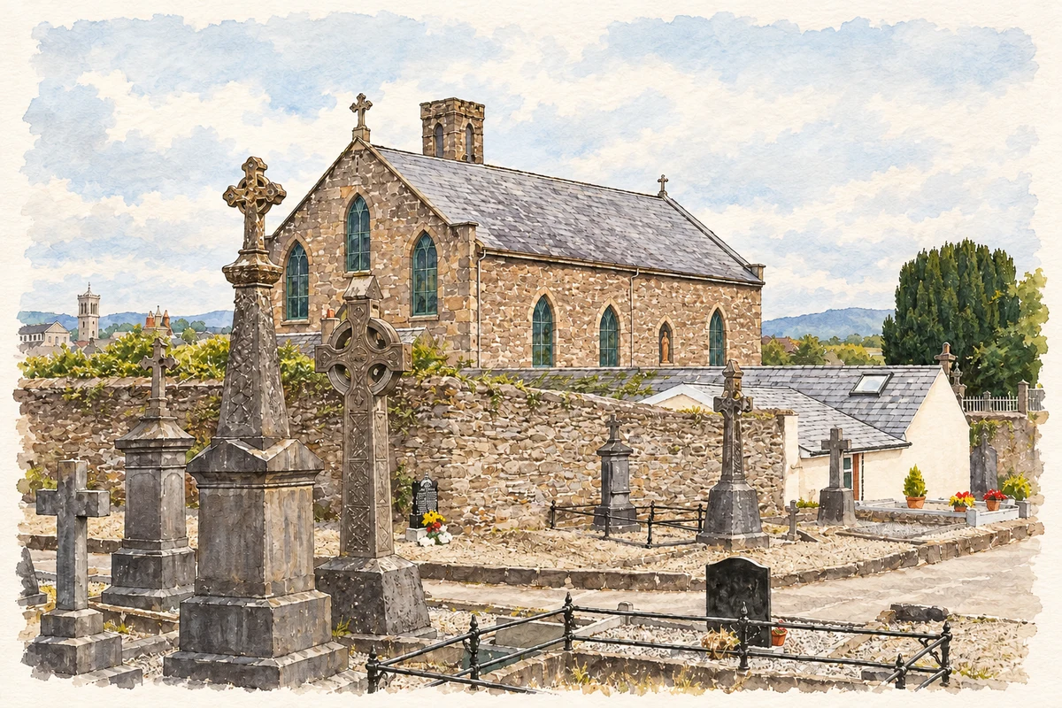
Saint Molleran’s Church incorporates remains of the Franciscan friary founded in 1336. John Clyn, the chronicler, was its first warden. The church was rebuilt in 1827 but retained medieval masonry, including the striking bell tower carried on a pyramidal corbel. Medieval doorway mouldings and carved capitals were also reused. The surviving structure brings the friary’s material history into a later parish church. [2] [3]
The later Franciscan house
A separate Franciscan church was built nearby in 1822, across the road from the older friary site, and subsequently enlarged. The order’s history records the friars’ return to the area in 1644 and again in 1669 after expulsion. When the later friary closed in 2006, its buildings and gardens were donated for community purposes, including proposed housing for older people and a heritage use for the church. [4]
Michael O’Hickey and the Irish language
Irish-language campaigner Michael O’Hickey was baptised at Carrickbeg in March 1861. Ordained in 1884, he became professor of Irish at Maynooth in 1896 and a Gaelic League vice-president in 1899. His advocacy of compulsory Irish for university admission brought him into conflict with church authorities; he lost his Maynooth chair in 1909. His career connected this local upbringing with a major national dispute over language and education. [5]
Geographic information
- Place type
- Population centre
- County
- Waterford
- Barony
- Glenahiry
- Barony
- Upperthird
- Civil parish
- Kilmoleran
- Coordinates
- 52.33925, -7.41307 (approximate)
- Logainm ID
- 1414599 ↗
Sources & further reading
- Logainm.ie — Carrickbeg. Place names and geographic record, licensed under CC BY 4.0.
- Carrickbeg, 1837 · Samuel Lewis, A Topographical Dictionary of Ireland
- Saint Molleran’s Catholic Church:22123032 · National Inventory of Architectural Heritage
- Carrick-on-Suir / Carrickbeg former friary · Irish Franciscans
- O’Hickey, Michael (Ó Hiceadha, Micheál) · Patrick Maume, Dictionary of Irish Biography
- St Molleran's Church, Carrickbeg, County Waterford illustration: based on a Saint Molleran, Carrickbeg by Andreas F. Borchert. AI-assisted watercolour and ink adaptation; cream paper margins added, incidental clutter omitted and fine details simplified. Licence: CC BY-SA 4.0.
Name record retrieved 2026-10-25 · Source record modified 2012-02-16. How this page was prepared.