These Irish name elements are associated with this record in the Logainm glossary.
An element’s translation is a clue, rather than a complete explanation of the name. Its form and meaning depend on local history and the full Irish name.
Recorded forms
Áth Liag· Irish · main form · validated name
Athleague· English · main form
Place & story
The mill beside the river
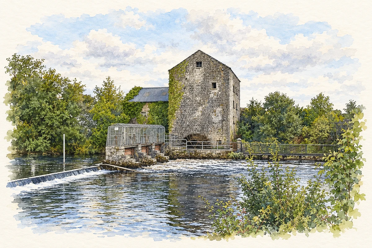
Athleague’s former water mill dates to about 1800. The architectural inventory records a four-storey limestone building with an attic, later extensions and a separate drying kiln to the east. Its mill race runs westward beneath the bridge. The wheel recorded in the 2003 survey was a comparatively recent insertion, made around 2002, rather than an untouched survival from the original mill. The buildings and waterworks together show how grain processing shaped this part of the village.[2]
A church dated by its records
The Representative Church Body Library’s parish history distinguishes Athleague’s nineteenth-century Church of Ireland building from an older church associated with the Lystre family. The new foundation stone was laid on 18 August 1841, and the church was consecrated on 10 October 1843. A surviving plan and elevation by Joseph Welland are dated 1843. These records help resolve older descriptions that continued to describe the previous, poorly repaired building even after its replacement.[3]
Folklore & tradition
The stone and the flood
Writing in 2016, Maolsheachlainn Ó Caollaí recalled other children telling him Athleague’s flood prophecy beside the bridge. The village would supposedly drown when the Suck covered the Liag Fionn, a stone in the ford. In the associated tale, Fionn Mac Cumhaill had thrown the stone from Sliabh Muire. Ó Caollaí also traced the prophecy to John O’Donovan’s 1837 record, while noting that O’Donovan did not know its author. It is a documented local tradition, not a forecast of particular floods.[4]
People & connections
History in the Circle of Life
Artist Paul Harrison brought several of these local themes into Athleague’s Circle of Life sculpture. The council’s account identifies two coloured discs with the mill wheel, curved openings with the River Suck, and ash timber with the village’s hurling tradition. A granite boulder recalls the nearby Castlestrange La Tène stone. Harrison returned in February 2025 to meet pupils from Athleague National School, giving children a chance to discuss the design and the work of a sculptor.[5]
Both counts use the 2016 settlement boundary, allowing like-for-like comparison. CSO supplies the 2022 count on this older boundary for comparison only. The official 2022 Built Up Area has different boundaries.
View population figures
Athleague — Census 2016 settlement footprint — census population
These figures use different area definitions. Read the boundary note before comparing them.
Athleague, Roscommon
Published census settlement populations
248people · 2016
Settlement boundaries changed during this period. Differences may reflect boundary changes as well as population change. Where a 2011 legal-town-and-environs count is shown, it has not been recalculated onto the 2016 settlement boundary.
Athleague Mill on the River Suck illustration: based on a Athleague Mill by RoryFC. AI-assisted watercolour and ink adaptation; cream paper margins added, incidental clutter omitted and fine details simplified. Licence: CC BY-SA 4.0.
 placenames