A broad crossing of the River Suck, Saint Joseph’s church and the career of footballer and politician Jack McQuillan give Ballyforan distinctive links with engineering, worship and public life.
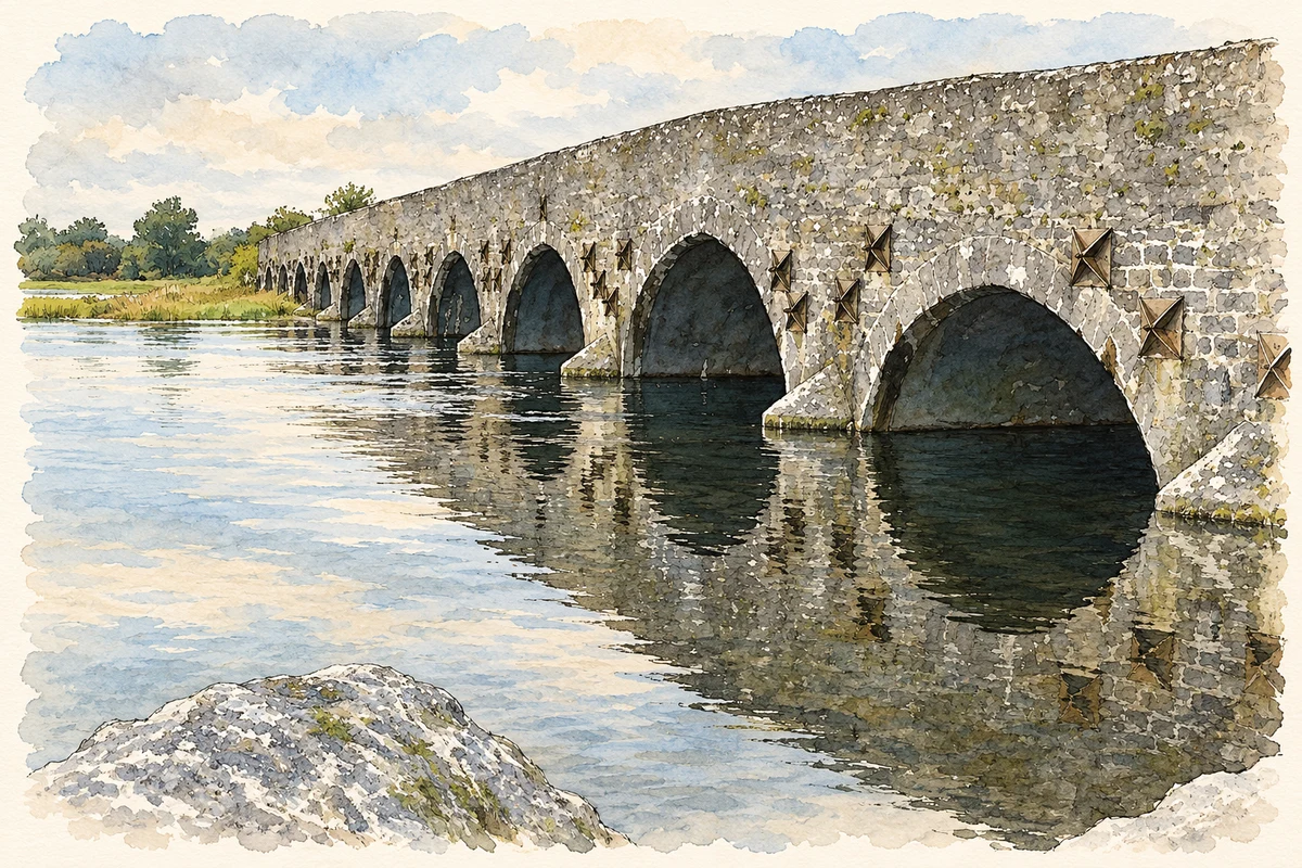
Illustration, Ballyforan Bridge over the River Suck, near Ballyforan, about 800 metres southwest of the village centre.
⊕Recorded locationBallyforan53.47110° N · 8.26627° WInteractive map supplied by OpenStreetMap.
These Irish name elements are associated with this record in the Logainm glossary.
An element’s translation is a clue, rather than a complete explanation of the name. Its form and meaning depend on local history and the full Irish name.
Recorded forms
Béal Átha Feorainne· Irish · main form · validated name
Ballyforan· English · main form
Place & story
Crossing the Suck
Ballyforan Bridge carries the road across the River Suck at the Galway–Roscommon boundary. The National Inventory of Architectural Heritage dates it to about 1820 and records thirteen arches, with the central nine larger than the two pairs at either end. Cut limestone defines the arch rings, while rubble limestone forms the walls above them. Pointed cutwaters with pyramidal caps divide the river around the piers. Iron ties visible in the masonry add another detail to this substantial nineteenth-century crossing.[2]
Saint Joseph’s church
Saint Joseph’s Catholic church at Fair Green was built in 1857. Its western entrance tower has battlements, while buttresses reinforce the limestone walls of the nave. Round-headed windows contain stained glass, and the interior has an open timber roof above a single worship space and square-ended chancel. Memorials to former parish priests stand in the grounds. A small wrought-iron kissing gate beside the main entrance is another surviving detail of the church enclosure.[3]
People & connections
Jack McQuillan
Jack McQuillan was born in Ballyforan in 1920 and played for its football club before transferring to Saint Patrick’s, Knockcroghery, after Ballyforan’s club disbanded. He helped Roscommon win the All-Ireland senior championships of 1943 and 1944, scoring a goal in the 1943 final replay against Cavan. His later public career took him into the Dáil as a Roscommon TD from 1948 to 1965. With Noel Browne, he founded the National Progressive Democratic Party in 1958, bringing a concern for rural development into his political campaigning.[4]
Both counts use the 2016 settlement boundary, allowing like-for-like comparison. CSO supplies the 2022 count on this older boundary for comparison only. The official 2022 Built Up Area has different boundaries.
View population figures
Ballyforan — Census 2016 settlement footprint — census population
These figures use different area definitions. Read the boundary note before comparing them.
Ballyforan, Roscommon
Published census settlement populations
200people · 2016
Settlement boundaries changed during this period. Differences may reflect boundary changes as well as population change. Where a 2011 legal-town-and-environs count is shown, it has not been recalculated onto the 2016 settlement boundary.
Ballyforan Bridge over River Suck, County Roscommon illustration: based on a Ballyforan Bridge by Graham Horn. AI-assisted watercolour and ink adaptation; cream paper margins added, incidental clutter omitted and fine details simplified. Licence: CC BY-SA 2.0.
 placenames